



Guatemala
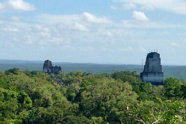
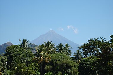
Guatemala is roughly the size of Ohio, yet it holds active volcanoes, Maya ruins, colonial towns, and a highland lake. Its culture is deeply Indigenous: more than 20 Maya languages are still spoken, and daily life in the western highlands follows centuries-old traditions, not staged shows for visitors. The jungle-covered pyramids of Tikal National Park rise in the north. The colonial capital, Antigua Guatemala, sits below three volcanoes in the central highlands.
Guatemala suits travelers who want ruins, hiking, and market culture over beach resorts. The Pacific coast has dark volcanic sand. The short Caribbean stretch near Livingston is remote and quiet. Neither is a classic beach destination. Distances feel longer than the map suggests, since mountain roads are slow. Most visitors focus on one or two regions rather than trying to cover the whole country in a single trip.




Guatemala – Utazást tervezel?
Állítsd össze a napi útvonalad a Tripomatic alkalmazásban.


Pénz és fizetés
The currency is the quetzal (GTQ), named after Guatemala's national bird.
Hotels and larger restaurants in cities, Antigua Guatemala, and the Lake Atitlán towns take cards. Away from those places, carry cash: village markets, local buses, and small comedores are cash-only. ATMs are common in cities and main tourist towns, but scarce in rural areas. Withdraw money before heading to smaller destinations like Chichicastenango or into the Petén jungle.
Kiemelt listák


Guatemala's Natural Wonders
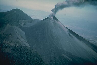
Guatemala’s diverse terrain is defined by the Sierra Madre range, featuring Central America’s highest peak, Volcán Tajumulco, and active stratovolcanoes like Fuego and Pacaya. Beyond the volcanic highlands, the landscape includes the turquoise waters of Laguna Lachuá, the extensive karst cave systems of Naj Tunich—noted for its Maya hieroglyphs—and the tropical wetlands of the San Pedro River. This collection spans from the humid lowlands of Petén to the geothermal hot springs and waterfalls of the Izabal region.
20 hely

Túrák és tevékenységek
Guatemala — Térkép

 Interaktív térkép megnyitása
 Borravaló
Tipping is not automatic in Guatemala, but it is appreciated and increasingly expected in tourist-facing businesses.
10%, unless already added
small tip for porters/housekeeping
guides rely on tips, especially on volcano hikes
Some restaurants in tourist areas already add a 10% service charge to the bill — check before adding more on top. Guides for volcano hikes and multi-day treks rely heavily on tips, since their base pay is often low.
Elektromos hálózat
Guatemala uses Type A and B plugs at 120 V / 60 Hz, the same standard as the United States and Canada. Travelers from those countries need no adapter.
Nyelv
Spanish is the official language, but it is a second language for many Guatemalans. Over 20 Maya languages are spoken across the country, including K'iche', Kaqchikel, Mam, and Q'eqchi'. In some highland communities, people are more comfortable in their Maya language than in Spanish.
English is spoken at hotels, tour agencies, and restaurants in Antigua Guatemala, around Lake Atitlán, and in Flores. It drops off quickly outside tourist areas.
Kapcsolattartás és internet
Prepaid SIM cards from Claro and Tigo are cheap and sold at the airport and in shops in any town. Bring your passport to register the SIM. Coverage is solid in cities and along the main tourist routes.
Signal drops out on volcano trails, boat crossings on Lake Atitlán, and remote roads in the Petén jungle. Download offline maps before heading into those areas.
Biztonság és segélyhívás
Guatemala has a real crime problem. Most visits to the main tourist circuit — Antigua Guatemala, Lake Atitlán, Tikal National Park, and Flores — pass without incident. Armed robbery and carjacking are the biggest risks, concentrated in Guatemala City and on some rural highways after dark. Avoid intercity travel at night, and use registered tour operators or shuttle vans rather than local buses after dusk.
The tourist police unit (DISETUR) patrols Antigua Guatemala and other main destinations and can escort hikers on popular trails. Hike volcanoes such as Pacaya Volcano and Acatenango with a licensed guide. Solo hikers have been targeted for robbery on some routes in the past.
Egészségügy
Tap water is not safe to drink in most of Guatemala. Stick to bottled or purified water, including for brushing teeth in smaller towns. Pharmacies (farmacias) are common in cities and larger towns, and some city-center locations stay open late or 24 hours.
Mosquito-borne illnesses, including dengue, are a risk in lowland and jungle areas such as Petén and the Pacific coast. Use repellent and cover up in the evenings. Altitude can affect visitors in the highlands: both Lake Atitlán and Quetzaltenango sit high enough to cause mild symptoms in some travelers. Check with a travel clinic about hepatitis A, typhoid, and rabies vaccinations before the trip.
Vízum és beutazás
Most visitors can enter Guatemala without a visa for tourism. This includes passport holders from the United States, Canada, the United Kingdom, the EU, and most of Latin America.
Guatemala shares a joint tourist zone (the CA-4 agreement) with El Salvador, Honduras, and Nicaragua. The combined stay across all four countries is capped at 90 days. Crossing between them does not reset the clock or require a new entry stamp.
Travelers who do need a visa can usually apply at a Guatemalan consulate before the trip.
Visa and entry requirements change frequently. Verify current requirements with the official immigration authority or your country's embassy before travel.
Etikett és szokások
Ask before photographing people, especially in Maya markets and villages. Some Indigenous communities strongly dislike being treated as a photo subject. At religious sites and during processions, dress modestly and stay out of the way of ceremonies in progress.
Bargaining is normal and expected in craft markets like Chichicastenango, but not in shops with marked prices or in restaurants. A friendly greeting first is valued everywhere, from market stalls to offices.
Ünnepnapok és nyitvatartás
Public holidays and Catholic festivals can close shops, banks, and government offices for the day, and intercity buses fill up fast around them.
Semana Santa (Holy Week) is the biggest event of the year in Antigua Guatemala, with elaborate processions over carpets of dyed sawdust and flowers. Hotels there are fully booked months ahead. Outside the capital and tourist towns, many shops close on Sundays, and lunch breaks can run long in smaller towns.
Közlekedés
- By air: Domestic flights connect Guatemala City to Flores, the gateway to Tikal National Park — worth booking to skip the 8–10 hour drive.
- By shuttle van: Tourist shuttles are the practical way to move between Antigua Guatemala, Panajachel on Lake Atitlán, Chichicastenango, and Quetzaltenango. Book a day ahead through any travel agency or hostel.
- By local bus: Guatemala's "chicken buses" (repurposed U.S. school buses) reach almost everywhere and cost very little, but are crowded, slow, and awkward with luggage.
- By boat: Lanchas cross Lake Atitlán between Panajachel and the lake's other villages — the main way to get around once there.
There is no functioning national passenger rail network.
Vezetés
- Speed limits: 40 km/h in towns, 80 km/h on standard rural roads, up to 100 km/h on the few divided highways.
- Road conditions: Mountain roads are narrow and winding, with landslides common in the May–October rainy season. Night driving on rural highways is best avoided.
- Tolls: A few stretches, including a bypass near Amatitlán, charge a small cash toll.
- Fuel: Stations are attended, not self-service — pumps are labeled "Súper" and "Regular" for petrol, "Diésel" for diesel. Card payment is common in cities; carry cash for rural stations.
- Parking: Guarded parking lots (parqueos) are the norm in cities and are worth using instead of street parking.
Ételek és italok
Breakfast is often eggs with black beans, fried plantain, and tortillas. Lunch is the main meal of the day, and dinner tends to be lighter. Corn and beans appear in most meals, alongside dishes with Maya origins.
Pepián, a thick stew of meat and vegetables in a toasted-seed-and-chile sauce, is considered close to a national dish. Kak'ik, a spiced turkey soup from Alta Verapaz, and tamales wrapped in banana or maxán leaves are both worth seeking out. Street stalls sell elotes locos (dressed corn on the cob) and grilled meat skewers. Rellenitos — fried mashed plantain filled with sweetened black beans — are a common dessert.
Guatemala is a major coffee producer, and the regions around Antigua Guatemala and Cobán are known for it. Atol, a hot corn-based drink, and Gallo beer are both everyday staples.
Mit érdemes felfedezni
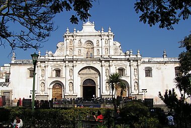
Colonial highlands: Antigua Guatemala, the former colonial capital, is Guatemala's most visited town. It is ringed by three volcanoes, including the frequently active Fuego Volcano, and centered on the yellow arch of Arco de Santa Catalina. Panajachel is the main gateway to Lake Atitlán, surrounded by volcanoes and Maya villages reachable by lancha. Chichicastenango draws crowds for the Thursday and Sunday market at Mercado de Chichicastenango, one of the largest Indigenous markets in Central America. Nearby, the Postclassic ruins of Iximche are a quieter alternative for travelers with no time for Petén. Quetzaltenango is Guatemala's second city. Locals call it Xela. It's a base for volcano hikes and Spanish-language schools, with far fewer tourists than Antigua.
The Petén jungle: Flores, a small island town on Lake Petén Itzá, is the base for visiting Tikal National Park, home to Temple I and dozens of other Maya temples rising above the jungle canopy.
Alta Verapaz: Cobán is the access point for the turquoise limestone pools of Semuc Champey.
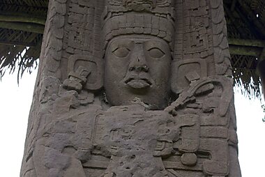
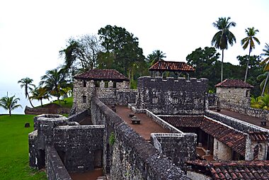
Izabal and the coast: The Río Dulce river connects Lake Izabal to the Caribbean. It passes Castle of San Felipe de Lara, a 17th-century fort built to fend off pirates, before reaching Livingston, a Garífuna town reachable only by boat. Inland, the carved stelae of Quiriguá are an easy stop between Guatemala City and the coast.
The capital, Guatemala City, is most travelers' arrival point by air. National Palace of Culture and the city's museums are worth a stop before heading to the highlands.
Guatemala – Tervezd meg az utazásod
Válaszd ki a meglátogatni kívánt helyeket, és a Tripomatic napokra lebontott útvonalat készít belőlük okos útvonaltervezéssel, időbecslésekkel és mindennel, ami a tökéletes utazáshoz kell.


Kapcsolódó úti célok


Data: © OpenStreetMap contributors, Wikidata, Wikipedia, Tripomatic, Official websites, geoBoundaries (CC BY 4.0). Tours by GetYourGuide. We earn commission from bookings. Travel guide generated with AI.