



Lago di Como
Lake Como is a narrow, Y-shaped lake in the Italian Alps, ringed by grand villas, terraced gardens, and pastel-colored villages. Steep green mountains rise straight from the water, and small ferries connect the shoreline towns faster than any road can. Wealthy visitors have come here since Roman times, and the grand villas built for European nobility from the 1600s onward still line the shore today.
The lake suits travelers who want a slower, scenic trip: touring historic gardens, riding a ferry between towns, and eating lunch on a terrace with a mountain view. It suits couples, garden lovers, and anyone who prefers small towns to big cities, since the sights here are spread across several villages rather than concentrated in one place. Como, the largest town on the lake, was the birthplace of the physicist Alessandro Volta, who invented the battery; the volt, the unit of electrical potential, is named after him.

Lago di Como – Stai pianificando un viaggio?
Costruisci il tuo itinerario giorno per giorno nell'app Tripomatic.


Quando andare
Spring and autumn are mild and are the best times to visit, with thinner crowds than summer. Summer is warm and humid, and the lake gets busy with visitors, especially on weekends. Winter is cold and quiet, and many villa gardens and some hotels close for the season.
Time a spring visit around the Concorso d'Eleganza, a celebrated classic car and motorcycle show held every May at Villa d'Este in Cernobbio, when collectors bring rare cars from across the world.
Periodo migliore per la visita: settembre, ottobre
Attrazioni principali

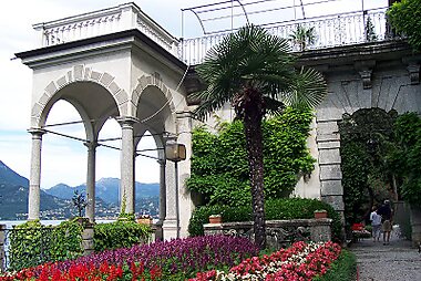
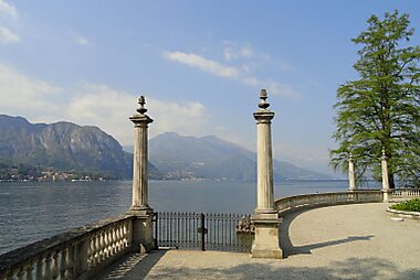
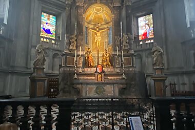
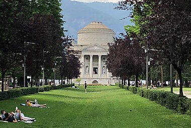
Duomo di Como is Como's marble-fronted cathedral, built over several centuries and topped with a Baroque dome that is visible from across the lake.
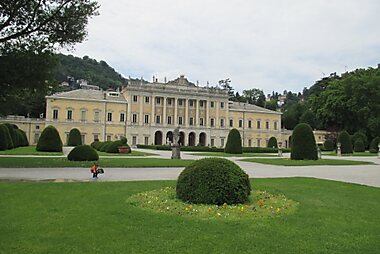
Facing the water nearby, Villa Olmo is a neoclassical villa with formal gardens open to the public, built in the late 18th century for the noble Odescalchi family.
Villa Carlotta in Tremezzina is famous for its terraced gardens, which bloom with azaleas and rhododendrons every spring.
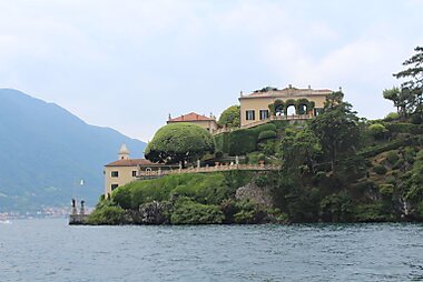
Villa del Balbianello, on a wooded point near Lenno, has appeared in several films for its dramatic setting above the water. The gardens can be visited on your own, though seeing the villa's interior requires a guided tour.
In Bellagio, Villa Melzi d'Eril has one of the first English-style gardens built on the shore of the lake, planted with camellias and exotic species.
Villa Monastero in Varenna sits directly on the shore, and its lakefront terrace and botanical garden are open to visitors.
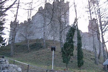
Above Varenna, Castello di Vezio is a medieval hilltop fortress with wide views over the lake, reached by a short, steep walk.
Overlooking Bellagio, Punta di Spartivento sits where the lake divides into its southern and eastern arms, and is one of the most photographed spots on Lake Como.
Elenchi in evidenza


Lombardy Peaks and Viewpoints
This collection features prominent summits across the Lugano Prealps and Bergamo Alps, centered around the Larian Triangle and Lake Como. Elevations range from the 614-meter Monte Sasso to the 2,245-meter Pizzo di Gino, the highest peak in the Lugano Prealps. The list includes peaks with diverse historical and geological significance, such as Monte Legnoncino, which preserves World War I military fortifications from the Cadorna Line, and Monte Sighignola on the Swiss-Italian border. These locations provide strategic vantage points over the alpine foothills and the three branches of Lake Como.
20 luoghiCosa provare
- Ride the more than 100-year-old funicular from Como up to Brunate, a hilltop village with a panoramic view over the whole lake.
- Hop a passenger ferry just to cross the lake and back, standing on deck for the view of the villas and mountains from the water.
- Walk the wooden catwalks through the Orrido di Bellano, a narrow gorge where a mountain stream crashes past just below your feet.
- Take a small boat from Tremezzina out to the ruins and church on Isola Comacina, the lake's only island.
- In summer, rent a small motorboat that needs no license to explore the shoreline at your own pace.
- Walk a stretch of the Greenway del Lago di Como, an easy waymarked path linking villages along the western shore, with views across to Bellagio the whole way.
Tour e attività
Lago di Como — Mappa

Gite in giornata
Lake Como sits close to some of northern Italy's biggest draws, and right on the border with Switzerland.
- Lugano, Switzerland: under an hour by car, bus, or train. A lakeside city with its own promenade and a car-free old town; bring a passport or ID card for the border crossing.
- Milan: about 40 minutes by train from Como. Italy's fashion and design capital, with its own cathedral, the La Scala opera house, and major shopping streets.
- Bergamo: about 1.5 hours by car, or around 2 hours by train with a change in Milan. A walled hilltop old town, Città Alta, reached by funicular, with narrow lanes and wide views over the plain below.
- The Valtellina wine valley: about 1.5 to 2 hours by car, northeast of the lake. Known for its terraced vineyards and Nebbiolo-based red wines.
Cosa esplorare
The lake's towns each have a different character, and passenger ferries make it easy to visit several in one day.
- Como, at the southern tip, is the largest town on the lake and the easiest to reach by train, with a walkable historic center.
- Bellagio, on the point where the lake divides into two arms, is the most visited village, known for its steep, arcaded stairways and lakefront promenade.
- Varenna, on the eastern shore, is a quieter fishing village with colorful houses built directly into the cliffside.
- Menaggio, on the western shore, is a good base for hiking and water sports, and sits close to the Swiss border.
- Tremezzina groups several small villages, including Lenno and Tremezzo, known for their historic villas and gardens.
- Cernobbio, just north of Como, is known for its luxury lakefront hotels.
- Lecco, at the tip of the lake's eastern branch, sits beneath dramatic limestone peaks and has a livelier, less touristy feel.
- Laglio, a small village on the western shore, is known for a lakefront villa owned by the American actor George Clooney.
Come arrivare
- By air: The main gateway is Milan, served by Malpensa (MXP) and Linate (LIN) airports, plus Bergamo's Orio al Serio (BGY) airport for low-cost carriers. From Malpensa, the fastest route is the Malpensa Express to Saronno with a change to a regional train to Como, about 1 hour total; a taxi or private transfer also takes about 1 hour direct to the lake.
- By train: Regular trains run from Milano Centrale to Como San Giovanni, about 40 minutes, and to Lecco, about 50 minutes, both on the lake. Trains also connect from Lugano in Switzerland.
- By car: The A9 motorway links Milan and the Swiss border directly to Como. Expect tolls and, in summer, slow traffic on the narrow roads that circle the lake.
Come muoversi
- Ferries: Passenger ferries run by Navigazione Laghi connect every town on the lake and are the fastest way to get around, especially between Bellagio, Varenna, and Menaggio. Buy tickets at the pier ticket office or the operator's official site; a one- or multi-day pass pays off if you plan to hop between several towns. Navigazione Laghi
- Bus: Regional buses circle the lakeshore roads and reach villages the ferry does not, but are slower than boats between the main towns.
- Taxi boats: Private water taxis are available in Bellagio, Como, and Varenna for a faster, more direct crossing, at a higher price than the scheduled ferry.
- On foot: Each lakeside village is small and easy to explore on foot, but the roads connecting them are narrow, hilly, and not built for walking between towns.
Guidare
- Is a car worth it?: A car helps for reaching smaller villages and hillside sights, but is not needed if you are staying in one or two lakeside towns and using the ferries. Traffic on the single road that circles the lake is slow, especially on summer weekends.
- Parking: Central Bellagio, Varenna, and Como have limited parking; most visitors park at a paid lot on the edge of town and walk in, or arrive by train or ferry instead.
- Restrictions: Some village centers restrict cars to residents during peak season; watch for local signs rather than assuming free access.
Cibo e bevande
Lake fish shows up on most menus here: look for risotto with perch (persico) or whitefish (lavarello), and missoltino, a traditional sun-dried, salted shad that has been a Lake Como specialty for centuries. Polenta, often paired with local game or cheese, is another mountain-influenced staple.
For a meal with a view, look for restaurants along the lakefront promenades in Bellagio and Varenna, where terraces face the water. Dining customs follow the rest of Italy: a cover charge (coperto) is normal and tipping is not expected.
Sicurezza e salute
Lake Como is very safe for tourists. The main risks are practical rather than criminal: pickpocketing on crowded ferries and at busy piers in high season, and slippery cobbled lanes in villages like Bellagio and Varenna. If you swim in the lake, stay close to shore in signed swimming areas; currents and boat traffic can be a hazard further out. The narrow, winding roads around the lake also see far more cyclists, scooters, and pedestrians than a typical highway, so drive cautiously.
Storia
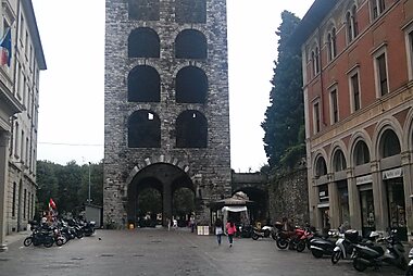
Como was founded as a Roman colony, and Roman-era remains, including the Terme Romane, can still be seen in the old town, which still follows its Roman street grid inside the walls. Parts of the medieval walls survive too, including Porta Torre and the hilltop fortress of Castello del Baradello.
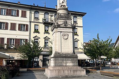
From the 1600s onward, and especially during the 18th and 19th century Grand Tour era, wealthy European families built the lakeside villas that still define the shoreline today. The physicist Alessandro Volta, born in Como in 1745, invented the first electric battery. Tempio Voltiano, shaped like a small Roman temple, was built in his honor and displays his instruments. A monument to Volta, Alessandro Volta (monument), stands near the lakefront.
Informazioni sul paese
Quick practical facts for Italy at a glance:
- Valuta
- euro EUR € · Pagamenti con carta · Ampiamente accettata
- Numeri di emergenza
- 112
- Elettricità
- 230 V · 50 HzTipo C / Tipo F / Tipo L
- Lingue
- italiano
- Acqua del rubinetto
- Potabile
- Senso di marcia
- A destra
- Prefisso telefonico
- +39


Lago di Como – Pianifica le tue giornate
Trasforma i luoghi di questa guida in un vero itinerario, con percorsi intelligenti, stime dei tempi e tutto il necessario per un viaggio perfetto.




