Wat te doen in Park County
-
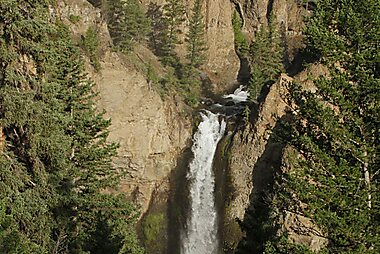
Tower Fall
Tower Fall is a waterfall on Tower Creek in the northeastern region of Yellowstone National Park, in the U.S. state of Wyoming.
- B/ Public domain
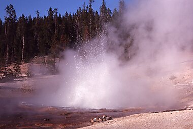
Norris Geyser Basin Museum
The Norris Geyser Basin Museum, also known as Norris Museum, is one of a series of "trailside museums" in Yellowstone National Park…
-
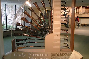
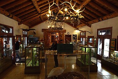
Buffalo Bill Center of the West
Het Buffalo Bill Center of the West is een museum in Cody, een plaats in de Amerikaanse staat Wyoming.
-
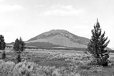
Mount Washburn
Mount Washburn, elevation 10,219 feet, is a prominent mountain peak in the Washburn Range in Yellowstone National Park, Wyoming, United…
- EUS Government, National Park Service / Public domain
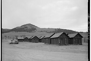
Lamar Buffalo Ranch
The Lamar Buffalo Ranch is a historic livestock ranch in the Lamar River valley of Yellowstone National Park, in the U.S. state of Wyoming.
-
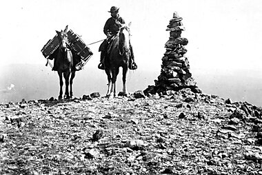
Old Trail Town
These buildings all come from the times of the 19th century American West. A charming sight that will transport you back to the past.
-
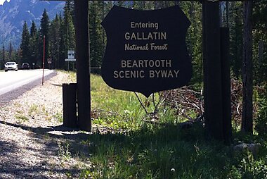
Beartooth Highway
The Beartooth Highway is an All-American Road on a section of U.S. Route 212 in Montana and Wyoming between Red Lodge and the Northeast…
- HMike Cline / Public domain
Bunsen Peak
Bunsen Peak el. 8,564 feet is a prominent peak due south of Mammoth Hot Springs in Yellowstone National Park, Wyoming.
-
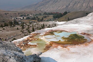
Mammoth Hot Springs Terraces
Mammoth Hot Springs is a large complex of hot springs on a hill of travertine in Yellowstone National Park adjacent to Fort Yellowstone and…
-
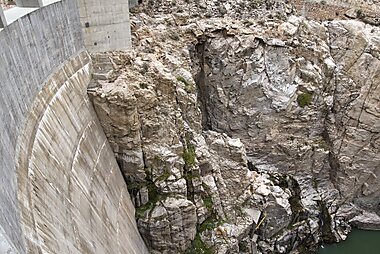
Buffalo Billdam
De Buffalo Billdam is een betonnen zwaartekracht-boogdam in de Shoshone River in de Amerikaanse staat Wyoming.
-
Fishing Bridge Museum
The Fishing Bridge Museum is one of a series of "trailside museums" in Yellowstone National Park, Wyoming, United States, designed by…
-
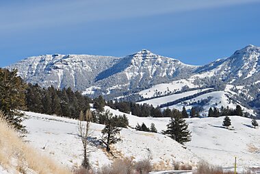
Gallatin Range
De Gallatin Range is een bergketen in de Centrale Amerikaanse Rocky Mountains in de Amerikaanse deelstaten Montana en Wyoming.
-
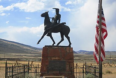
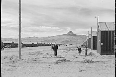
Heart Mountain Relocation Center Memorial
The Heart Mountain War Relocation Center, named after nearby Heart Mountain and located midway between the northwest Wyoming towns of Cody…
-
Beartooth Highway
The Beartooth Highway is an All-American Road on a section of U.S. Route 212 in Montana and Wyoming between Red Lodge and the Northeast…
- OT. A. Jagger / Public domain
Dead Indian Pass
Dead Indian Pass is a mountain pass on Wyoming Highway 296. The pass is located on Chief Joseph Scenic Byway and crosses the Absaroka Range.
- PMike Cline / Public domain
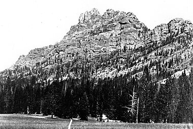
The Thunderer
The Thunderer el. 10,558 feet is a mountain peak in the northeast section of Yellowstone National Park, in the Absaroka Range of the U.S.…
- QJ. P. Iddings / Public domain
Eagle Peak
Eagle Peak is a mountain in the Absaroka Range in the U.S. state of Wyoming and at 11,372 feet is the highest point in Yellowstone National…
-
Younts Peak
Younts Peak is a peak in the Absaroka Range in northwestern Wyoming in the United States and the highest point in the Teton Wilderness.
-
Heart Mountain
Heart Mountain is an 8,123-foot klippe just north of Cody in the U.S. state of Wyoming, rising from the floor of the Bighorn Basin.


Plan je dag-tot-dag reisroute
Maak een gedetailleerde reisroute met slimme routing, tijdsinschattingen en alles wat je nodig hebt voor een perfecte reis.


Plan je dag-tot-dag reisroute
Maak een gedetailleerde reisroute met slimme routing, tijdsinschattingen en alles wat je nodig hebt voor een perfecte reis.