



Andermatt
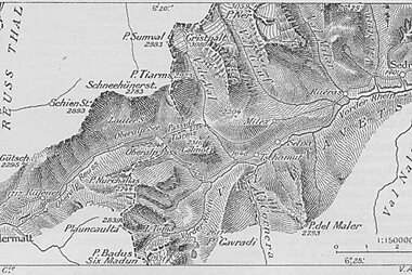
Andermatt sits at 1,444 meters in the Urseren Valley, in the canton of Uri. Four of Switzerland's best-known mountain roads meet here: the Gotthard, Furka, Oberalp, and Susten passes. For centuries this made the village a key stop on the route between northern Europe and Italy, and later the home of a large Swiss Army garrison.
Since the mid-2000s, a large resort project has added a new quarter beside the historic center, with hotels, apartments, and a concert hall built on former military land. The result is a small alpine town where a centuries-old core of stone and timber houses sits next to contemporary architecture. Andermatt suits travelers drawn to dramatic mountain scenery: freeride skiers head for the Gemsstock, cyclists and drivers tackle the surrounding passes, and the Glacier Express stops here on its way between Zermatt and St. Moritz.

Andermatt – Gezi mi Planlıyorsun?
Tripomatic uygulamasında gün gün güzergahını oluştur.


Ne zaman gidilmeli
Winters are cold and reliably snowy, with skiing from December into April. Summers, from June to September, are mild and are when all four surrounding passes are open for driving, hiking, and cycling. Spring and late autumn are quiet shoulder seasons, when some high trails and passes can still be closed.
Plan around Freeride Days Andermatt, usually held on the Gemsstock in winter, when off-piste skiers and snowboarders from across the Alps gather to ride the mountain's steep terrain.
Even in summer, days rarely feel hot at this altitude, and afternoon showers are common, so pack layers for a visit in any season.
En popüler turistik yerler




- Teufelsbrücke carries the old Gotthard road across a dramatic gorge on the Reuss river. A devil-themed mural and information panels nearby explain the bridge's construction legend and the 1799 battles fought around it.
- Suvorov Monument is a memorial carved into the rock face of the gorge, honoring the Russian soldiers who died crossing the Alps under General Alexander Suvorov in September 1799.
- Gemsstock rises to 2,962 meters above the village and is Andermatt's local ski mountain, reached by cable car, with terrain rated among the more demanding in the Alps.
- Oberalppass is the highest point on the Matterhorn Gotthard Bahn railway, where a small alpine lake, the Tomasee, marks one of the sources of the Rhine.
- Nearby, Leuchtturm Rheinquelle is a small working lighthouse built in 2010, standing at over 2,000 meters — an odd sight this far from any sea, and the only lighthouse in the Alps.
- Pfarrkirche St. Peter und Paul is the valley's Baroque parish church, built in 1602, with an ornate high altar and reliquaries said to hold relics of Zurich's patron saints.
- Andermatt Konzerthalle opened in 2019 as Switzerland's highest-altitude concert hall, home to the Swiss Orchestra and one of the most visible new buildings in the resort quarter beside the old village.
- Talmuseum Ursern traces the history of the Urseren Valley, including the century-old Furka mountain railway, inside a building more than 240 years old.
Öne Çıkan Listeler

Neler deneyimlenmeli
- Cycle or drive one of the four alpine passes that meet at Andermatt — a rite of passage for road cyclists each summer, with the Furka and Oberalp both featuring on classic Swiss touring routes.
- Ride the historic Furka steam train from Realp over the pass on preserved rolling stock from the original line, a slow, scenic summer trip through the mountains.
- Walk through Andermatt Reuss, the new resort quarter built beside the old village, where contemporary Swiss design sits next to centuries-old farmhouses.
- In winter, ride the Gütsch-Express gondola up to Nätschen for wide views back across the Urseren Valley, away from the busier Gemsstock slopes.
Turlar ve Aktiviteler
Andermatt — Harita

Günübirlik geziler
Andermatt's location at a crossroads of alpine passes makes it a good base for day trips, from five-minute neighboring villages to a full day over a mountain pass.
- Hospental — about 10 minutes by bus or a scenic 45-minute walk along the valley floor. A tiny village watched over by a 13th-century tower.
- Realp — about 10 minutes by train. Base of the Furka steam railway, a preserved cogwheel line that climbs toward the Furka Pass in summer.
- Göschenen — about 10 minutes by train through the Schöllenen Gorge. The northern gateway to the Gotthard rail tunnel, with hiking trails back along the gorge.
- Sedrun — about 30 minutes by car or train over the Oberalp Pass. Andermatt's ski partner in the SkiArena Andermatt-Sedrun, with its own gentler beginner and family slopes.
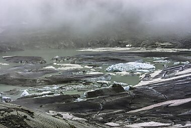
- Furka Pass and the Rhône Glacier — about 30-40 minutes by car, open only in summer. The Furka road is one of Switzerland's most dramatic drives, and a short walk from the pass reaches an ice grotto cut into Rhône Glacier each year.
- Disentis/Mustér — about 50 minutes by train, on the Glacier Express line over the Oberalp Pass. A Benedictine monastery has stood here for over a thousand years.
- Lucerne — about 1.5 to 2 hours by train. A full day trip to a lakeside city, with an old town, covered bridges, and Lake Lucerne cruises.
Nasıl gidilir
- By air: the main gateway is Zurich Airport, roughly 2 hours away by car or train (change at Arth-Goldau or Erstfeld). Milan's airports are a similar distance to the south via the Gotthard route.
- By train: Andermatt is a stop on the Glacier Express between Zermatt and St. Moritz, and sits on the Matterhorn Gotthard Bahn line, with connections east toward Chur and Disentis over the Oberalp Pass. From the Swiss lowlands, trains reach Andermatt via Göschenen and a branch line up through the Schöllenen Gorge.
- By bus: seasonal PostBus routes cross the Susten and Furka passes in summer, connecting Andermatt with Bern and Valais when the roads are open.
Ulaşım
- On foot: the historic village center is small and easy to walk. Reaching sights outside the village, like the Gemsstock or the passes, needs a cable car, train, or car.
- Cable car: gondolas run from the village up to the Gemsstock ski area and toward Nätschen and Gütsch, useful for both skiers and summer hikers wanting valley views.
- Trains and buses: local Matterhorn Gotthard Bahn trains and PostBus services link Andermatt with nearby villages; buy tickets at station machines or through the SBB app. SBB
Araç kullanımı
- Is a car worth it? Trains and buses cover the village and open passes, but a car gives more freedom to explore the passes at your own pace. Skip it if you are only staying in the village itself.
- Passes close in winter. The Furka, Oberalp, and Susten passes, plus the old Gotthard Pass road, typically close from around November to May depending on snow — always check current conditions before planning a route over them.
- Andermatt stays open year-round. The village itself is reachable by road at any time of year via Göschenen and the Schöllenen Gorge. When the Furka Pass is shut, a car-carrying train through the Furka Base Tunnel still links Realp with the Valais side. Toward Ticino, the Gotthard road tunnel keeps a year-round link to Airolo even when the historic pass road above it is closed.
- Parking: several car parks and an underground garage serve the village center; street space is limited during the winter high season.
Yeme ve içme
Andermatt's kitchens reflect its position in the Uri Alps: rösti, älplermagronen (alpine macaroni baked with potato, cheese, and fried onion), and local mountain cheeses appear on most menus, along with game dishes in autumn.
For eating, head to the historic core along Gotthardstrasse, where family-run guesthouses serve regional food, or to the newer piazza in Andermatt Reuss, which added several restaurants and cafés alongside the resort's hotels.
Güvenlik ve sağlık
Andermatt is a very safe destination with little crime; the main risks come from mountain weather and terrain rather than people. Tap water is safe to drink throughout the village.
Mountain conditions can change quickly: check avalanche and weather bulletins before skiing off-piste or hiking above the tree line, and expect some roads, cable cars, and trails to close outside the main seasons. Sun exposure is stronger at altitude, so use sunscreen even on cool or overcast days.
Tarihçe
Andermatt's fortunes have always followed the route through the Alps. The Schöllenen Gorge blocked a direct path north until a bridge — ancestor of today's Teufelsbrücke — was built across it around the 13th century, opening the Gotthard route between northern Europe and Italy and turning Andermatt into a trading and coaching stop.
In September 1799, Russian and French forces fought through the gorge as General Alexander Suvorov's army crossed the Alps during the Napoleonic Wars; Suvorov Monument marks the site today. Canton Uri, whose capital Altdorf lies at the foot of the valley, is also the setting of the William Tell legend, the founding story of the Swiss Confederacy.
Andermatt later became home to a large Swiss Army garrison, which shaped the village through much of the 20th century. Since the mid-2000s, much of that former military land has instead been developed by Andermatt Swiss Alps, a project led by Egyptian investor Samih Sawiris, adding hotels, apartments, a golf course, and Andermatt Konzerthalle in a new quarter beside the historic village center.
Ülke bilgileri
Quick practical facts for Switzerland at a glance:
- Para birimi
- İsviçre frangı CHF CHF · Kartla ödeme · Yaygın olarak kabul ediliyor
- Acil durum numaraları
- 112
- Elektrik
- 230 V · 50 HzTip C / Tip J
- Diller
- Almanca, Fransızca, İtalyanca, Romanşça
- Musluk suyu
- İçilebilir
- Trafik akış yönü
- Sağ
- Ülke kodu
- +41


Andermatt – Günlerini Planla
Bu rehberdeki yerleri; akıllı rota oluşturma, tahmini süreler ve kusursuz bir gezi için gereken her şeyle gerçek bir güzergaha dönüştür.




