


Кальс-ам-Гросглокнер
Kals am Großglockner is a mountain village in East Tyrol, in the Hohe Tauern National Park, at about 1,300 m. The Grossglockner, Austria's highest peak, rises above the valley at its head, and the village is the Tyrolean base for climbing it.
Kals is a hikers' and climbers' village. It is quiet and traditional, with farmhouses, small chapels and a real mountain feel. It is a good choice for walkers who want to be near the big peaks without crowds.

Кальс-ам-Гросглокнер — Плануєш подорож?
Створи свій щоденний маршрут у додатку Tripomatic.


Коли їхати
July to September is best for hiking, and mountain huts are open. Early autumn has the clearest air. Winter is for ski touring, snowshoeing and a small ski area. Spring is quiet, and many huts are closed.
Головні пам'ятки

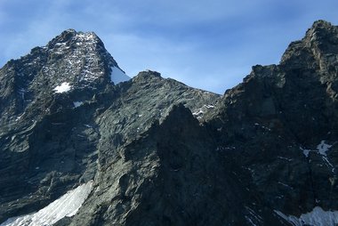
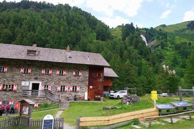
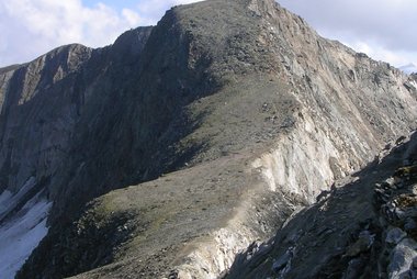
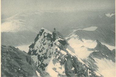
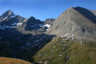
- Großglockner is Austria's highest peak. Many climbers start from Kals.
- Stüdlhütte and Erzherzog-Johann-Hütte are high huts used by climbers.
- Glorerhütte is a mountain hut on a hiking route above the village.
- Lucknerhütte is a hut at the end of the valley road, where many routes begin.
- Kalser Tauernhaus is a mountain inn in the Dorfertal valley.
- Kleinglockner is the neighbouring peak of the Grossglockner.
- Muntanitz is a high peak above the Dorfertal.
- Salmhütte is a hut on a high route.
- Heimatmuseum shows local rural life, and Widum is the old parish house.
Цікаві добірки

Що варто спробувати
- Hike to a mountain hut.
- See the Grossglockner from a high viewpoint.
- Walk in the Dorfertal valley.
- Try ski touring in winter.
- Visit local chapels and farmhouses.
Екскурсії та активності
Кальс-ам-Гросглокнер — Карта

Одноденні поїздки
- Lienz is about 40 minutes away by car.
- Sillian is about 1 hour away by car.
- Heiligenblut is about 1 hour 15 minutes away by car, over the Iselsberg pass.
- Matrei in East Tyrol and the Virgental valley are 20 to 30 minutes away.
Що дослідити поруч
Як дістатися
- By air: Innsbruck Airport is about 2 hours 15 minutes away. Salzburg is about 2 hours 30 minutes.
- By train: The nearest main station is Lienz. A bus then runs to Kals. Check train times on ÖBB.
- By car: The Felbertauern road from Salzburg and Zell am See leads to Matrei, then the road to Kals.
Транспорт і пересування
The village is small. A local bus links Kals with Lienz and trailheads, and a hiker's shuttle runs in summer to higher points. A car helps but is not essential.
Водіння авто
A car helps for trailheads. The road to Lucknerhaus is narrow in places and may charge a toll. The Felbertauern tunnel is a toll tunnel. Winter tyres or chains are required in snow. Motorways in Austria need a vignette.
Їжа та напої
East Tyrol food is hearty. Try Schlipfkrapfen, filled dumplings, and Tiroler Gröstl, a pan of potatoes and meat. Mountain huts serve soups, dumplings and cakes.
Безпека й здоров'я
Kals is very safe, but the high mountains are serious. Climbing the Grossglockner needs experience, equipment or a guide. Weather changes fast, and avalanche risk applies in winter. Tap water is clean and safe to drink. The emergency number is 112. The mountain rescue number is 140.
Історія
Kals is an old farming and herding village, with scattered farms and small chapels. The first recorded ascent of the Grossglockner in 1800 helped shape the village as a base for climbers. Today it stays small and works hard to protect its mountain landscape.
Факти про країну
Quick practical facts for Austria at a glance:
- Валюта
- євро EUR € · Оплата карткою · Широко розповсюджена
- Номери екстрених служб
- 112
- Електроенергія
- 230 В · 50 ГцТип C / Тип F
- Мови
- німецька
- Водопровідна вода
- Безпечна для пиття
- Сторона руху
- Праворуч
- Телефонний код
- +43


Кальс-ам-Гросглокнер — Сплануй свої дні
Перетвори місця з цього путівника на справжній маршрут із розумною навігацією, розрахунком часу та всім необхідним для ідеальної подорожі.


Схожі напрямки
Data: © OpenStreetMap contributors, Wikidata, Wikipedia, Tripomatic, Official websites, geoBoundaries (CC BY 4.0). Tours by GetYourGuide. We earn commission from bookings. Travel guide generated with AI.
Плануй подорож разом із Tripomatic
- Планування на основі ШІДозволь ШІ побудувати твій маршрут, відповісти на запитання про поїздку та впорядкувати бронювання.
- Сповіщення для мандрівниківОфіційні попередження, негода, страйки та природні небезпеки для місць на кожен день подорожі.
- Державні свята та подіїДізнавайся про свята, фестивалі та вихідні в дні твоєї поїздки та про те, як вони можуть вплинути на плани.
- Оцінка витратРозрахунок витрат на поїздку за допомогою ШІ допоможе заздалегідь визначити бюджет.
- Екскурсії та квиткиБронюй екскурсії, квитки без черги та цікаві активності просто у своєму плані.