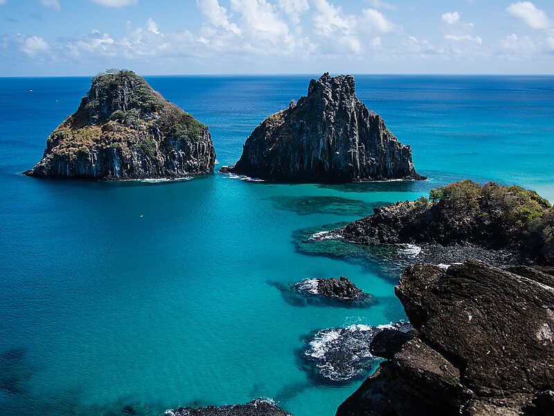
Tripomatic

Fernando de Noronha

Fernando de Noronha, officially the State District of Fernando de Noronha and formerly known as the Territory of Fernando de Noronha until… Read more…

hidden gem
Riverside Hotel
Taxi · 8 min
Fernando de Noronha
2h
Walk · 6 min
Corner Café
45 min
Walk · 18 min
Riverside Hotel

Add Fernando de Noronha to Your Trip

Create a detailed travel itinerary with smart routing, time estimates, and everything you need for a perfect trip.

3M+ downloads · 4.6 stars · 15 years of trip planning
QR code
Scan to download the app

Fernando de Noronha, officially the State District of Fernando de Noronha and formerly known as the Territory of Fernando de Noronha until 1988, is an archipelago in the Atlantic Ocean, part of the State of Pernambuco, Brazil, and located 354 km off the Brazilian coast. It consists of 21 islands and islets, extending over an area of 26 km2. Only the eponymous main island is inhabited; it has an area of 18.4 km2 and a population estimated at 3,101 in 2020. While most of the archipelago is relatively low-lying, there are parts reaching more than 100 m in elevation.

The islands are administratively unique in Brazil. They form a "state district" that is administered directly by the government of the state of Pernambuco. The state district's jurisdiction also includes the very remote Saint Peter and Saint Paul Archipelago, located 625 km northeast of Fernando de Noronha. Seventy percent of the islands' area was established in 1988 as a national marine park.

Source: Wikipedia

More Information and Contact

Address Brazil
Coordinates 3°51'41.385" S, 32°24'10.354" W
Riverside Hotel
Taxi · 8 min
Fernando de Noronha
2h
Walk · 6 min
Corner Café
45 min
Walk · 18 min
Riverside Hotel

Add Fernando de Noronha to Your Trip

Create a detailed travel itinerary with smart routing, time estimates, and everything you need for a perfect trip.

3M+ downloads · 4.6 stars · 15 years of trip planning
QR code
Scan to download the app

More interesting places