Tripomatic

Kandersteg

قرية · كانتون برن, 🇨🇭 سويسرا

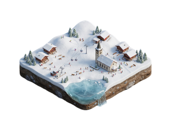
Kandersteg is a mountain village at the head of the Kander valley in the Bernese Oberland. High cliffs and glaciers surround it. The village is quiet and has long been a base for hikers and cross-country skiers.

Its best-known sight is Lake Oeschinen, a deep blue lake high above the village. Kandersteg is also the northern end of the Lötschberg railway tunnel.

Kandersteg – هل تخطط لرحلة؟

أنشئ خط سير رحلتك يوماً بيوم في تطبيق Tripomatic.

أفضل وقت للزيارة

June to October is the best time for hiking and for the lake. Snow can block high paths until late June. December to March is the season for skiing, sledging and winter walks. Spring and November are quiet, and some lifts and hotels close.

اختر شهراً

الطقس المعتاد في شهر يناير

رديء
  • 1° (الحرارة المحسوسة -3°) · درجات الحرارة القصوى -14°–6°
  • -6° ليلاً
  • 13 يوماً ممطراً
  • 6 أيام مشمسة
  • 4 ساعات سطوع شمس يومياً
  • هواء جاف
  • رياح هادئة
  • مؤشر الأشعة فوق البنفسجية 1 · منخفض

الطقس المعتاد في شهر فبراير

رديء
  • 2° (الحرارة المحسوسة -2°) · درجات الحرارة القصوى -15°–8°
  • -6° ليلاً
  • 12 يوماً ممطراً
  • 8 أيام مشمسة
  • 5 ساعات سطوع شمس يومياً
  • هواء جاف
  • رياح هادئة
  • مؤشر الأشعة فوق البنفسجية 2 · منخفض

الطقس المعتاد في شهر مارس

رديء
  • 5° (الحرارة المحسوسة 2°) · درجات الحرارة القصوى -10°–12°
  • -3° ليلاً
  • 13 يوماً ممطراً
  • 10 أيام مشمسة
  • 6 ساعات سطوع شمس يومياً
  • هواء جاف
  • رياح هادئة
  • مؤشر الأشعة فوق البنفسجية 3 · معتدل

الطقس المعتاد في شهر أبريل

رديء
  • 10° (الحرارة المحسوسة 7°) · درجات الحرارة القصوى -6°–17°
  • 1° ليلاً
  • 14 يوماً ممطراً
  • 8 أيام مشمسة
  • 7 ساعات سطوع شمس يومياً
  • هواء جاف
  • رياح هادئة
  • مؤشر الأشعة فوق البنفسجية 4 · معتدل

الطقس المعتاد في شهر مايو

مقبول
  • 15° (الحرارة المحسوسة 13°) · درجات الحرارة القصوى 0°–21°
  • 6° ليلاً
  • 19 يوماً ممطراً
  • 8 أيام مشمسة
  • 7 ساعات سطوع شمس يومياً
  • هواء جاف
  • رياح هادئة
  • مؤشر الأشعة فوق البنفسجية 5 · معتدل

الطقس المعتاد في شهر يونيو

جيد
  • 19° (الحرارة المحسوسة 18°) · درجات الحرارة القصوى 5°–25°
  • 10° ليلاً
  • 18 يوماً ممطراً
  • 11 يوماً مشمساً
  • 9 ساعات سطوع شمس يومياً
  • هواء جاف
  • رياح هادئة
  • مؤشر الأشعة فوق البنفسجية 7 · مرتفع

الطقس المعتاد في شهر يوليو

جيد
  • 20° · درجات الحرارة القصوى 6°–26°
  • 11° ليلاً
  • 17 يوماً ممطراً
  • 13 يوماً مشمساً
  • 9 ساعات سطوع شمس يومياً
  • هواء جاف
  • رياح هادئة
  • مؤشر الأشعة فوق البنفسجية 7 · مرتفع

الطقس المعتاد في شهر أغسطس

جيد
  • 21° (الحرارة المحسوسة 20°) · درجات الحرارة القصوى 6°–27°
  • 11° ليلاً
  • 16 يوماً ممطراً
  • 14 يوماً مشمساً
  • 8 ساعات سطوع شمس يومياً
  • هواء جاف
  • رياح هادئة
  • مؤشر الأشعة فوق البنفسجية 6 · مرتفع

الطقس المعتاد في شهر سبتمبر

جيد
  • 17° (الحرارة المحسوسة 15°) · درجات الحرارة القصوى 2°–23°
  • 8° ليلاً
  • 14 يوماً ممطراً
  • 12 يوماً مشمساً
  • 7 ساعات سطوع شمس يومياً
  • هواء جاف
  • رياح هادئة
  • مؤشر الأشعة فوق البنفسجية 4 · معتدل

الطقس المعتاد في شهر أكتوبر

رديء
  • 13° (الحرارة المحسوسة 11°) · درجات الحرارة القصوى -1°–20°
  • 4° ليلاً
  • 14 يوماً ممطراً
  • 9 أيام مشمسة
  • 5 ساعات سطوع شمس يومياً
  • هواء جاف
  • رياح هادئة
  • مؤشر الأشعة فوق البنفسجية 3 · معتدل

الطقس المعتاد في شهر نوفمبر

رديء
  • 6° (الحرارة المحسوسة 3°) · درجات الحرارة القصوى -10°–14°
  • -1° ليلاً
  • 15 يوماً ممطراً
  • 3 أيام مشمسة
  • 3 ساعات سطوع شمس يومياً
  • هواء جاف
  • رياح هادئة
  • مؤشر الأشعة فوق البنفسجية 1 · منخفض

الطقس المعتاد في شهر ديسمبر

رديء
  • 2° (الحرارة المحسوسة -2°) · درجات الحرارة القصوى -13°–7°
  • -5° ليلاً
  • 14 يوماً ممطراً
  • 2 يومان مشمسان
  • 3 ساعات سطوع شمس يومياً
  • هواء جاف
  • رياح هادئة
  • مؤشر الأشعة فوق البنفسجية 1 · منخفض

بيانات المناخ: NASA POWER (MERRA-2) · 1996–2025

أبرز المعالم

  • Oeschinensee is a lake in a bowl of cliffs, reached by gondola and a short walk. You can swim, row or walk around it.
  • Gasterntal is a wild valley south of the village, reached by a narrow road or a cable car.
  • Altels is a high peak with a glacier, seen from the valley.
  • Seilbahnmuseum shows the history of local cable cars.

تجارب ننصح بها

  • Take the gondola to the lake and walk around it.
  • Swim or row on the lake in summer.
  • Hike in the Gasterntal.
  • Try cross-country skiing or sledging in winter.
  • Visit the cheese dairy or cable car museum in the village.

جولات وأنشطة

Kandersteg — خريطة

Kandersteg — خريطة

رحلات اليوم الواحد

  • Spiez is on Lake Thun, about 30 minutes away by train.
  • Frutigen is the small main town of the valley.
  • Adelboden is a ski resort in the next valley.
  • Thun has a castle and a lakeside old town, about 50 minutes away.
  • The Gemmi Pass path leads from the Oeschinen area towards Leukerbad in the Valais.

أماكن للاستكشاف

الوصول إلى الوجهة

  • By air: Zurich and Geneva are the main airports.
  • By train: Kandersteg is on the line from Bern and Spiez to the Valais. Check times on SBB.
  • Trains from Bern take about 1 hour.
  • A car train carries vehicles through the Lötschberg tunnel to the Valais.

التنقل والمواصلات

  • The village is small and easy to walk.
  • A gondola leaves from the village for the lake.
  • Local buses and trails link the nearby valleys.
  • A path leads along the stream to the lake. It is steep in parts.

القيادة

  • A car is not needed for the village.
  • The Lötschberg car train runs through the mountain to the Valais.
  • Parking at the gondola is limited in summer.

المأكولات والمشروبات

Try rösti, cheese fondue and raclette in the mountain restaurants. The lake has a mountain inn with simple dishes. Local cheese comes from alpine farms.

People speak German with a Bernese dialect. English is widely understood.

الفطور
BirchermüesliA raw-oat, fruit, and yogurt breakfast invented by a Zurich doctor around 1900, now standard on breakfast buffets.
الغداء
RöstiA fried, shredded-potato cake, originally a Bernese farmer's breakfast, now a national side dish.
العشاء
Cheese Fondue  FondueMelted Gruyère and Vacherin cheese in a shared pot, eaten by dipping bread cubes on long forks.
RacletteCheese melted tableside or under a grill and scraped over boiled potatoes, pickles, and onions.
Zürcher GeschnetzeltesSliced veal and mushrooms in a creamy white-wine sauce, traditionally served with rösti.
ÄlplermagronenAlpine herder's macaroni gratin with potatoes, cheese, and cream, often topped with fried onions and served with apple sauce.
وجبات خفيفة وأطعمة الشارع
CervelatSwitzerland's best-known sausage, usually grilled and often called the country's unofficial national dish.
حلويات
Swiss Chocolate  Schweizer SchokoladeSwitzerland pioneered milk chocolate in the 19th century; look for small-batch chocolatiers alongside the big national brands.
Basler LäckerliA dense, spiced honey-and-candied-fruit biscuit from Basel, traditional around Christmas.
مشروبات
Swiss Wine  Vin SuisseMostly consumed domestically rather than exported; Valais and Vaud, along Lake Geneva, produce the best-known Chasselas whites.

السلامة والصحة

  • Kandersteg is very safe.
  • Mountain weather changes fast. Check the forecast before a hike.
  • Do not walk on snow slopes or glaciers without a guide.
  • Rockfall can occur on steep paths.

التاريخ

Kandersteg was a small farming and pass village for centuries. Walkers crossed to the Valais over the Gemmi Pass. In the 19th century visitors began to come for the mountain views.

The Lötschberg railway tunnel opened in 1913 and made the village a stop on the north-south route.

حقائق عن البلد

Quick practical facts for Switzerland at a glance:

العملة
فرنك سويسري CHF CHF · الدفع بالبطاقات · مقبولة على نطاق واسع
أرقام الطوارئ
112
الكهرباء
النوع C / النوع J
230 فولت · 50 هرتز
اللغات
الألمانية, الفرنسية, الإيطالية, الرومانشية
مياه الصنبور
صالحة للشرب
جهة القيادة
اليمين
رمز الاتصال الدولي
+41
معرفة المزيد
فندق ريفرسايد
تاكسي · 8 min
Kandersteg
2h
مشي · 6 min
مقهى الزاوية
45 min
مشي · 18 min
فندق ريفرسايد

Kandersteg – إضافة إلى رحلتك

أنشئ خط سير مفصل للرحلة مع تحديد ذكي للمسار، وتقديرات زمنية، وكل ما تحتاجه لرحلة مثالية.

+٣ مليون تنزيل · ٤٫٦ نجوم · 15 سنة من تخطيط الرحلات
QR code
امسح الرمز لتنزيل التطبيق

وجهات ذات صلة

Data: © OpenStreetMap contributors, Wikidata, Wikipedia, Tripomatic, Official websites, geoBoundaries (CC BY 4.0). Travel guide generated with AI.

خطط لرحلتك مع Tripomatic