


تسيل أم زيه
Zell am See sits on the shore of a clear alpine lake, with the Kitzsteinhorn glacier and the Schmittenhöhe above it. The old town is small and sits on a peninsula in the lake.
The resort works in both seasons. In winter it has ski slopes and a glacier nearby. In summer, visitors swim, sail and hike. Together with Kaprun, it forms the Europe Sport Region.

تسيل أم زيه – هل تخطط لرحلة؟
أنشئ خط سير رحلتك يوماً بيوم في تطبيق Tripomatic.


أفضل وقت للزيارة
December to March is ski season, and the glacier at Kaprun gives reliable snow. June to September is warm enough for lake swimming and hiking. Spring and autumn are quiet, and some lifts close for maintenance. Winters are cold and snowy.
أبرز المعالم

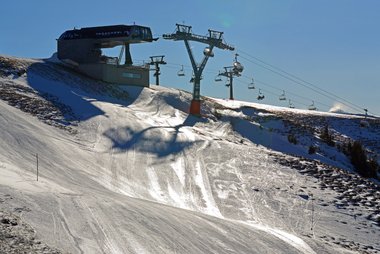
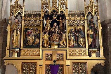
- Zeller See is the lake at the heart of the town. Swim, rent a boat or walk the shore path.
- Schmittenhöhe is the town's own mountain, reached by cable car, with ski runs and summer hiking trails.
- Schloss Rosenberg is a small castle in the old town.
- Vogtturm Museum is a museum of local history in a medieval tower.
- Stadtpfarrkirche St. Hippolyt is the parish church in the old town.
- Strandbad Thumersbach is a lido on the quieter side of the lake.
- The Kitzsteinhorn glacier above Kaprun gives year-round snow and views.
- The Grossglockner High Alpine Road, Austria's highest paved pass, is about 45 minutes away.
قوائم مميزة

أساسيات تسيل أم زيه
تُسلط هذه المجموعة الضوء على المعالم المعمارية والطبيعية في تسيل أم زيه. وتتميز بقمة شميتن هوه التي يبلغ ارتفاعها 1965 متراً ومنتجع التزلج المرتبط بها، إلى جانب بحيرة تسيل العذبة. تشمل المواقع التاريخية قلعة شلوس روزنبرغ، وهي قلعة من القرن السادس عشر تعمل الآن كمبنى للبلدية، ومحكمة المقاطعة المحمية كتراث. يمكن للزوار استكشاف متنزه إسبلاناد المطل على البحيرة، أو مشاهدة عرض نافورة تسيلر زيه زاوبر، أو اللعب في ملعب الجولف المكون من 36 حفرة، وهو الأكبر في جبال الألب النمساوية.
10 أماكنتجارب ننصح بها
- Ski the Schmittenhöhe or the Kitzsteinhorn glacier.
- Swim and paddle on the lake in summer.
- Walk or cycle around the lake.
- Take a cable car and hike a ridge trail.
- Drive the Grossglockner High Alpine Road in summer.
جولات وأنشطة
تسيل أم زيه — خريطة

رحلات اليوم الواحد
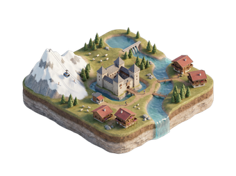
- Kaprun is the gateway to the Kitzsteinhorn glacier, about 15 minutes away.
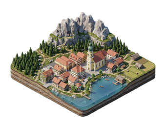
- Saalfelden lies in a valley under rocky peaks, about 20 minutes away.
- Saalbach is a large ski area, about 30 minutes away.
- Bad Gastein is a historic spa town in a waterfall setting, about 1 hour by car.
- Kitzbühel is a famous ski town, about 45 minutes by car.
- Salzburg is about 1 hour by car or 1 hour 30 minutes by train.
أماكن للاستكشاف
- Kaprun, Saalfelden and Saalbach are the closest resorts.
الوصول إلى الوجهة
- By air: Salzburg Airport is about 1 hour away by car. Innsbruck and Munich are the other options.
- By train: Zell am See has a station on the Salzburg–Innsbruck line. Salzburg takes about 1 hour 30 minutes. Check times on ÖBB.
- By car: The town is reached from the A10 motorway via the B311 road.
التنقل والمواصلات
The old town and the lakefront are small and walkable. Local buses and ski buses link Kaprun and other nearby villages. Boats cross the lake in summer. A summer card gives free use of cable cars and public transport in the region.
القيادة
A car is helpful for the Grossglockner road and nearby valleys. The old town has restricted traffic. Winter tyres or chains are required in snow. Motorways in Austria need a vignette. The Grossglockner road is a toll road and is closed in winter.
المأكولات والمشروبات
Salzburg-region food includes Kasnocken, cheese dumplings, and Kaiserschmarrn. Lake fish such as char and whitefish appear on menus. Mountain huts serve simple dishes in summer and winter.
السلامة والصحة
Zell am See is very safe. Be careful on the water in changing weather. Stay on marked runs and follow avalanche warnings in winter. Tap water is clean and safe to drink. The emergency number is 112. The mountain rescue number is 140.
التاريخ
Zell am See grew around a monastery cell founded in the 8th century, from which it takes its name. It later became a market town and a base for trade. Tourism grew in the 19th century with the railway and the lake. The Kitzsteinhorn cable cars opened in the 1960s.
حقائق عن البلد
Quick practical facts for Austria at a glance:
- العملة
- يورو EUR € · الدفع بالبطاقات · مقبولة بصورة شائعة
- أرقام الطوارئ
- 112
- الكهرباء
- 230 فولت · 50 هرتزالنوع C / النوع F
- اللغات
- الألمانية
- مياه الصنبور
- صالحة للشرب
- جهة القيادة
- اليمين
- رمز الاتصال الدولي
- +43


تسيل أم زيه – خطط لأيامك
حوّل الأماكن المذكورة في هذا الدليل إلى خط سير حقيقي، مع ملاحة ذكية وتقديرات زمنية وكل ما تحتاجه لرحلة مثالية.


وجهات ذات صلة

Data: © OpenStreetMap contributors, Wikidata, Wikipedia, Tripomatic, Official websites, geoBoundaries (CC BY 4.0). Tours by GetYourGuide. We earn commission from bookings. Travel guide generated with AI.
خطط لرحلتك مع Tripomatic
- تخطيط مدعوم بالذكاء الاصطناعيدع الذكاء الاصطناعي يبني خط سير رحلتك، ويجيب عن أسئلة السفر، ويُدرج مستندات حجوزاتك داخل رحلتك.
- تنبيهات السفرإرشادات رسمية، وتحذيرات الطقس القاسي، والإضرابات، والمخاطر الطبيعية للأماكن المجدولة في كل يوم من رحلتك.
- العطلات الرسمية والفعالياتتعرف على العطلات والمهرجانات وأوقات الإغلاق خلال أيام رحلتك، وتأثيرها على خططك.
- تقدير التكاليفتفصيل تكاليف الرحلة مدعوم بالذكاء الاصطناعي لتعرف الميزانية المناسبة قبل انطلاقك.
- جولات وتذاكراحجز الجولات وتذاكر تجاوز طوابير الانتظار والأنشطة مباشرة من داخل خطتك.