



Bogotá
Bogotá is Colombia's capital and its largest city, spread across a high Andean plateau at about 2,640 m. A wall of green mountains rises on its eastern edge, so you always know which way is east. The air is thin and cool, and a light jacket is useful all year.
Most visitors base themselves in the colonial centre or in the northern neighbourhoods and stay three or four nights. The city suits travellers who like museums, history, street art and food more than beach time. It is also the main gateway for trips across the country.

Bogotá – Planst du eine Reise?
Erstelle deine Reiseroute Tag für Tag in der Tripomatic-App.


Beste Reisezeit
Bogotá is cool and spring-like all year, with little change between months. The driest months are December to February, with the fewest rainy days in January. April–May and October–November bring the most rain, usually as afternoon showers; July and August are a little drier.
The biggest annual event is Rock al Parque, a free open-air rock festival in Parque Metropolitano Simón Bolívar. It is one of the largest free rock festivals in Latin America, and in 2026 it runs 10–12 October.
Days can feel warm in the sun, but evenings are chilly. Pack layers and a rain jacket in any season.
Top-Sehenswürdigkeiten


Most of the classic sights sit in or near La Candelaria, the colonial old town, so you can walk between them.
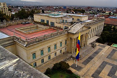
- Plaza de Bolívar is the heart of the city, framed by the cathedral, Congress and City Hall. Come on a weekday to see it busy with office workers, pigeons and street vendors.
- Gold Museum holds the world's largest collection of pre-Hispanic gold objects. Do not miss the Muisca raft, a tiny gold model linked to the legend of El Dorado.
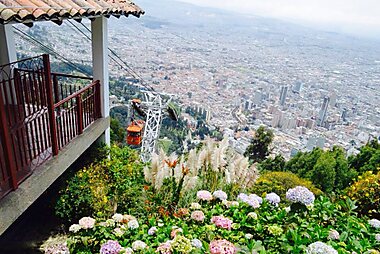
- Cerro de Monserrate rises 3,152 m above sea level, directly above the centre. Ride up by Teleférico de Monserrate or funicular for the best view of the city and a hilltop church.
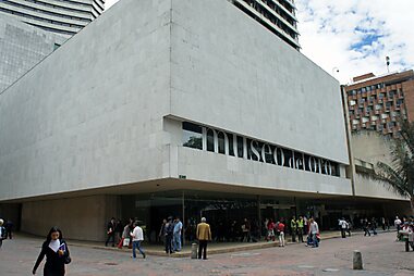
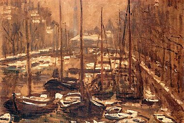
- Botero Museum shows the rounded figures of Fernando Botero next to his own collection of works by Picasso, Monet, Dalí and others. Entry is free.
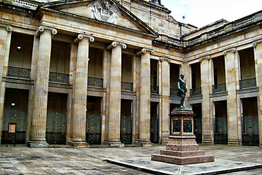
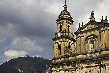
- Catedral Primada de Bogotá is the city's main church, a large neoclassical building on the east side of the square. On the south side of the square, Capitolio Nacional is the seat of Colombia's Congress.
- Iglesia de San Francisco dates from the 16th century and has a large gold-leaf altarpiece. It is a short walk north along Carrera Séptima.
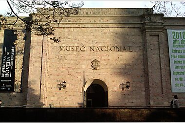
- National Museum of Colombia tells the story of Colombia from early cultures to the present. It is housed in a 19th-century former prison.
- Quinta de Bolívar is the country house where Simón Bolívar lived, with restored rooms and quiet gardens at the foot of the mountains.
Empfohlene Listen


Bogota Peaks and Viewpoints
Bogotá sits in a high-altitude savanna flanked by the Eastern Hills, providing numerous natural vantage points. This collection features the iconic 3,152-meter Monserrate and the historic Plaza de Bolívar, alongside lesser-known peaks like Alto Los Tunjos and Cuchilla Las Ánimas. These locations span from the urban center to the high-altitude páramo of Sumapaz, offering views of the city's grid, the southern residential districts, and the surrounding Andean cordillera. Many sites also serve as critical communication hubs marked by telecommunication towers.
13 Orte


Erlebnisse & Aktivitäten
A few things make a stay in Bogotá different from other capitals.
- Join the Sunday Ciclovía: every Sunday and public holiday, from 7:00 to 14:00, about 128 km of main roads close to cars. Rent a bike or just walk with the crowds of cyclists, runners and skaters.
- Play tejo: Colombia's national sport means throwing a metal disc at a clay target lined with small gunpowder packets that explode on a hit. It is usually played in local clubs with beer, and many clubs welcome beginners.
- Watch sunset from Cerro de Monserrate: ride up in the late afternoon and watch the city lights come on across the plateau. Take a warm layer, because it gets cold fast at the top.
- Take a street-art walk: La Candelaria and the centre are covered in large murals. Guided graffiti walks explain the artists and the political stories behind the paintings.
- Browse the Sunday market in Usaquén: this former village in the north fills with craft and food stalls every Sunday.
Touren & Aktivitäten
Bogotá — Karte

 Interaktive Karte öffnen
 Tagesausflüge
The high plateau around Bogotá has colonial towns, lakes and rock formations within easy reach. Most trips start from the north of the city.
- Zipaquirá — about 1 hour by car or by bus from the Portal Norte TransMilenio station. The main draw is the Salt Cathedral, a church carved into a salt mine 200 m underground. On weekends and holidays, the Tren de la Sabana tourist train also runs there from Bogotá.
- Suesca — about 1.5 hours by car. Its sandstone cliffs are Colombia's best-known rock-climbing area, and local operators offer beginner sessions.
- Lake Guatavita — about 1.5–2 hours by car. This round mountain lake is where the Muisca held the gold ceremony behind the El Dorado legend. Visits are on guided walks, and swimming is not allowed.
- Villa de Leyva — about 3 hours by car or bus. A well-preserved colonial town with one of the largest cobbled squares in South America. It is better as an overnight trip than a day trip.
Orte zum Entdecken
Bogotá is surrounded by Cundinamarca, a region of farm country, small colonial towns and páramo highlands that holds most of the easy day trips.
Heading north-east, Boyacá has some of Colombia's best-preserved colonial towns and the battlefield where the country won its independence.
Anreise
- By air: El Dorado International Airport (BOG) is about 15 km west of the centre and is Colombia's main international hub. A taxi to La Candelaria takes 30–45 minutes and costs roughly 30,000–45,000 COP; use the official taxi rank or an app. The cheaper option is the TransMilenio feeder bus 16-14 to Portal El Dorado, then a trunk bus along Calle 26 into the centre. El Dorado Airport
- By bus: The main long-distance bus station is the Terminal de Transportes (Salitre), with frequent buses to Medellín, Cali and most other Colombian cities. Journeys are long, so many travellers fly between major cities instead.
- By train: There are no intercity passenger trains. The only passenger rail is the Tren de la Sabana tourist train, which runs on weekends and holidays.
Unterwegs vor Ort
- TransMilenio and SITP buses: The red TransMilenio buses run in their own lanes on the main avenues, and the blue SITP buses cover the rest of the city. You pay with a rechargeable TuLlave card, sold and topped up at TransMilenio stations. One trip costs 3,550 COP (2026). Paying by tapping a bank card or phone works only at a few pilot stations for now. TransMilenio
- Metro: The first metro line is under construction and is not expected to open before 2028.
- Taxi / ride-hailing: Taxis are cheap; book them through an app (see Safety).
- On foot / cycling: La Candelaria is compact and easy to walk, but streets are steep and the altitude makes you tired quickly. The city has a large network of bike lanes, and bike tours are a popular way to see it.
Autofahren
- Is a car worth it?: No, not for a city stay — traffic is heavy and taxis are cheap. A car only helps for exploring the countryside on your own.
- Pico y placa: On weekdays from 6:00 to 21:00, private cars may drive only on alternate days. On odd-numbered dates, plates ending in 1–5 may drive; on even-numbered dates, plates ending in 6–0. A paid daily exemption ("pico y placa solidario") is sold only through the city's official mobility website.
- Parking: Use guarded paid car parks (parqueaderos), charged by the minute. Avoid leaving anything visible in the car.
Essen & Trinken
Bogotá's signature dish is ajiaco, a thick chicken and potato soup served with cream, capers and avocado. For breakfast or an afternoon snack, try hot chocolate with a slice of cheese dropped into the cup, or a tamal wrapped in banana leaf. The small historic cafés near the cathedral in La Candelaria are the classic place for both; La Puerta Falsa has served them since 1816.
For fruit you have never seen before, visit Paloquemao market in the morning, where the flower hall is also a sight in itself. For dinner, most good restaurants cluster in the north: Zona G, Zona T, the streets around Parque de la 93, and the old centre of Usaquén.
Sicherheit & Gesundheit
Bogotá is a big city with real crime, but most visits go without problems if you take normal care. Phone and bag snatching are the most common issues, especially in crowds and on buses. Keep your phone out of sight on the street, and carry only the cash you need.
- Taxis: Do not hail taxis on the street. Robberies in street taxis do happen; book through an app or a dispatch service instead.
- Drugging: Criminals sometimes drug victims to rob them, often after meeting through dating apps or in bars. Never leave a drink unattended, and meet new people in busy public places.
- At night: La Candelaria and the centre become quiet after dark. Take a taxi rather than walking back late.
- Altitude: At 2,640 m, many visitors feel short of breath or get headaches at first. Take the first day slowly, drink water and go easy on alcohol.
- Tap water: Unlike much of Colombia, tap water in Bogotá is treated and rated safe to drink.
- Sumapaz: The national park in Bogotá's rural south is not open to tourism. Do not join tours that offer visits there.
Geschichte
Before the Spanish arrived, this plateau was the land of the Muisca people, famous for their goldwork. You can see their treasures in the Gold Museum. The Spanish conquistador Gonzalo Jiménez de Quesada founded the city in 1538 and named it Santa Fe. By tradition, the first settlement stood at Chorro de Quevedo.
Bogotá became the capital of a large Spanish colony, and its churches and mansions still line the streets of La Candelaria. The independence movement began here on 20 July 1810, in a building on Plaza de Bolívar. Simón Bolívar later lived at Quinta de Bolívar.
The 20th century brought violent moments. In 1948, the murder of the politician Jorge Eliécer Gaitán started riots known as the Bogotazo, which destroyed much of the centre. In 1985, the M-19 guerrilla group seized the Palace of Justice on Plaza de Bolívar; the building standing there today is a replacement.
Länderfakten
Quick practical facts for Colombia at a glance:
- Währung
- Kolumbianischer Peso COP $ · Kartenzahlung · Häufig akzeptiert
- Notrufnummern
- 123
- Stromnetz
- 110 V · 60 HzSteckertyp A / Steckertyp B
- Sprachen
- Spanisch
- Leitungswasser
- Mit Vorsicht trinken
- Fahrseite
- Rechtsverkehr
- Telefonvorwahl
- +57


Bogotá – Plane deine Tage
Verwandle die Orte aus diesem Reiseführer in eine echte Reiseroute mit intelligenter Routenführung, Zeitschätzungen und allem für eine perfekte Reise.


Ähnliche Reiseziele


Data: © OpenStreetMap contributors, Wikidata, Wikipedia, Tripomatic, Official websites, geoBoundaries (CC BY 4.0). Tours by GetYourGuide. We earn commission from bookings. Travel guide generated with AI.