



Kolumbien
Colombia stretches from Caribbean beaches to Amazon rainforest, Andean peaks, and Pacific jungle, all inside one country. Bogotá, Medellín, and Cali anchor the Andean interior, while Cartagena and Santa Marta open onto the Caribbean coast. The legend of El Dorado, a mythical king said to cover himself in gold dust, drew Spanish conquistadors here for centuries and still explains why Bogotá's Gold Museum holds the world's largest collection of pre-Columbian gold. After decades of conflict, Colombia has become one of South America's most visited countries, though safety still varies sharply by region.
Colombia suits travelers who want many different experiences in one trip: colonial architecture in walled Cartagena, salsa nightlife in Cali, coffee-farm stays in the coffee region, and multi-day treks to Ciudad Perdida or Caño Cristales. It works well both for first-time South America visitors who stick to the main cities and the coffee region, and for more adventurous travelers heading into the Amazon or the Caribbean islands of San Andrés and Providencia.

Kolumbien – Planst du eine Reise?
Erstelle deine Reiseroute Tag für Tag in der Tripomatic-App.


Geld & Bezahlen
Prices are quoted in thousands, so a coffee might cost 5,000 and a dinner 60,000 — the extra zeros feel unfamiliar at first, but the value is small. Cards are accepted at most restaurants and hotels in Bogotá, Medellín, and Cartagena; keep cash for taxis, small vendors, and towns off the main tourist route. ATMs (cajeros) are widely available in cities — withdraw indoors at a bank branch or shopping mall rather than a street-corner machine, which is a more common target for theft.
Empfohlene Listen


Colombian Peaks and Volcanoes
Colombia's topography is defined by the Andes and isolated massifs. This list includes the Nevado del Huila, the country's highest volcano at 5,364 meters, and the active Cumbal stratovolcano in Nariño. In the north, the El Totumo mud volcano offers a unique geothermal feature near the Caribbean coast. Urban peaks like Medellín's Cerro El Volador provide protected green space, while remote ranges like the Serranía de Macuira and the Serranía de San Lucas harbor high-altitude cloud forests and diverse ecosystems.
20 Orte


Touren & Aktivitäten
Kolumbien — Karte

 Interaktive Karte öffnen
 Trinkgeld
Tipping follows a system called propina voluntaria (voluntary tip): at restaurants, staff ask if you want to add a tip, usually around 10%, before bringing the card machine over — you can decline without any awkwardness. Taxis don't expect a tip; rounding up the fare is enough. Tour guides, especially on coffee-farm or multi-day hiking trips, rely on tips as a real part of their income, so budget for it.
~10%, often offered as "propina voluntaria" on the bill — you can decline
round up the fare
5,000–10,000 COP for porters or housekeeping
20,000–50,000 COP per person
Strom & Stecker
Colombia uses Type A/B plugs at 110 V / 60 Hz, the same as the United States and Canada. Travelers from Europe or the UK need a plug adapter, and some higher-power devices may also need a voltage converter.
Sprache
Spanish is Colombia's official language. Outside hotels, tour operators, and higher-end restaurants in Bogotá, Medellín, and Cartagena, English is not widely spoken. Learning a few basic Spanish phrases helps a lot, especially in smaller towns and rural areas.
Internet & Mobilfunk
Prepaid SIM cards (Claro, Movistar, Tigo) are sold at the airport and in shopping malls; buying one requires your passport for registration. Coverage is strong in cities, the coffee region, and along the Caribbean coast, but drops in remote parts of the Amazon, the Pacific coast, and high mountain areas. An eSIM from an international provider is a simpler option if you don't need a local number.
Sicherheit & Notfälle
Most visits to Colombia's main cities and tourist routes are trouble-free, but petty theft, such as phone and bag snatching or pickpocketing on buses, is the most common problem in Bogotá, Medellín, and Cartagena's Old Town. Use official taxis or ride-hailing apps rather than hailing a car on the street, and avoid displaying phones or jewelry openly on public transport. A small number of rural regions, mostly near the Venezuelan and Ecuadorian borders and parts of the Pacific coast, still see armed-conflict-related activity; check current travel advisories before heading off the main tourist routes.
Gesundheit
Tap water is treated to safe standards in Bogotá and other major cities, but stick to bottled or filtered water in smaller towns, rural areas, and the Amazon. Pharmacies are common in every city, and pharmacists can often help with minor ailments without a doctor visit. Bogotá sits 2,640 meters above sea level, and some visitors feel mild shortness of breath or fatigue for the first day or two. Travelers heading to the Amazon or the Pacific coast should check with a doctor about yellow fever vaccination and malaria precautions before the trip.
Visum & Einreise
Citizens of the United States, Canada, the UK, the EU, Australia, New Zealand, Japan, South Korea, and most Latin American countries can enter Colombia without a visa. They receive up to 90 days on arrival, extendable once for a total of 180 days within a calendar year. Travelers from countries without a visa-free agreement, including China, India, and Russia, need to apply for a tourist visa online in advance.
Visa and entry requirements change frequently. Verify current requirements with the official immigration authority or your country's embassy before travel.
Knigge & Bräuche
Colombians are generally warm and informal, but a handshake or a light cheek kiss on one cheek is the standard greeting, even between new acquaintances. Dress modestly when visiting churches: no shorts, and cover your shoulders. Bargaining is expected in craft markets and with street vendors, but not in shops with marked prices. Ask before photographing people, especially in indigenous communities such as those encountered on the Ciudad Perdida trek or in the Amazon.
Feiertage & Öffnungszeiten
Colombia observes many public holidays, and several are shifted to the following Monday to create a long weekend even when the original date falls elsewhere in the week. Expect banks, offices, and many shops to close on these days, though malls and restaurants in tourist areas usually stay open. Shops generally open Monday to Saturday from around 9:00 to 19:00, with many closing for lunch in smaller towns; Sunday hours are shorter, especially outside the big cities.
Unterwegs vor Ort
- By air: distances and mountain terrain make flying the fastest way between distant regions — Bogotá to Cartagena, San Andrés, or Leticia in the Amazon can take a full day by road but only around two hours by air. Avianca, LATAM, and budget carriers Wingo and JetSmart cover most routes.
- By bus: an extensive intercity coach network connects almost every town, and it is the most common way to travel between nearby cities. Mountain roads mean journeys take longer than the distance suggests — Bogotá to Medellín is around 400 km by road but takes 8–9 hours to drive.
- By taxi and ride-hailing: Uber, InDriver, and Cabify all operate in Colombian cities and are the easiest way to get a fair-priced ride; in Bogotá, Uber trips are arranged in-app rather than flagged down on the street.
Autofahren
- Key rules: seatbelts are mandatory for all occupants, and using a handheld phone while driving is illegal. Night driving on rural mountain roads is best avoided — they are winding, poorly lit, and shared with slow-moving trucks.
- Pico y placa: most large cities restrict cars from driving on certain days based on the last digit of the license plate, aimed at easing congestion — check local rules before driving into Bogotá, Medellín, or Cali on a weekday.
- Parking: paid parking lots (parqueaderos) are common in city centers and generally safer than street parking; look for one with an attendant.
- Fuel: stations are normally attended — hand your card or cash to the attendant rather than pumping yourself. Card payment is widely accepted at fuel stations in cities, though carrying cash is safer in smaller towns.
- Electric vehicles: charging infrastructure is still limited outside Bogotá and Medellín, so renting an EV for a road trip is not yet practical in most of the country.
Essen & Trinken
Colombians eat their largest meal at lunch, typically a set menu called ejecutivo or corrientazo: soup, a main with rice, beans, and salad, and juice, all for a fixed, low price. Breakfast is light, often just arepas or bread with coffee, and dinner tends to be smaller than lunch. Meal times run later than much of Europe, with lunch from around 12:00 to 14:00 and dinner rarely before 19:00.
Each region has its own specialties. The Andean interior favors hearty, meat-heavy dishes built around rice, beans, and plantain, while the Caribbean coast leans toward coconut rice, fish, and seafood. Street food is common in every city: roasted corn, empanadas, and skewered meats from carts are a normal part of daily eating, not just a tourist experience.
Coffee culture runs deep, though the best export-grade beans have traditionally been sold abroad — look for a specialty café in Bogotá, Medellín, or the coffee region to try Colombia's own high-grade coffee. Fresh tropical fruit juices, made from fruits with no direct English name like lulo, guanábana, and maracuyá, are a highlight worth trying wherever you see a juice stand.
Orte zum Entdecken
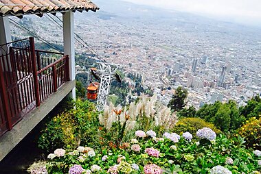
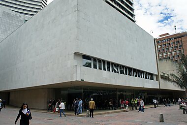
Colombia's essential stops fall into a few clusters. In the Andean interior, Bogotá is the high-altitude capital with the country's best museums, Medellín pairs a mild climate with cable-car transit and a booming food scene, and Cali is known across the country as its salsa capital.
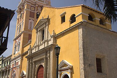
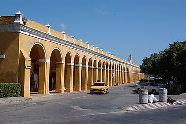
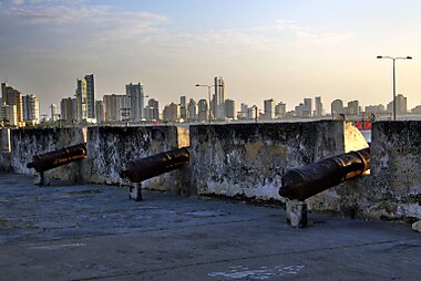
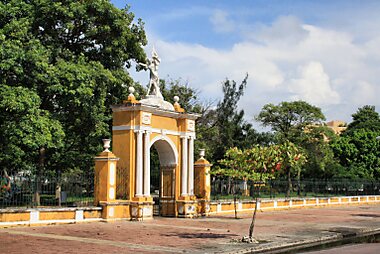
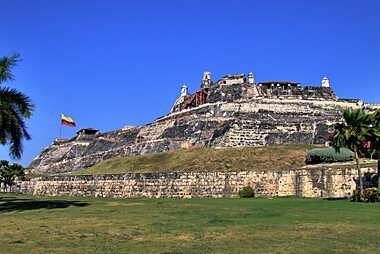
On the Caribbean coast, walled Cartagena is a UNESCO World Heritage city and the country's top Caribbean draw, Santa Marta is the gateway to Tayrona National Park and the Ciudad Perdida trek, and Barranquilla hosts one of the world's largest carnivals every February. The islands of San Andrés add a Caribbean beach escape with a distinct Creole culture.
For a slower pace, coffee-region town Salento is the base for visiting the wax palms of the Cocora Valley. Guatapé is known for its brightly painted houses and a nearby rock formation with sweeping views. Colonial Villa de Leyva centers on one of South America's largest cobblestone squares. Whitewashed Popayán is known for its Holy Week processions.
Kolumbien – Plane deine Reise
Wähle die Orte aus, die du sehen möchtest, und Tripomatic erstellt daraus eine Route Tag für Tag – mit intelligenter Wegführung, Zeitschätzungen und allem für die perfekte Reise.


Ähnliche Reiseziele


Data: © OpenStreetMap contributors, Wikidata, Wikipedia, Tripomatic, Official websites, geoBoundaries (CC BY 4.0). Tours by GetYourGuide. We earn commission from bookings. Travel guide generated with AI.