


Provincia de Kon Tum
Kon Tum is a quiet highland province in the Central Highlands of Vietnam, near the borders with Laos and Cambodia. The provincial city sits on the Đắk Bla River at about 500 metres. It is known for its communal houses (nhà rông), the French-era wooden church and the villages of the Bahnar, Sedang and Jarai peoples.
Most visitors spend one or two nights, often between Hội An and Pleiku or Buôn Ma Thuột.

Provincia de Kon Tum – ¿Estás planeando un viaje?
Crea tu itinerario día a día en la app de Tripomatic.


Cuándo viajar
November to April is the dry season and the best time to visit. Skies are clear and roads are open. May to October is the rainy season, with afternoon storms and muddy trails. Nights can be cool in winter. Festivals of the highland peoples take place in the dry season.
Mejor época para viajar: enero
Lugares destacados
- Nhà Rông Kon Pring is a tall communal house of the Bahnar people, near the river and the suspension bridge.
- Cầu dây võng Kon Pring is a footbridge over the Đắk Bla River at Kon Pring.
- Our Lady of Mang Den is the Marian shrine at Măng Đen, in the cool pine hills.
- Kon Tum Prison is a former French prison with a museum, in the city.
- Bishop of Kontum's Building is the old bishop's building next to the wooden church.
- Thác Pa Sỹ is a waterfall in the Măng Đen area.
- Hồ Đắk Ke is a lake in the Măng Đen pine forest.
- Pine path is a pine-lined path near the lake.
The Kon Tum Wooden Church, built in 1913 from dark wood in a Bahnar style, is the best known building in the city.
Qué experimentar
- Visit the wooden church: Look at the carved wood and the nearby orphanage.
- Cycle to the villages: Short rides lead to Bahnar and Sedang communal houses.
- Stay in a pine-forest homestay at Măng Đen: Cool air, lakes and waterfalls.
- Try highland food: Grilled meats, bamboo-tube rice and wild vegetables.
- Drink local coffee: The highlands are a coffee region.
Tours y actividades
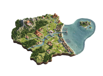
Provincia de Kon Tum — Mapa

Excursiones de un día
Qué explorar
- South: Pleiku is the city of Gia Lai province.
- South-east: Dak Lak has coffee and waterfalls.
- East: Quang Ngai and Da Nang are on the coast.
Cómo llegar
- By bus: Buses run from Da Nang, Quảng Ngãi, Pleiku and Hanoi.
- By air: The nearest airport is in Pleiku, about 1 hour away by road.
- By road: Highway 14 (Hồ Chí Minh road) runs through the city.
- By train: There is no railway to Kon Tum. Vietnam Railways
Cómo desplazarse
- Walking: The city centre is small and walkable.
- Bicycle: Good for the river and nearby villages.
- Motorbike hire: Best for Măng Đen and villages.
- Taxi: A few taxis serve the city.
Conducción
- Is a car worth it? A car or motorbike helps for Măng Đen and the villages. The city is easy on foot.
- Roads: Highway 14 is busy with trucks. Mountain roads to Măng Đen are winding.
- Fuel: Fill up in the city before mountain drives.
Gastronomía
Highland food in Kon Tum is simple and smoky. Try cơm lam, rice cooked in bamboo, grilled meats, wild vegetables and rice wine. Coffee, pepper and cassava grow in the province. Local restaurants cluster around the city centre.
Seguridad y salud
Kon Tum is a quiet and safe city.
- Mountain roads can be slippery after rain. Take care on a motorbike.
- Respect village customs. Ask before photographing people and houses.
- Nights are cool in the highlands. Bring a light jacket.
- Stay on tracks near the border areas.
- Medical care is basic outside the city.
Historia
Kon Tum was settled by the Bahnar, Sedang and Jarai peoples long before the French. French missionaries arrived in the 19th century and built a church, a seminary and a bishop's house. The French also built a prison, now a museum.
The province saw heavy fighting in the Vietnam War, particularly near the Laos border. Today Kon Tum is a quiet city that keeps its mission buildings and the villages of its highland peoples.
Datos del país
Quick practical facts for Vietnam at a glance:
- Moneda
- dong vietnamita VND ₫ · Pago con tarjeta · Habitualmente aceptado
- Electricidad
- 220 V · 50 HzTipo A / Tipo C / Tipo F
- Idiomas
- vietnamita
- Agua del grifo
- No potable
- Sentido de la circulación
- Derecha
- Prefijo telefónico
- +84
Provincia de Kon Tum – Planifica tu viaje
Elige los lugares que quieres ver y Tripomatic los convertirá en una ruta día a día, con cálculo inteligente de rutas, estimaciones de tiempo y todo lo necesario para un viaje perfecto.


Destinos relacionados



Data: © OpenStreetMap contributors, Wikidata, Wikipedia, Tripomatic, Official websites, geoBoundaries (CC BY 4.0). Tours by GetYourGuide. We earn commission from bookings. Travel guide generated with AI.