


La Paz
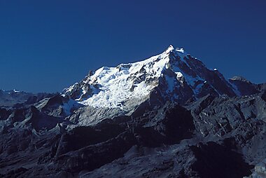
La Paz is the highest seat of government in the world, filling a steep canyon more than 3,600 meters up in the Bolivian Andes. The snow-capped peak of Illimani watches over the city from almost every street, and the skyline climbs the canyon walls up to the sister city of El Alto on the rim above.
The city blends colonial Spanish architecture with strong Aymara indigenous culture. Street markets, ritual healers, and steep cobbled lanes give La Paz its own distinct character. It suits travelers who want a dramatic, high-altitude city with easy access to the Andes.

La Paz – ¿Estás planeando un viaje?
Crea tu itinerario día a día en la app de Tripomatic.


Cuándo viajar
La Paz has two seasons: a dry, sunny season from May to October, and a wetter season from November to April with afternoon showers. Days stay mild year-round thanks to the altitude, but nights are cold, and temperatures can drop below freezing between June and August.
Time a visit around Gran Poder, La Paz's biggest festival, when thousands of dancers in elaborate costumes parade through the city for a full day.
Lugares destacados
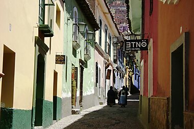




Jaen Street is the best-preserved colonial street in the city, lined with brightly painted balconies, small museums, and craft shops.
Just downhill, The Witches' Market sells Andean ritual items, herbal remedies, and dried llama fetuses used as offerings to Pachamama, the Andean earth goddess.
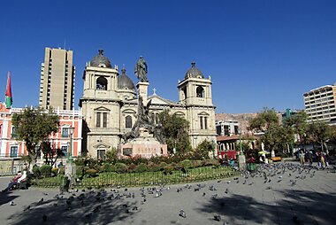
Plaza Murillo is the political heart of Bolivia, ringed by the presidential palace, congress, and the cathedral.
Facing the plaza, Cathedral Basilica of Our Lady of Peace, La Paz took nearly a century to build and was finished in 1925 for Bolivia's centennial.
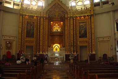
A few blocks away, Basilica of San Francisco, La Paz combines Baroque stone carving with Andean motifs, built largely by Indigenous and mestizo craftsmen in the 18th century.
For the best view over the whole city, climb to Killi Killi Viewpoint, a free lookout above the historic center.
South of downtown, Moon Valley is a badlands landscape of eroded clay spires and canyons, an easy trip from the center.
Listas destacadas


Qué experimentar
- Ride Mi Teleférico end to end for views over the canyon and the snow peaks beyond — a rare case of a city's public transit doubling as a sightseeing ride.
- Watch Lucha libre cholitas, cholita wrestling, where women in traditional layered skirts wrestle in a ring in El Alto, a spectacle unique to the region.
- Mountain-bike down the Yungas Road, once known as one of the world's most dangerous roads, descending thousands of meters from the Andes into cloud forest.
Tours y actividades
La Paz — Mapa

 Abrir el mapa interactivo
Excursiones de un día
La Paz sits close to some of Bolivia's biggest sights, from ancient ruins to the world's highest lake.
- Valley of the Souls, about 45 minutes by taxi: a canyon of narrow clay spires near Moon Valley, quieter and less visited.
- Chacaltaya, about 1.5 hours by car: Chacaltaya was once the world's highest developed ski area; the glacier is gone, but the drive and the summit view over the Cordillera Real are still worth it.
- Spiritual and Political Centre of the Tiwanaku Culture, about 1.5-2 hours by bus or car: a UNESCO World Heritage archaeological site, once the capital of an empire that predates the Inca.
- Lake Titicaca and Copacabana, about 3-4 hours by bus: the world's highest navigable lake, with boats out to Isla del Sol, a site sacred in Inca mythology.
Qué explorar
The mountains and wilderness around La Paz are as much a part of the region as the city itself.
Cordillera Real is the jagged, glaciated range visible from almost anywhere in the city, home to Huayna Potosí Mountain, Bolivia's most-climbed 6,000-meter peak.
Further north, Cordillera Apolobamba is a remote high-Andean range known for alpaca herding and ancient trekking routes.
To the northeast, the vast Área Natural de Manejo Integrado Madidi protects a slice of the Amazon basin, reachable by a short flight or a long overland journey from La Paz.
Cómo llegar
- By air: El Alto International Airport (LPB) sits on the plateau above the city, one of the highest international airports in the world. It's a 20-30 minute taxi ride down into central La Paz.
- By bus: La Paz's main bus terminal has long-distance connections across Bolivia and to neighboring countries, including Peru, Chile, and Argentina.
- By train: Bolivia has no significant passenger rail service into La Paz; nearly all travelers arrive by air or bus.
Cómo desplazarse
- Public transit: Mi Teleférico, the city's cable-car network, is one of the fastest ways to cross town and to reach El Alto; pay with a rechargeable card sold at any station. Minibuses (micros) and shared vans (trufis) cover routes the cable car doesn't reach; pay the driver in cash.
- Taxi: use a registered radio taxi rather than hailing one on the street, especially at night. Ride-hailing app coverage is limited; ask your hotel for a trusted local taxi number instead.
- On foot: La Paz is extremely hilly and sits above 3,600 meters, so walking uphill is far more tiring than the distance suggests. Pace yourself, especially in the first day or two.
Conducción
- Is a car worth it?: no. La Paz's streets are steep, narrow, and often one-way, and parking downtown is scarce. Use taxis or the cable car in the city, and rent a car only to explore the wider region independently.
- Parking: paid street parking and a handful of guarded lots exist near the center; most visitors skip driving in the city altogether.
Gastronomía
La Paz treats the salteña as a breakfast ritual: a juicy, slightly sweet baked pastry, typically bought from a stall or bakery before late morning, before they sell out. Street stalls around the San Pedro and Mercado Lanza area serve cheap, filling almuerzo lunches, while Sopocachi is the neighborhood for a wider range of modern Bolivian restaurants.
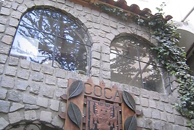
Coca leaf is part of daily life here, not just a tourist novelty; Coca Museum covers its history and its complicated relationship with cocaine production.
Seguridad y salud
La Paz is generally safe for tourists, but altitude is the biggest health risk, not crime. At over 3,600 meters, altitude sickness (headache, nausea, breathlessness) is common in the first day or two; rest, drink plenty of water, and go easy on alcohol until you've adjusted. Coca tea is a common local remedy.
Petty theft happens in crowded markets and bus stations — keep bags zipped and valuables out of sight. Avoid the informal "prison tours" once offered at San Pedro Prison; they are illegal and unsafe, whatever a tout on the street tells you.
Historia
La Paz was founded in 1548 by the Spanish, in a canyon chosen for shelter and for its streams' gold. The city's full name, Nuestra Señora de La Paz, comes from that founding.
Basilica of San Francisco, La Paz and the surrounding old town date from the colonial period that followed, built largely with Indigenous and mestizo labor.
Plaza Murillo is named after Pedro Domingo Murillo, a leader of La Paz's 1809 uprising against Spanish rule, executed on the same square in 1810. The plaza has been the stage for Bolivian politics ever since, and Casa Grande del Pueblo still houses the presidency today.
Datos del país
Quick practical facts for Bolivia at a glance:
- Moneda
- boliviano BOB · Pago con tarjeta · Se prefiere efectivo
- Teléfonos de emergencia
- 911
- Electricidad
- 230 V · 50 HzTipo A / Tipo C
- Idiomas
- aimara, español, guaraní, quechua
- Agua del grifo
- No potable
- Sentido de la circulación
- Derecha
- Prefijo telefónico
- +591


La Paz – Planifica tus días
Convierte los lugares de esta guía en un itinerario real, con rutas inteligentes, estimaciones de tiempo y todo lo que necesitas para un viaje perfecto.


Destinos relacionados


Data: © OpenStreetMap contributors, Wikidata, Wikipedia, Tripomatic, Official websites. Tours by GetYourGuide. We earn commission from bookings. Travel guide generated with AI.