


Mũi Né
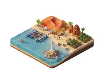
Mũi Né is a beach strip on the south-central coast, a short way east of Phan Thiết. It is known for red and white sand dunes, a busy fishing harbour, a small canyon and steady wind.
Most visitors stay two to three nights. Days are for the dunes, the Fairy Stream and the beach. The wind makes Mũi Né one of Vietnam's main places for kitesurfing and windsurfing. Resorts line the main road along the sea.

Mũi Né – ¿Estás planeando un viaje?
Crea tu itinerario día a día en la app de Tripomatic.


Cuándo viajar
The dry season from November to April is the best time. Skies are clear and the wind is strongest for kitesurfing. Mũi Né is one of the drier parts of Vietnam. The rainy season runs from May to October. Rain comes in short showers, and the sea is rougher.
Dune sunrise and sunset are the best times for photos and for cooler temperatures. Midday on the sand is very hot.
Mejor época para viajar: enero, febrero, marzo, diciembre
Lugares destacados
- Mui Ne Red Sand Dunes lie close to the main road. Visitors slide down the slopes on plastic sheets. Sunrise and sunset are best.
- Fairy Stream is a shallow stream that you walk up barefoot. Red and white sand walls rise on both sides.
- Red Canyon is a small gorge of eroded red and cream rock, north of the village.
- Fisherman's harbor is the fishing harbour, with hundreds of round basket boats and colourful fishing boats. Go early in the morning.
- Wine Castle is a castle-style winery near Phan Thiết that offers tours and tastings.
- Po Sah Inu Cham Towers is a Cham tower complex near Phan Thiết.
- Ham Tien Beach is a sandy beach on the Phan Thiết side of the strip.
The White Sand Dunes lie about 25 km north of the village. Most visitors reach them on a jeep tour.
Listas destacadas

Qué experimentar
- Kitesurf or windsurf: Schools along the beach offer lessons and rentals. The best months are November to April.
- Sandboard on the dunes: Slide down the slopes at sunrise or sunset.
- Jeep tour at sunrise: A set route links the White Dunes, the Red Dunes, the Fairy Stream and the harbour.
- Walk the Fairy Stream: A short barefoot walk in shallow water.
- Eat fresh seafood: Beach restaurants cook the day's catch.
Tours y actividades
Mũi Né — Mapa

Excursiones de un día
- White Sand Dunes: about 45 min north by jeep or car. A large dune field with a small lake. Quads are also available.
- Phan Thiết: 20 to 30 min by car. The city has a fish market, the Cham towers and local restaurants.
- Da Lat: about 4 to 5 hours by road. Combine it with an overnight stay.
- Ho Chi Minh City: about 4 to 5 hours by bus or car.
Qué explorar
- Nearby: Phan Thiết is the city that Mũi Né belongs to.
- Highlands: Da Lat is a cooler hill town reached by a mountain road.
- Coast to the north: Nha Trang is a larger beach city.
- Big city: Ho Chi Minh City is the main gateway.
Cómo llegar
- By air: There is no airport in Mũi Né. Most visitors fly into Ho Chi Minh City and continue by road.
- By bus: Tourist buses and limousine vans run from Ho Chi Minh City and take about 4 to 5 hours. Buses also run from Da Lat and Nha Trang.
- By train: A few trains stop near Phan Thiết. A taxi or bus continues to Mũi Né. Vietnam Railways
- By car: A private car from Ho Chi Minh City is a comfortable choice for groups.
Cómo desplazarse
- Motorbike and scooter: The most common way to move along the strip. Wear a helmet.
- Taxi and Grab: Available on the main road. Agree the price or use the meter.
- Jeep tours: The usual way to see the dunes, the Fairy Stream and the harbour in one trip.
- Bicycle: Good for the flat beach road, but the sun is strong at midday.
Conducción
- Is a car worth it? A driver helps if you want the dunes, the harbour and the stream in one day. For the beach strip, taxis and scooters are enough.
- Roads: The main beach road is straight and busy with scooters. Night driving is harder.
- Parking: Resorts offer free parking. Dune and stream sites have small paid lots.
Gastronomía
Mũi Né is a fishing coast, and seafood is the main food. Fish sauce from Phan Thiết is famous across Vietnam. Look for grilled fish, squid, shrimp and sour fish soups at beach restaurants. Local noodles and rice pancakes are common for breakfast.
The harbour area has simple seafood places. Dried squid and fish sauce make good gifts from the market.
Seguridad y salud
Mũi Né is a relaxed beach area, but a few things need care.
- Sun is strong. Use sunscreen, a hat and water, especially on the dunes.
- Currents and wind can be strong. Swim only where the beach is calm, and follow warnings.
- Scooter accidents are common. Wear a helmet and drive slowly.
- Agree on prices for jeeps and quads before you start.
- Keep valuables out of sight on the beach.
Historia
Mũi Né grew from a fishing village on the coast of the old Cham lands. Cham towers near Phan Thiết, such as Po Sah Inu Cham Towers, remain from that time. The area is also known for its fish sauce industry.
Tourism began to grow in the 1990s. Wind conditions brought kitesurfing and windsurfing, and resorts spread along the beach road.
Datos del país
Quick practical facts for Vietnam at a glance:
- Moneda
- dong vietnamita VND ₫ · Pago con tarjeta · Habitualmente aceptado
- Electricidad
- 220 V · 50 HzTipo A / Tipo C / Tipo F
- Idiomas
- vietnamita
- Agua del grifo
- No potable
- Sentido de la circulación
- Derecha
- Prefijo telefónico
- +84

Mũi Né – Planifica tus días
Convierte los lugares de esta guía en un itinerario real, con rutas inteligentes, estimaciones de tiempo y todo lo que necesitas para un viaje perfecto.


Destinos relacionados


Data: © OpenStreetMap contributors, Wikidata, Wikipedia, Tripomatic, Official websites. Tours by GetYourGuide. We earn commission from bookings. Travel guide generated with AI.