



Nerja
Nerja is a whitewashed coastal town on the eastern end of the Costa del Sol, about 55 km east of Málaga, between the sea and the Sierras de Almijara. It is known for the Balcón de Europa, a clifftop promenade, a huge cave with prehistoric paintings, and small beaches in coves below the cliffs.
It is quieter and more traditional than many Costa del Sol resorts. It is a good base for a few days, with the white villages of Frigiliana and Maro, and hiking in the mountains, close by.

Nerja – Suunnitteletko matkaa?
Rakenna päiväkohtainen matkasuunnitelmasi Tripomatic-sovelluksessa.


Milloin matkustaa
The weather is mild for most of the year. Spring and autumn are the best seasons for walking and sightseeing. Summer is hot and crowded, and August is the busiest month. Winters are mild, and the town stays open.
The Festival of the Cave of Nerja in July is a music and dance event held in the cave.
Paras aika matkustaa: huhtikuu, toukokuu, kesäkuu, heinäkuu, syyskuu, lokakuu, marraskuu
Päänähtävyydet
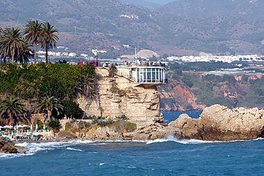
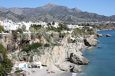
- Balcon de Europa is a promenade on a headland above the sea, with palm trees, a statue of King Alfonso XII and views along the coast.
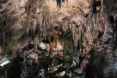
- Cueva de Nerja is a large cave system, about 4 km east of town, with enormous halls, stalactites and prehistoric paintings.
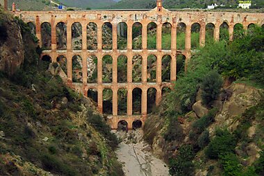
- Acueducto del Águila is a 19th-century brick aqueduct with several tiers of arches, near the village of Maro.
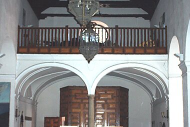
- Iglesia El Salvador is the town's main church, near the Balcón de Europa.
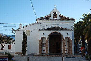
- Ermita de Ntra. Sra. de las Angustias is a small chapel with a view in the old town.
- The Museo de Nerja tells the story of the area, from the cave finds to the present day.
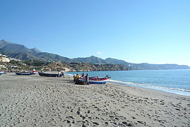
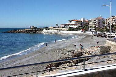
- Playa Burriana is the main town beach with chiringuitos (beach bars), and Playa Calahonda and Playa La Torrecilla are small beaches near the Balcón de Europa.
- The Río Chillar walk follows a river through a narrow gorge.
Suositellut listat


Scenic Viewpoints and Peaks
Nerja’s landscape is defined by the dramatic meeting of the Sierra de Almijara mountains and the Mediterranean Sea. This collection features historic architectural landmarks like the 19th-century Eagle Aqueduct and 16th-century coastal watchtowers alongside rugged limestone summits. From the central promenade built on fortress ruins to the 1,831-meter peak of Navachica, these sites offer specific vantage points over the Maro-Cerro Gordo cliffs and the Axarquía coastline.
14 paikkaaMitä kokea
- Walk on the Balcón de Europa at sunset.
- Visit the Cave of Nerja and its large halls.
- Have a paella at a beach bar at Burriana.
- Walk along the cliffs of Maro and Cerro Gordo to reach quiet coves.
- Spend a day in Frigiliana.
Kierrokset ja aktiviteetit
Nerja — Kartta

Päiväretket
- Frigiliana (about 6 km): a pretty white village in the hills, with narrow lanes and Moorish heritage.
- Málaga (about 55 km): the main city of the Costa del Sol.
- Granada (about 115 km): the Alhambra and old city.
- Antequera (about 100 km): dolmens and churches.
- Sierra Nevada and the Alpujarras: Capileira and Bubión are mountain villages.
Missä vierailla
Saapuminen
- By air: Málaga airport is about 55 km away. A direct bus runs to Nerja, or you can take a transfer or rental car.
- By bus: Buses run from Málaga's bus station in about an hour to an hour and a quarter, and from Granada in about 2 hours.
- By car: The A-7 motorway runs along the coast.
Liikkuminen paikan päällä
- On foot: The center and the Balcón de Europa are walkable, with some steep streets. The cave is a short bus or taxi ride out.
- Bus: Local buses run to the cave, Maro and Frigiliana.
- Taxi: Available in the center.
Autoilu
- Is a car worth it?: Useful for Frigiliana, the cave and the cliffs, though buses also reach them.
- Parking: Paid car parks are in the center and fill up in summer.
- Roads: The A-7 is busy at weekends in summer, and the old coast road is narrow and winding.
Ruoka ja juoma
Nerja serves Andalusian food with a coastal focus. Try ajoblanco (a cold almond and garlic soup), fried fish, espetos (grilled sardines on skewers) and paella at the beach bars. Frigiliana is known for miel de caña (sugar-cane honey).
The mountains produce sweet Moscatel wines.
Turvallisuus ja terveys
Nerja is a safe town. In summer, the sun is strong, so use sun protection and drink water. The cliff paths can be steep, and some beaches have currents, so check the swimming flags. Inside the cave, the floor is damp and the path has steps.
Historia
The area has been inhabited since prehistoric times, and the Cave of Nerja was used by humans for tens of thousands of years. The Moors ruled the coast for centuries, and the town was captured by the Catholic Monarchs in 1487.
In 1885 an earthquake damaged the town, and King Alfonso XII visited and gave the Balcón de Europa its name. The cave was rediscovered in 1959 by local boys. Tourism developed from the 1960s.
Tietoa maasta
Quick practical facts for Spain at a glance:
- Valuutta
- euro EUR € · Korttimaksut · Laajasti hyväksytty
- Hätänumerot
- 112
- Sähkö
- 230 V · 50 HzTyyppi C / Tyyppi F
- Kielet
- espanja
- Hanavesi
- Juomakelpoista
- Ajosuunta
- Oikea
- Suuntanumero
- +34


Nerja – Suunnittele päiväsi
Muunna tämän oppaan paikat todelliseksi matkasuunnitelmaksi älykkäillä reiteillä, aika-arvioilla ja kaikella, mitä tarvitset onnistuneeseen matkaan.


Liittyvät määränpäät


Data: © OpenStreetMap contributors, Wikidata, Wikipedia, Tripomatic, Official websites, geoBoundaries (CC BY 4.0). Tours by GetYourGuide. We earn commission from bookings. Travel guide generated with AI.
Suunnittele matkasi Tripomaticilla
- Tekoälypohjainen suunnitteluAnna tekoälyn rakentaa matkasuunnitelmasi, vastata matkakysymyksiin ja arkistoida varausasiakirjasi matkaasi.
- MatkustustiedotteetViralliset tiedotteet, vaaralliset säät, lakot ja luonnonkatastrofit matkasi jokaisen päivän paikkoihin.
- Juhlapyhät ja tapahtumatNäe matkasi päiville osuvat lomat, festivaalit ja sulkuajat sekä niiden vaikutus suunnitelmiisi.
- KustannusarvioTekoälypohjaiset matkakustannuserittelyt auttavat sinua hahmottamaan budjetin ennen lähtöä.
- Kierrokset ja liputVaraa kierroksia, jonon ohi -lippuja ja aktiviteetteja suoraan suunnitelmaasi.