


Fort-de-France
Fort-de-France is the capital and largest city of Martinique. It sits on a wide bay on the island's Caribbean coast, with green hills rising behind it. The city is a working place, not a resort: offices, schools, the port and busy shopping streets fill the centre. French and Creole are heard everywhere, and daily life mixes French and Caribbean ways.
Most visitors spend a day or two here. The compact centre has a famous iron-and-glass library, a metal-framed cathedral, a sea fort and a covered spice market, all close to the central park. Gardens and rainforest start just north of the city, and ferries cross the bay to the beaches of Les Trois-Îlets. The poet and politician Aimé Césaire, who led the city as mayor for more than 50 years, is its most famous figure.

Fort-de-France – Tu prépares un voyage ?
Crée ton itinéraire jour par jour dans l'application Tripomatic.


Quand partir
Fort-de-France is warm all year. The dry season, from about December to May, is the most comfortable and the most popular time to visit. From June to November the air is hotter and more humid, heavy showers are frequent, and it is the Atlantic hurricane season.
The big event is Carnival. It starts in January and builds to five days of parades just before Lent, ending on Ash Wednesday. The Carnival Queens parade through Fort-de-France, red devils fill the streets on Mardi Gras, and the carnival king, Vaval, is burned on the last night. Book flights and rooms early if you want to be here for it.
Sites incontournables
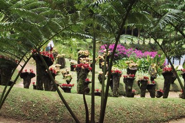
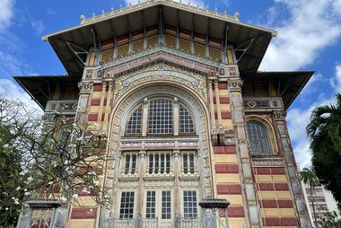
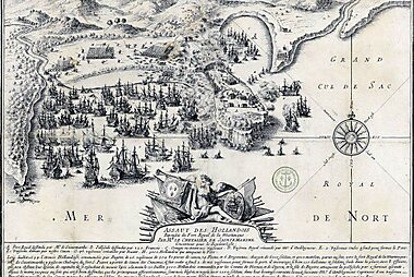
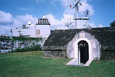

The main sights of the centre are all within a short walk of each other. Balata and its gardens are a short drive north, in the hills.
- Schœlcher Library is the city's most famous building, a colourful library of iron and glass under a dome. It was built in the Tuileries in Paris in the 1880s and shown at the 1889 World Fair, then taken apart, shipped to Martinique and opened here in 1893. It is still a working library, and you can walk in to see the reading room.
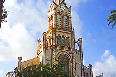
- Fort-de-France Cathedral has a full metal frame, built in the 1890s to resist earthquakes. Its slim spire is a landmark from the bay.
- Fort Saint-Louis guards the harbour from a rocky point. It is still a French navy base, so you can only visit on a guided tour. Buy tickets at the tourist kiosk in La Savane, and go early on cruise-ship days.
- La Savane is the large park at the heart of the city, between the old town and the sea. It is a place to rest in the shade.
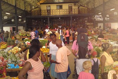
- Grand Marché de Fort-de-France is a covered market under a metal roof. Stalls sell spices, vanilla, flavoured rum, fruit and crafts, and small counters serve Creole lunches.
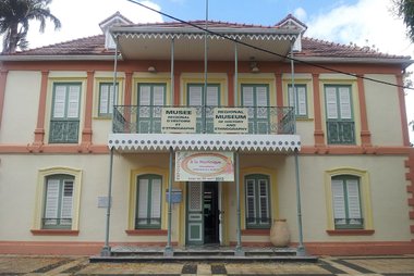
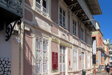
- Musée Régional d'Histoire et d'Ethnographie tells the story of the island's people in a restored 19th-century villa, with Creole furniture and costumes. Nearby, Musée Départemental d'Archéologie et de Préhistoire de la Martinique shows pottery and objects from the Amerindian peoples who lived here before the Europeans.
- Sacré-Cœur de Balata is a smaller copy of the Sacré-Cœur in Paris, built in the 1920s on a hill above the city. It has wide views over the bay.
- Jardin de Balata is a tropical garden in the hills about 15 to 20 minutes north of the city. Paths lead past palms, giant bamboo and more than 1,000 plant species.
Listes recommandées


Martinique Heritage Sites
Fort-de-France serves as the cultural heart of Martinique, preserving centuries of Caribbean history through its diverse architecture. This collection includes the 17th-century Fort Saint-Louis, the metal-framed Saint-Louis Cathedral, and the intricate Bibliothèque Schoelcher, a library originally constructed in Paris for the 1889 World's Fair. The sites range from neoclassical administrative buildings like the former Palace of Justice to religious landmarks and monuments reflecting the island's colonial past and its path toward modern identity.
12 lieuxExpériences à vivre
- Cross the bay by ferry: take a boat to Pointe du Bout or Anse-à-l'Âne for an afternoon on the beach, with the best view back over the city and its hills.
- Walk in the treetops at Balata: the canopy walk at Jardin de Balata follows hanging bridges between the trees, high above the garden. Go in the morning, when it is cooler.
- Hike a rainforest trail: several marked trails start along the Route de la Trace, among them the Trace des Jésuites. Wear good shoes, as the paths are often muddy.
Visites et activités
Fort-de-France — Carte

Excursions à la journée
Martinique is small, so most of the island is within a day trip of Fort-de-France. A car gives you the most freedom.
- Les Trois-Îlets (by ferry across the bay): Blue Lines boats land at Pointe du Bout, Anse-à-l'Âne and the village. Spend the day on the beaches of Anse Mitan and Pointe du Bout, or visit La Pagerie, the birthplace of Empress Joséphine, now a museum.
- Saint-Pierre (about 40 minutes by car, north along the coast): the island's old capital, destroyed in 1902 by the eruption of Montagne Pelée. You can walk among the ruins of the theatre and the old town, with the volcano behind.
- Les Anses-d'Arlet (about 50 minutes by car): a fishing village whose church stands on the beach, facing a long wooden pier. The bays nearby are good for snorkelling, and turtles are often seen in the water.
- The Route de la Trace (starts on the edge of the city): a mountain road through the rainforest, past Balata and up to the north. Several forest trails start beside it.
- The summit of Montagne Pelée (about 45 minutes to 1 hour by car to the main trailhead): the volcano is part of a UNESCO World Heritage site since 2023. The climb is a long, steep hike for fit walkers. Go only in clear weather.
- Sainte-Anne (about 1 hour by car, more in traffic): a village in the far south, close to Grande Anse des Salines, Martinique's most famous white-sand beach.
Où s'aventurer
Fort-de-France is the capital of Martinique.
- Along the north-west coast: Schœlcher is the next town along the coast, with small beaches. Case-Pilote and Le Carbet are quiet fishing villages further north.
- East of the city: Le Lamentin is home to the international airport. Le Robert sits on a large bay on the Atlantic coast.
- Mountains and coast: Montagne Pelée rises over the north of the island, and Les Anses-d'Arlet is a beach village in the south-west.
S'y rendre
- By air: Martinique Aimé Césaire International Airport (FDF) is in Le Lamentin, about 10 km east of the city. Direct flights arrive from Paris, other Caribbean islands and North America. The drive to the centre takes about 15 minutes outside rush hours, but much longer in morning and evening traffic. Taxis wait outside the terminal. Martinique airport
- By sea: ferries link Fort-de-France with Guadeloupe, Dominica and Saint Lucia. Many cruise ships also stop in the city's port, close to the centre.
Se déplacer
- On foot: the old centre is small, flat and easy to walk. The hills around it are steep, and the midday heat is strong.
- Buses: the Martinique Transport network runs city buses and a fast bus line (TCSP) towards Le Lamentin. Buy tickets in the MT Ticket app, or load a rechargeable card at ticket machines and sales points. Martinique Transport
- Shared minibuses (taxis collectifs): they run fixed routes to towns around the island and are cheap. Service is thin on Saturday afternoons and Sundays.
- Ferries: Blue Lines boats cross the bay to Les Trois-Îlets. Use the same app or card. Blue Lines ferries
- Taxis: there are taxi ranks in the centre. Taxis are expensive for long trips.
Conduite
- Do you need a car? Not for the city centre, which is best on foot. To explore the rest of the island at your own pace, a rental car is the most practical choice.
- Traffic: roads into and out of Fort-de-France are often jammed at morning and evening rush hours. Plan longer trips outside these times.
- Parking: the centre has paid street parking and car parks. Street spaces are hard to find on weekdays.
Gastronomie
Fort-de-France is a good place to try everyday Creole food. Lunch is the main meal, and many people eat at simple counters and family restaurants in the centre.
The best place to start is Grand Marché de Fort-de-France, where small counters serve plates of grilled fish, accras and colombo at lunchtime. The stalls around it sell spices, vanilla and flavoured rum to take home. The streets between the market and the cathedral have many small restaurants and bakeries.
Sécurité et santé
Fort-de-France is generally safe for visitors during the day. The centre empties after the shops close and on Sundays, so avoid walking alone in quiet streets at night and take a taxi instead. Watch for pickpockets in crowds, and never leave bags in a parked car.
Mosquitoes can carry dengue, so use insect repellent, especially in the rainy season. On beaches, do not shelter under manchineel trees, whose sap and fruit are poisonous. The sun is very strong all year, so use high-factor sun protection.
Histoire
The French built a fort on this point in 1639, and a town called Fort-Royal grew up beside it. In 1692 it became the colony's capital, replacing Saint-Pierre. It took the name Fort-de-France in 1807. Fort Saint-Louis still stands on the same rocky point.
For a long time, Saint-Pierre in the north remained the island's main town for business and culture. That changed in 1902, when Montagne Pelée erupted and destroyed Saint-Pierre in minutes. Fort-de-France then became the island's main city and port.
Victor Schœlcher, who led the campaign to end slavery in the French colonies in 1848, left his books to the island. They became the first collection of Schœlcher Library. In the 20th century, the poet Aimé Césaire was the city's mayor from 1945 to 2001. A statue of Empress Joséphine, born on the island, stood in La Savane until protesters pulled it down in 2020.
Infos pays
Martinique is part of the EU, so EU mobile roaming rules apply here.
- Devise
- euro EUR € · Paiements par carte · Largement acceptées
- Numéros d'urgence
- 112
- Électricité
- 230 V · 50 HzType C / Type E
- Langues
- français
- Eau du robinet
- Potable
- Sens de conduite
- À droite
- Indicatif téléphonique
- +596


Fort-de-France – Planifie tes journées
Transforme les lieux de ce guide en un véritable itinéraire, avec des itinéraires intelligents, des estimations de temps et tout ce dont tu as besoin pour un voyage parfait.


Destinations associées



Data: © OpenStreetMap contributors, Wikidata, Wikipedia, Tripomatic, Official websites. Tours by GetYourGuide. We earn commission from bookings. Travel guide generated with AI.