


Læsø
Læsø is the largest island in the Kattegat, a flat and quiet place about 90 minutes by ferry from Frederikshavn. Fewer than 2,000 people live here, spread between the ferry port at Vesterø Havn, the inland main town of Byrum and the fishing harbour at Østerby Havn. Most visitors come for slow days of cycling, walking and swimming, with a strong sense of island life.
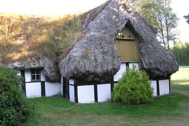
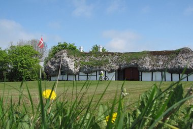
The island's history is unusual. In the Middle Ages, Læsø was known for boiling salt from its salty groundwater, and the fuel demand cut down almost all of its forest. With almost no wood left, people roofed their houses with eelgrass from the shore. These seaweed roofs are now the island's symbol, and the cultural landscape is on Denmark's tentative list for UNESCO World Heritage. The south of the island is a large wetland of salt meadows and sandbanks, important for wading birds and ducks.

Læsø – 旅行を計画中ですか?
Tripomaticアプリで日ごとの旅程を作成しましょう。


ベストシーズン
Summer is the best time to visit. Days are long and mild, the sea is at its warmest, and the sights keep their longest opening hours. Spring and early autumn are quieter and good for walking and birdwatching, but expect wind and changeable weather. Winters are dark, wet and windy, and several sights close.
The biggest event is the Langoustine Festival (Jomfruhummerfestival) in Østerby Havn, held on the first Saturday in August. Danish chefs compete in a cooking contest, and the day is a free harbour party built around the island's langoustines.
主要観光スポット
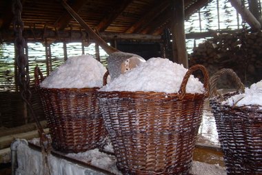
At Læsø Salt Museum, known locally as Læsø Saltsyderi, the island's medieval salt trade comes back to life. In a rebuilt seething hut, salt is boiled from brine in iron pans over an open fire, and you can buy the salt in the museum shop. It sits at the edge of the southern salt meadows.
Museumsgården "På Lynget" is a whitewashed farm with a thick seaweed roof, the best place to see the island's traditional building style up close. Its rooms keep furniture and household items from the mid-1800s.
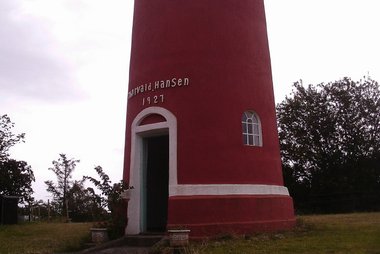
Læsøtårnet in Byrum is a 17 m brick lookout tower built in 1927 by a local clogmaker, Thorvald Hansen, who made the bricks himself. Climb it for a view across the whole flat island.
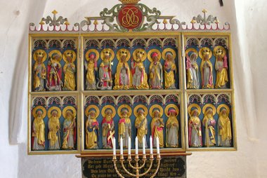
Byrum Kirke is the largest of the island's churches, built in the 13th century. Inside is a winged altarpiece from about 1450.
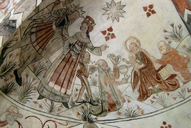
Vesterø Søndre Kirke is a medieval church outside Vesterø Havn. Its choir vault has early 16th-century wall paintings of the Three Kings.
South of the salt works, the wetland of Rønnerne covers more than 1,700 hectares of salt meadows, heath and sandbanks. Many waders and ducks breed or rest here, and guided nature tours are available.
ツアー&アクティビティ
Læsø — 地図

アクセス方法
- By ferry: Læsøfærgen sails from Frederikshavn to Vesterø Havn several times a day, and the crossing takes about 90 minutes. Book ahead if you bring a car, especially in summer, and check in at least 15 minutes before departure (10 minutes on foot).
- By train: Trains run from Aalborg to Frederikshavn in about 1 hour 15 minutes to 1 hour 30 minutes. From there, continue to the ferry at the harbour.
- By air: Aalborg Airport is the nearest major airport. Take the train from Aalborg to Frederikshavn for the ferry.
- On the island: The local bus, route 840, is free. The island is flat, with about 100 km of paved roads, so cycling is the easiest way to explore. You can bring a bike on the ferry or rent one on the island.
- Combine with the mainland: Skagen is about 40 minutes north of Frederikshavn by train, so it is easy to add to the same trip.
See Læsøfærgen for timetables and booking.
国の基本情報
Quick practical facts for Denmark at a glance:
- 通貨
- デンマーク クローネ DKK kr · カード決済 · 広く利用可能
- 緊急連絡先
- 112
- 電源・電圧
- 230 V · 50 HzCタイプ / Eタイプ / Fタイプ / Kタイプ
- 言語
- デンマーク語
- 水道水
- 飲用可能
- 通行区分
- 右側通行
- 国番号
- +45


Læsø – 旅行に追加
スマートなルート案内、所要時間の目安など、充実した旅行に必要なすべてを備えた詳細な旅程を作成しましょう。


関連する目的地


Data: © OpenStreetMap contributors, Wikidata, Wikipedia, Tripomatic, Official websites. Tours by GetYourGuide. We earn commission from bookings. Travel guide generated with AI.