


Lauterbrunnen
Lauterbrunnen is a narrow valley with steep rock walls and many waterfalls. The village lies on the valley floor. Mountain villages, trains and cable cars start from here.
The valley is a base for hikes and for trips to the Jungfrau region. Most visitors stay two or three nights.

Lauterbrunnen – 旅行を計画中ですか?
Tripomaticアプリで日ごとの旅程を作成しましょう。


ベストシーズン
June to September is best for hiking and for open mountain lifts. July and August are busiest. In winter the valley is cold and snowy. Skiing is in Wengen and Mürren, and some waterfall paths close. Spring and autumn can be quiet, and some mountain lifts close for maintenance. Rain is frequent in late spring and summer, and clouds can hide the peaks.
主要観光スポット
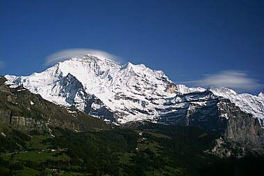
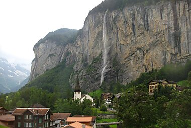
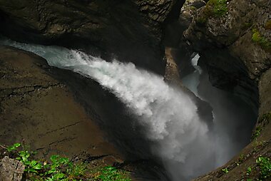
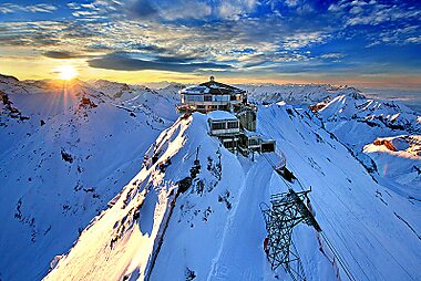

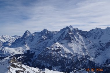


- Staubbachfall is a waterfall near the village that falls from a cliff of nearly 300 m.
- Trümmelbachfälle is a set of waterfalls inside the mountain. A lift and paths lead you through the rock.
- Jungfraujoch - Top of Europe is the high-altitude train station between the Mönch and the Jungfrau. It has viewpoints and a glacier walk.
- Schilthorn has a revolving restaurant at the top and views of the Eiger, Mönch and Jungfrau.
- Eiger is the north face that rises above Grindelwald. It is famous with climbers.
- Kleine Scheidegg is a railway pass between Lauterbrunnen and Grindelwald, with hotels and views.
- Männlichen is a viewpoint reached by gondola from Wengen or Grindelwald.
- Talmuseum Lauterbrunnen shows the history of the valley.
注目のリスト


Swiss Mountain Cable Cars & Lifts
This collection features the essential transport links within the Lauterbrunnen Valley and the surrounding Bernese Oberland peaks. It includes the multi-stage Schilthorn cable car system, known for its connection to the Piz Gloria revolving restaurant, and the hybrid Lauterbrunnen–Mürren Mountain Railway. The list covers various systems, from small local lifts like Isenfluh-Sulwald to high-capacity chairlifts serving the Männlichen and Kleine Scheidegg ski and hiking areas, providing access to car-free villages and high-altitude summits.
17か所のスポット
おすすめの体験
- Walk the valley path between the waterfalls. It is flat and quiet.
- Take the train up to Kleine Scheidegg and walk down toward Wengen or Grindelwald.
- See Eispalast, a tunnel cut into the glacier at the top of Jungfraujoch.
- Try the The Eiger Trail for a walk with views of the north face.
- See the nearby Mürrenbachfall on the way to Mürren.
- Watch skiers at Lauberhorn, where a famous downhill race takes place in January.
ツアー&アクティビティ
Lauterbrunnen — 地図

日帰り旅行
- Wengen is a car-free village on a terrace above the valley. A cogwheel train goes up from Lauterbrunnen.
- Mürren is a car-free cliff-top village. It is reached by cable car and a short train.
- Grindelwald is a larger mountain village under the Eiger. You can cross by train via Kleine Scheidegg or by gondola.
- Interlaken is the lake town at the bottom of the valley, about 20 minutes away by train.
- Brienz is a woodcarving village on Lake Brienz.
探索したいエリア
- Wengen and Mürren are the two car-free villages in the municipality.
- Grindelwald and Brienz lie in the same region.
アクセス方法
- By air: most visitors fly to Zurich, Geneva or Basel and take the train.
- By train: trains run from Interlaken Ost to Lauterbrunnen in about 20 minutes. Check times on SBB.
- Lauterbrunnen is the last stop for road traffic. Wengen and Mürren have no cars.
現地での移動
- The valley floor is flat and easy to walk. The village is spread out along the main road.
- A local bus runs up the valley to Stechelberg and the Schilthorn cable car.
- Mountain trains and cable cars are separate services. Check times and prices on the day, because weather can change what runs.
- Many trips need two or more lifts. Plan to start early for views.
運転・ドライブ
- Lauterbrunnen is the last village you can reach by car. Parking is limited and costly, so many visitors park in Interlaken or Stechelberg.
- Wengen and Mürren are car-free.
- The road in the valley is narrow and busy in summer.
グルメ&ドリンク
Try rösti, cheese fondue and raclette. Mountain restaurants serve simple dishes with a view. Prices are high, and mountain-top meals cost even more.
Bring a picnic for hikes and fill water bottles at village fountains.
安全&健康
- The valley is very safe.
- Mountain weather changes quickly. Check the forecast and the last lift time.
- At high altitude, such as Jungfraujoch, some people feel dizzy. Go slowly and drink water.
- Stay on marked paths, and be careful near waterfalls, which can have slippery rock.
- Tap water is safe to drink.
歴史
The valley was a quiet farming area until the 18th and 19th centuries. Writers such as Goethe wrote about Staubbachfall. Early mountaineers began to climb the Jungfrau in 1811.
The Jungfrau railway was opened in stages from 1898, and the station at Jungfraujoch opened in 1912. Tourism has been the main industry since then.
国の基本情報
Quick practical facts for Switzerland at a glance:
- 通貨
- スイス フラン CHF CHF · カード決済 · 広く利用可能
- 緊急連絡先
- 112
- 電源・電圧
- 230 V · 50 HzCタイプ / Jタイプ
- 言語
- ドイツ語, フランス語, イタリア語, ロマンシュ語
- 水道水
- 飲用可能
- 通行区分
- 右側通行
- 国番号
- +41


Lauterbrunnen – 毎日のスケジュールを計画
このガイドの場所をもとに、スマートなルート案内や所要時間などを備えた本格的な旅程を作成しましょう。


関連する目的地


Data: © OpenStreetMap contributors, Wikidata, Wikipedia, Tripomatic, Official websites, geoBoundaries (CC BY 4.0). Tours by GetYourGuide. We earn commission from bookings. Travel guide generated with AI.