



키루나시
Kiruna is Sweden's northernmost town, built around one of the world's largest underground iron ore mines. It sits deep in Swedish Lapland, above the Arctic Circle. This makes it one of Europe's most reliable places to see the northern lights in winter and the midnight sun in summer.
The town has an unusual story. The mine beneath it has grown so large that the old town centre had to be dismantled and rebuilt about three kilometres away. Visitors can see this relocation up close, alongside more typical Lapland draws: dog sledding, Sami reindeer-herding culture, and easy access to some of Sweden's best mountain hiking. Kiruna suits travelers who want real Arctic wilderness with a proper town to sleep and eat in, not just an isolated lodge.

키루나시 – 여행을 계획 중이신가요?
Tripomatic 앱에서 일자별 일정을 만들어 보세요.


방문 시기
Winters (December-March) are long, dark, and very cold; summers (June-August) are mild and bright, with the sun barely setting in June and July. Plan a winter trip around the Kiruna Snow Festival in late January, when the town hosts an international snow-sculpture competition and reindeer racing.
Aurora chances are best on clear nights from late September to March. In June and July the sun does not set, so bring an eye mask if you want to sleep well.
주요 명소



Kiruna City Hall is the new town hall, nicknamed Kristallen for its faceted copper-clad tower. Completed in 2018 to replace the old city hall in the original town centre, it has become the symbol of Kiruna's move to a new site.
A short walk away, Kiruna Church is one of Sweden's largest wooden buildings, shaped like a Sami tent and consecrated in 1912. The whole church was rolled about five kilometres across town in 2025 to keep it clear of the expanding mine, and it is expected to stay closed for restoration until 2027 — still worth seeing from outside during the move.
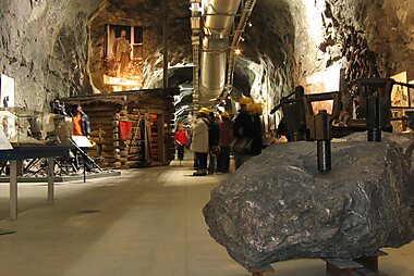
LKAB InfoMine is the visitor centre for the underground iron ore mine that the town exists to serve; book ahead for a guided bus tour hundreds of metres down into the mountain.
Hjalmar Lundbohm House preserves the home and office of Hjalmar Lundbohm, the mine's first managing director and the town's founder, alongside some of the oldest buildings in Kiruna.
For an introduction to local Sami culture and history, visit Samegården.
추천 리스트


Panoramic Viewpoints & Towers
This collection features elevated vantage points across the Kiruna region and Abisko National Park, including the iconic U-shaped valley of Lapporten and the Aurora Sky Station on Mount Nuolja. The list encompasses diverse structures ranging from the UNESCO-listed Struve Geodetic Arc to the Esrange Space Center and several regional telecommunications masts. These sites offer perspectives of the Abiskojåkka canyon, the Markkinajänkkä wetlands, and Dag Hammarskjöld’s meditation site along the Kungsleden trail.
장소 15곳체험해 볼 것들
A trip to Kiruna is as much about doing things outdoors as sightseeing in town.
- Join a dog-sledding or snowmobile tour into the surrounding wilderness — this is how many locals still get around in winter, not just a tourist novelty.
- Take part in a Sami-led reindeer sledding trip and hear about traditional herding, offered by operators around Jukkasjärvi and Kiruna.
- Chase the northern lights on a guided night tour with a guide who tracks where the sky is clearest.
- In June, tee off at midnight at Kiruna's golf course, played under continuous daylight — one of the world's northernmost courses.
- Try cross-country skiing on Kiruna's floodlit trails, a normal way locals get outdoor exercise through the dark winter months.
투어 및 액티비티
키루나시 — 지도

 인터랙티브 지도 열기
 근교 당일 여행
Kiruna's biggest draws for a day out are close by, with a couple of flagship wilderness destinations further away for anyone with more time.
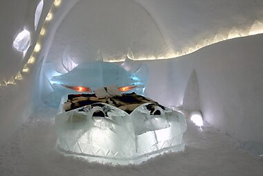
- Jukkasjärvi (about 20 minutes by car or bus) — home of the original Icehotel, rebuilt from ice and snow every winter, plus the 16th-century Jukkasjärvi Church.
- Esrange Space Center (about 40 minutes by car) — a working rocket range and satellite station used by ESA and other space agencies; guided tours run in summer.
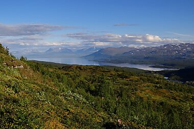
- Abisko National Park (about 1.5-2 hours by car or train) — sits on a lake shore with unusually clear skies; the chairlift up to Aurora Sky Station is one of the most reliable spots in Sweden to see the northern lights.
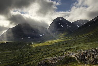
- Kebnekaise and Kungsleden (King's Trail) (about 1.5 hours by car to the Nikkaluokta trailhead) — Sweden's highest mountain and its best-known long-distance hiking route, reachable for day hikers as well as multi-day trekkers.
추천 여행 지역
Kiruna municipality is enormous — the largest in Sweden — reaching from mountains on the Norwegian border to forests near the Finnish border. The part most visitors also see is Jukkasjärvi, an old Sami trading village a short drive away that is home to the original Icehotel and one of the oldest churches in Lapland.
가는 방법
- By air: Kiruna Airport (KRN) is about 10 km southeast of town. SAS flies direct from Stockholm Arlanda in around 1 hour 35 minutes. A taxi or airport bus covers the transfer into town in about 15 minutes.
- By train: The Iron Ore Line (Malmbanan) runs an overnight sleeper service from Stockholm via Luleå, taking around 17 hours, and continues on to Narvik in Norway. Book through SJ. Trains arrive at Kiruna Station station, a short walk from the centre.
- By bus: Regional coaches connect Kiruna with Luleå and other towns in Norrbotten — useful for onward travel around Swedish Lapland when flights or trains do not fit your schedule.
교통편 및 이동 방법
- On foot: The new town centre is compact and walkable in a few blocks, though ice and sub-zero temperatures make sturdy winter boots essential from October to April.
- Public transport: Local buses run around town and to nearby villages; buy tickets on board or through the regional operator's app. Coverage is thin compared with a big city, so most visitors walk, drive, or book tours directly.
- Taxi: Local taxi firms are the easiest option after dark or in bad weather; ride-hailing apps do not operate this far north.
- Car: A rental car is the most flexible way to reach Abisko, Nikkaluokta, and other sights outside town (see Driving below).
운전
- Is a car worth it? Not needed in town — the centre is small and walkable — but very useful for reaching Abisko, Nikkaluokta, and other trailheads with limited public transport.
- Winter driving: Studded or winter tires are mandatory by law in snowy conditions, and roads can stay icy well into April; rental agencies fit the right tires automatically.
- Wildlife on the road: Reindeer and elk wander onto rural roads, especially at dawn, dusk, and night — slow down on open stretches.
- Parking: Free and metered street parking is available around the new town centre; car parks near Kiruna City Hall serve most visitor needs.
음식 및 음료
Kiruna's food scene is small but leans on local Arctic ingredients: reindeer meat, Arctic char and other cold-water fish, and cloudberries in late summer. Many restaurants serve a "Lapland plate" that combines several of these in one meal.
Restaurants and cafés cluster in the new town centre around Kiruna City Hall; there is no single food street or market worth a special trip, so pick whatever looks busy.
안전 및 건강
Kiruna is a safe destination with very little crime affecting tourists; the main risks are environmental rather than criminal. Dress for genuine Arctic cold in winter — frostbite and hypothermia are real risks if you are not prepared, especially outside town.
Watch your footing on pavements: black ice is common from autumn through spring. If you head into the mountains around Abisko or Kebnekaise, check weather and trail conditions locally before setting out, since conditions can change quickly.
역사
Kiruna did not exist before iron ore. The town was founded in 1900 by the mining company LKAB, led by its first managing director Hjalmar Lundbohm, to house workers extracting ore from the Kirunavaara mountain nearby. The name comes from the Sami word for ptarmigan, giron. Lundbohm shaped the early town personally, insisting on planned streets, parks, and public buildings rather than a rough mining camp; his former home is preserved as Hjalmar Lundbohm House.
Sami reindeer herders lived and traded in this area for centuries before the mine, particularly around Jukkasjärvi, and Sami culture remains a visible part of Kiruna today. The town's newest chapter is its relocation: the same ore body that built Kiruna has grown so large that it now undermines the original town centre, forcing a gradual, decades-long move of homes, streets, and landmarks about three kilometres east. Kiruna Church made the journey intact in 2025, and the new Kiruna City Hall opened in 2018 as the symbolic heart of the rebuilt centre.
국가 정보
Quick practical facts for Sweden at a glance:
- 통화
- 스웨덴 크로나 SEK kr · 카드 결제 · 널리 사용 가능
- 긴급 전화번호
- 112
- 전압 및 전원
- 230 V · 50 Hz플러그 타입 C / 플러그 타입 F
- 언어
- 스웨덴어
- 수돗물 음용
- 음용 가능
- 주행 방향
- 우측통행
- 국가 번호
- +46


키루나시 – 여행에 추가
스마트 경로 안내, 소요 시간 예측 등 완벽한 여행에 필요한 모든 기능을 통해 상세한 여행 일정을 만들어 보세요.

