



San Francisco
San Francisco packs fog-wrapped hills, a busy bay, and a compact street grid into a small area that visitors can explore mostly on foot or by cable car. Gold rushes, immigration waves, counterculture movements, and technology booms each shaped a different neighborhood over the city's history. It suits travelers who want a mix of famous landmarks, distinct ethnic neighborhoods, and dramatic coastal views within a few days.
Political and cultural pioneers have called the city home, including Harvey Milk, one of the first openly gay elected officials in the United States. A trip here combines well with California's coast or wine country, since both sit within a short drive.

San Francisco – planujesz wycieczkę?
Stwórz swój plan podróży dzień po dniu w aplikacji Tripomatic.


Kiedy jechać
Summer brings cool, foggy mornings to the city itself, while inland valleys nearby stay warm and dry. Spring and fall are the sunniest and warmest seasons downtown, and winter is mild with the most rain.
Plan around San Francisco Pride in late June if you want the city at its most festive — a major parade and celebration that fills Civic Center and Market Street for a full weekend.
Najlepszy czas na wizytę: kwiecień, maj, czerwiec, lipiec, sierpień, wrzesień, październik
Afternoons in the fog belt can feel noticeably cooler than a few kilometers inland, so bring a layer even in July.
Główne zabytki
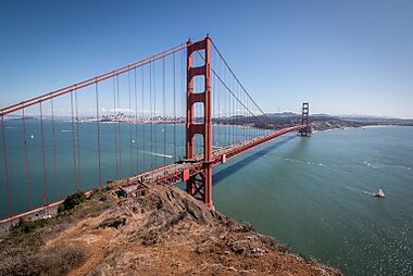

Golden Gate Bridge is the city's most photographed structure, its orange towers rising more than 220 meters above the strait it spans. Walk or cycle the pedestrian path for views back toward the skyline, or watch it disappear and reappear in the fog from a nearby beach.
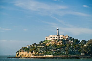
Alcatraz Island sits in the bay as a former federal prison that once held Al Capone, and ferries from Pier 33 are the only way to reach it. Book tickets well in advance, since sailings often sell out days ahead.
San Francisco Cable Cars are the last manually operated cable car system in the world, and the Powell Street turntable is where crews turn each car around by hand. Ride one up over Nob Hill for a slow, steep introduction to the city's hills.
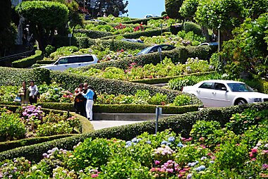
Lombard Street twists through eight switchbacks down a steep block of Russian Hill, lined with hydrangeas. It draws a steady line of cars and photographers, so visit early to avoid the worst of the queue.
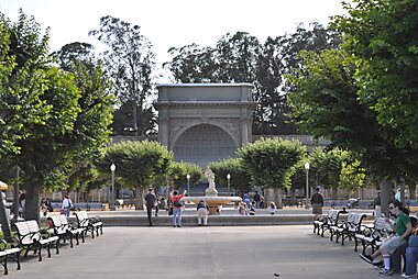
Golden Gate Park spreads over 400 hectares west of downtown, with a Japanese Tea Garden, an art museum, and a small bison herd inside its boundaries. Rent a bike near the entrance to cover more ground than walking allows.
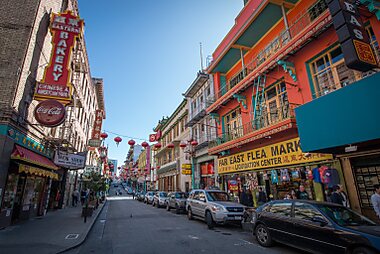
Chinatown San Francisco is the oldest Chinatown in North America and one of the largest outside Asia, packed with dim sum restaurants, herb shops, and a gate at Grant Avenue guarded by stone lions. Walk the side alleys off the main strip for a quieter version of the neighborhood.
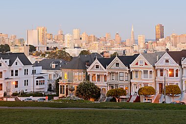
Painted Ladies is a row of Victorian houses on Steiner Street, famous for appearing in photos with the downtown skyline behind them. The best photo spot is Alamo Square park directly across the street.
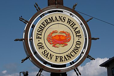
Fisherman's Wharf is the city's busiest waterfront district, with seafood stalls, souvenir shops, and sea lions that haul out on the docks at nearby Pier 39. It's touristy, but still a good starting point for boat trips and bay views.
Polecane zestawienia


San Francisco's Hidden Gems
San Francisco's alternative side features a range of specialized cultural sites and interactive installations. Explore the 16th Avenue Tiled Steps' mosaic artistry or the James Turrell "Three Gems" skyspace. Discover niche collections at the Antique Vibrator Museum and the taxidermy-filled Paxton Gate. For interactive experiences, the city offers concrete slides at Seward Street, vintage pinball at Free Gold Watch, and the immersive sound environment of Audium. These sites highlight the city's commitment to community art, peculiar history, and unconventional entertainment.
11 miejsc


San Francisco Viewpoints
San Francisco’s unique topography provides diverse vantage points, from the 922-foot summits of Twin Peaks to the coastal ruins of the Sutro Baths. This collection highlights elevated public spaces like the free Hamon Tower observation deck and natural overlooks along the Lands End trail. It also features historic rooftop venues such as Top of the Mark and The View Lounge, alongside neighborhood peaks like Corona Heights and Potrero Hill, offering perspectives of the Golden Gate Bridge and the downtown skyline.
20 miejsc
San Francisco Shopping Hotspots
San Francisco offers diverse retail experiences ranging from the high-end luxury boutiques of Union Square to the historic stalls of the Ferry Building. Explore the oldest Chinatown in North America for traditional wares, or visit Ghirardelli Square, a former chocolate factory turned retail hub. The city features major shopping centers like Westfield San Francisco Centre alongside unique specialty stores, artisanal gift shops, and weekend flea markets such as Alemany, which specializes in antiques and vintage collectibles.
39 miejscCzego warto doświadczyć
- Watch the fog roll through the strait from a picnic blanket in Presidio of San Francisco on a clear afternoon.
- Catch sunset from the viewpoint on Twin Peaks, one of the highest points in the city with a 360-degree view.
- Watch the sea lions bark and jostle for space on the docks at Pier 39.
- Browse the ever-changing murals along Clarion Alley in the Mission, repainted by local artists year-round.
Wycieczki i aktywności
San Francisco — Mapa

 Otwórz interaktywną mapę
 Wycieczki jednodniowe
Several rewarding day trips sit within a couple of hours of the city, from redwood forests to wine country.
- Sausalito — ≈30 min by ferry across the bay: a hillside town of houseboats, seafood shacks, and bay views back toward the skyline.
- Muir Woods National Monument — ≈45 min by car: old-growth coastal redwoods a short walk from the parking area; parking and shuttle spots must be reserved online in advance year-round — there is no same-day or walk-up parking.
- Napa Valley — ≈1–1.5 hours by car: California's best-known wine region, with tastings ranging from casual to formal across dozens of family-run and large estate wineries.
- Monterey and Carmel-by-the-Sea — ≈2–2.5 hours by car: a coastal aquarium, a scenic drive along the shoreline, and a small, art-filled beach town.
Jak dotrzeć
- By air: San Francisco International Airport (SFO) is the main gateway, about 22 km south of downtown. BART trains connect the airport to downtown in about 30 minutes; a taxi or rideshare takes 25–40 minutes depending on traffic. Oakland (OAK) and San Jose (SJC) airports are smaller alternatives, both roughly an hour away by car or transit.
- By train: Amtrak does not stop in San Francisco itself — trains terminate across the bay in Emeryville, with a connecting Amtrak bus into the city center. Caltrain runs south to San Jose and the Peninsula from its own station south of downtown.
- By bus: Long-distance coaches (Greyhound, FlixBus) arrive at the Salesforce Transit Center downtown, with connections up and down the West Coast.
Poruszanie się na miejscu
- Public transit: Muni operates buses, historic streetcars, and the cable cars; BART is the regional rail line connecting downtown to the airport, Oakland, and Berkeley. Tap a contactless bank card or phone directly at the fare gate or bus reader on both systems — no separate ticket or app is required. SFMTA publishes routes and service alerts, and BART covers the regional network.
- On foot / cycling: The street grid is compact and walkable, but many neighborhoods sit on steep hills that add real effort to a route — check the elevation before setting off. Cycling is popular along the flatter waterfront and through Golden Gate Park, and bike-share docks are common downtown.
Prowadzenie samochodu
- Car needed?: Not for downtown and the main neighborhoods — hills, one-way streets, and expensive parking make walking, cable cars, and rideshare easier. A car pays off for reaching Muir Woods, wine country, or the coast beyond the city.
- Parking: Expect to pay for most street parking via a meter or the SFMTA app, and garages downtown often run $20–40 a day. Free residential zones sit a 15–20 minute walk from the busiest tourist areas.
- Restrictions: A stretch of Market Street through downtown is closed to private cars — buses, taxis, bikes, and pedestrians only — so plan routes around it.
Jedzenie i napoje
San Francisco's food scene runs on immigration history as much as innovation: sourdough bread, Dungeness crab, and Mission-style burritos all trace back to specific communities that shaped the city. Seasonal, farm-driven cooking dominates the higher end, reflecting the produce grown just outside the city.
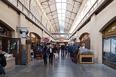
For a single stop that captures the range, the San Francisco Ferry Building combines a Saturday farmers market with a permanent hall of small, well-regarded food stalls. For the city's favorite everyday meal, walk the taquerias of Mission District, where oversized burritos wrapped in foil are the standard order.
Bezpieczeństwo i zdrowie
San Francisco is generally safe for visitors sticking to the main tourist areas, though conditions vary block by block downtown — the Tenderloin and parts of SoMa see more visible homelessness and drug use, and are best avoided after dark.
The most common problem for visitors is car break-ins: never leave bags, electronics, or shopping visible inside a parked car, even for a few minutes, since rental cars are a frequent target. Standard pickpocket awareness on crowded transit and at busy tourist sites otherwise applies.
Historia
Mission Dolores Basilica, built by Spanish missionaries in 1776, is the oldest surviving building in the city. The settlement stayed small until 1848, when gold was discovered in the Sierra foothills and prospectors flooded through the bay, pushing the population from a few hundred to tens of thousands within two years.
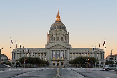
The 1906 earthquake and fire destroyed most of the city, including the original San Francisco City Hall, rebuilt a decade later with a dome modeled on St. Peter's Basilica in Rome. Immigration and counterculture later defined individual neighborhoods: Chinese arrivals built Chinatown San Francisco from the 1850s, Haight-Ashbury became the center of the 1967 Summer of Love, and Alcatraz Island — a federal prison from 1934 to 1963 — was occupied by Native American activists for 19 months starting in 1969.
Informacje o kraju
Quick practical facts for the United States at a glance:
- Waluta
- dolar amerykański USD $ · Płatności kartą · Powszechnie akceptowane
- Numery alarmowe
- 911 Policja · Pogotowie ratunkowe · Straż pożarna
- Elektryczność
- 120 V · 60 HzTyp A / Typ B
- Języki
- angielski
- Woda z kranu
- Zdatna do picia
- Ruch drogowy
- Prawostronny
- Numer kierunkowy
- +1


San Francisco – zaplanuj swoje dni
Zmień miejsca z tego przewodnika w prawdziwy plan podróży z inteligentnym wyznaczaniem tras, szacowanym czasem i wszystkim, czego potrzebujesz na udaną wycieczkę.




