Tripomatic

Ko Chang

Prowincja · Prowincja Trat, 🇹🇭 Tajlandia

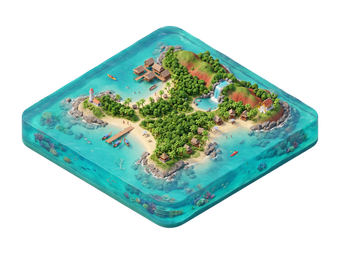
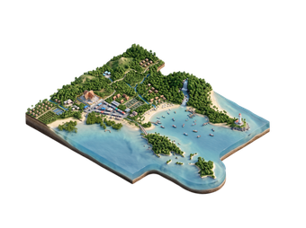
Ko Chang is Thailand's second-largest island, in the Gulf of Thailand near the Cambodian border. Mountains covered in forest rise behind long beaches on the west coast, and smaller islands and reefs lie to the south. Much of the island is part of a marine national park.

The name means Elephant Island. Ko Chang suits travelers who like beaches, waterfalls and jungle walks, without the crowds of the biggest resort islands.

Ko Chang – planujesz wycieczkę?

Stwórz swój plan podróży dzień po dniu w aplikacji Tripomatic.

Kiedy jechać

The best time is from November to April, when skies are mostly clear and seas are calm. These are also the busiest months.

From May to October the rainy season brings heavy showers and rough seas. Waterfalls are full and the forest is lush, but some boats and businesses slow down or close.

Wybierz miesiąc

Typowa pogoda w miesiącu: styczeń

Dobra
  • 30° (odczuwalna 33°) · skrajne 19°–33°
  • 23° w nocy
  • 8 deszczowych dni
  • 15 słonecznych dni
  • 8 godzin słońca dziennie
  • Parne, wilgotne powietrze
  • Spokojny wiatr
  • 28°C · ciepła woda do pływania
  • Indeks UV 8 · bardzo wysoki

Typowa pogoda w miesiącu: luty

Umiarkowana
  • 30° (odczuwalna 34°) · skrajne 21°–33°
  • 24° w nocy
  • 12 deszczowych dni
  • 8 słonecznych dni
  • 7 godzin słońca dziennie
  • Bardzo wysoka wilgotność
  • Spokojny wiatr
  • 28°C · ciepła woda do pływania
  • Indeks UV 8 · bardzo wysoki

Typowa pogoda w miesiącu: marzec

Słaba
  • 30° (odczuwalna 35°) · skrajne 23°–32°
  • 25° w nocy
  • 21 deszczowych dni
  • 4 słoneczne dni
  • 6 godzin słońca dziennie
  • Bardzo wysoka wilgotność
  • Spokojny wiatr
  • 29°C · ciepła woda do pływania
  • Indeks UV 9 · bardzo wysoki

Typowa pogoda w miesiącu: kwiecień

Słaba
  • 30° (odczuwalna 35°) · skrajne 24°–33°
  • 25° w nocy
  • 24 deszczowe dni
  • 3 słoneczne dni
  • 6 godzin słońca dziennie
  • Bardzo wysoka wilgotność
  • Spokojny wiatr
  • 30°C · ciepła woda do pływania
  • Indeks UV 9 · bardzo wysoki

Typowa pogoda w miesiącu: maj

Słaba
  • 29° (odczuwalna 35°) · skrajne 24°–32°
  • 25° w nocy
  • 30 deszczowych dni
  • 1 słoneczny dzień
  • 5 godzin słońca dziennie
  • Bardzo wysoka wilgotność
  • Spokojny wiatr
  • 31°C · ciepła woda do pływania
  • Indeks UV 9 · bardzo wysoki

Typowa pogoda w miesiącu: czerwiec

Słaba
  • 29° (odczuwalna 33°) · skrajne 24°–30°
  • 25° w nocy
  • 30 deszczowych dni
  • 1 słoneczny dzień
  • 5 godzin słońca dziennie
  • Bardzo wysoka wilgotność
  • Spokojny wiatr
  • 30°C · ciepła woda do pływania
  • Indeks UV 8 · bardzo wysoki

Typowa pogoda w miesiącu: lipiec

Słaba
  • 28° (odczuwalna 33°) · skrajne 24°–30°
  • 25° w nocy
  • 31 deszczowych dni
  • 1 słoneczny dzień
  • 4 godziny słońca dziennie
  • Bardzo wysoka wilgotność
  • Spokojny wiatr
  • 29°C · ciepła woda do pływania
  • Indeks UV 8 · bardzo wysoki

Typowa pogoda w miesiącu: sierpień

Słaba
  • 28° (odczuwalna 33°) · skrajne 24°–30°
  • 25° w nocy
  • 31 deszczowych dni
  • 0 słonecznych dni
  • 4 godziny słońca dziennie
  • Bardzo wysoka wilgotność
  • Spokojny wiatr
  • 29°C · ciepła woda do pływania
  • Indeks UV 9 · bardzo wysoki

Typowa pogoda w miesiącu: wrzesień

Słaba
  • 28° (odczuwalna 33°) · skrajne 24°–30°
  • 24° w nocy
  • 30 deszczowych dni
  • 0 słonecznych dni
  • 4 godziny słońca dziennie
  • Bardzo wysoka wilgotność
  • Spokojny wiatr
  • 29°C · ciepła woda do pływania
  • Indeks UV 8 · bardzo wysoki

Typowa pogoda w miesiącu: październik

Słaba
  • 29° (odczuwalna 34°) · skrajne 23°–31°
  • 24° w nocy
  • 26 deszczowych dni
  • 2 słoneczne dni
  • 5 godzin słońca dziennie
  • Bardzo wysoka wilgotność
  • Spokojny wiatr
  • 29°C · ciepła woda do pływania
  • Indeks UV 8 · bardzo wysoki

Typowa pogoda w miesiącu: listopad

Umiarkowana
  • 30° (odczuwalna 33°) · skrajne 21°–32°
  • 24° w nocy
  • 12 deszczowych dni
  • 7 słonecznych dni
  • 7 godzin słońca dziennie
  • Bardzo wysoka wilgotność
  • Spokojny wiatr
  • 29°C · ciepła woda do pływania
  • Indeks UV 8 · bardzo wysoki

Typowa pogoda w miesiącu: grudzień

Dobra
  • 30° (odczuwalna 32°) · skrajne 19°–32°
  • 23° w nocy
  • 5 deszczowych dni
  • 14 słonecznych dni
  • 8 godzin słońca dziennie
  • Parne, wilgotne powietrze
  • Spokojny wiatr
  • 29°C · ciepła woda do pływania
  • Indeks UV 8 · bardzo wysoki

Dane klimatyczne: NASA POWER + Copernicus ERA5-Land and ERA5 · 1996–2025

Główne zabytki

  • Ko Chang is the island itself, with forested mountains, waterfalls and beaches.
  • White Sand Beach is the island's busiest beach, with the most hotels, restaurants and shops.
  • Chai Chet Beach is a quieter beach on the west coast with a relaxed feel.
  • Tha Nam Beach is a beach in the southwest, away from the main resort area.
  • Than Mayom Waterfall is a waterfall in the island's interior, reached by a short walk.
  • Coral Beach is a beach in the far northwest of the island.

Czego warto doświadczyć

  • Beach days: Pick a west-coast beach and stay for sunset.
  • Waterfall visit: Walk to a waterfall in the forest.
  • Snorkeling trip: Take a boat tour to reefs and small islands.
  • Kayaking: Paddle through mangroves and quiet bays.
  • Ethical elephant visit: Choose a sanctuary where visitors watch elephants and do not ride them.

Wycieczki i aktywności

Ko Chang — Mapa

Ko Chang — Mapa

Wycieczki jednodniowe

These trips are listed from closest to farthest.

  • Snorkeling boat tours: trips to small islands to the south with reefs and clear water.
  • Waterfall and jungle walks: guided hikes from the interior roads.
  • Ko Kut and Ko Mak: nearby islands reachable by boat in the dry season.

Gdzie warto się udać

  • Ko Kut is a quieter island to the south.
  • Trat Province is the province that includes Ko Chang.
  • Khlong Yai is a district near the Cambodian border.

Jak dotrzeć

  • By bus and ferry from Bangkok: Buses run from Bangkok to the ferry piers near Trat, and car ferries cross to the island. The whole trip takes about 5 to 6 hours, depending on connections.
  • By air: Trat has a small airport with limited flights. Most travelers come by road.
  • From Pattaya or Rayong: Minivans run towards Trat and the ferry piers.

Poruszanie się na miejscu

  • Songthaews: Shared pick-up trucks run along the main road between the beaches.
  • Scooters: Common, but the road is hilly with sharp curves.
  • Taxis: Available at higher prices.
  • Boats: Water taxis and tours go to nearby islands.

Prowadzenie samochodu

  • Is a car worth it?: A scooter or rented car gives freedom, but the road is steep and winding.
  • Driving side: Traffic drives on the left.
  • Roads: Hills and sharp bends are common, especially in rain.
  • Scooters: Accidents are common among tourists. Wear a helmet and ride slowly.

Jedzenie i napoje

Ko Chang serves fresh seafood, Thai curries and international dishes at beachfront restaurants. Night markets sell snacks and grilled seafood.

Local fishing villages on the island have simple, cheap restaurants.

Obiad
Pad ThaiStir-fried rice noodles with egg, tofu or shrimp, bean sprouts, and tamarind sauce, topped with crushed peanuts.
Som TamSpicy shredded green papaya salad with lime, chili, fish sauce, and peanuts.
Boat Noodles  Kuay Teow ReuaSmall, intensely flavored bowls of noodle soup, traditionally served from boats along Bangkok's canals.
Kolacja
Tom Yum Goong  Tom Yum KungHot and sour soup with shrimp, lemongrass, galangal, kaffir lime leaves, and chili.
Green Curry  Gaeng Keow WanCoconut-milk curry with green chilies, Thai basil, and meat or tofu, served with rice.
Massaman Curry  Gaeng MassamanMild, rich curry with Persian and Indian influences, typically made with beef or chicken, potatoes, and peanuts.
Przekąski i street food
Satay  SateGrilled skewers of marinated meat served with peanut dipping sauce.
Mango Sticky Rice Roti  RotiCrispy pan-fried flatbread, often served sweet with condensed milk and banana, or savory.
Słodycze i desery
Mango Sticky Rice  Khao Niao MamuangSweet sticky rice served with fresh mango slices and coconut cream.
Napoje
Thai Iced Tea  Cha YenStrong black tea sweetened with condensed milk and served over ice.
Singha / Chang Beer  Beer Chang / SinghaPopular Thai lagers widely available at bars and restaurants.

Bezpieczeństwo i zdrowie

  • Roads: The hilly road is dangerous for new scooter riders.
  • Swimming: Currents can be strong in the rainy season.
  • Sun and sea: Use sunscreen and drink bottled water.
  • Wildlife and forest: Wear sturdy shoes and use repellent on forest walks.
  • Elephant tourism: Avoid camps that offer rides.
  • Drugs: Thai drug laws are strict. Do not carry or use drugs.
  • Royal family: Do not speak or write badly about the monarchy. It is a serious crime in Thailand.

Historia

Ko Chang was a quiet island of fishing villages and coconut farms for many years. Tourism grew from the late 20th century, and the area is now protected as a marine national park.

Informacje o kraju

Quick practical facts for Thailand at a glance:

Waluta
baht tajski THB ฿ · Płatności kartą · Zazwyczaj akceptowane
Numery alarmowe
191 Policja
Elektryczność
Typ A / Typ B / Typ C / Typ O
220 V · 50 Hz
Języki
tajski
Woda z kranu
Zalecana ostrożność
Ruch drogowy
Lewostronny
Numer kierunkowy
+66
Dowiedz się więcej
Riverside Hotel
Taksówka · 8 min
Ko Chang
2h
Pieszo · 6 min
Corner Café
45 min
Pieszo · 18 min
Riverside Hotel

Ko Chang – dodaj do wycieczki

Stwórz szczegółowy plan podróży z inteligentnym wyznaczaniem tras, szacowanym czasem i wszystkim, czego potrzebujesz do udanej wycieczki.


3 mln+ pobrań · 4,6 gwiazdek · 15 lat planowania wycieczek
QR code
Zeskanuj, aby pobrać aplikację

Powiązane cele podróży

Data: © OpenStreetMap contributors, Wikidata, Wikipedia, Tripomatic, Official websites, geoBoundaries (CC BY 4.0). Travel guide generated with AI.