



Сальвадор
El Salvador is Central America's smallest country, a compact strip of Pacific coastline, volcanic highlands, and coffee-growing hills that can be crossed in a few hours. The capital, San Salvador, sits in a valley ringed by volcanoes and anchors a country long overshadowed by its 1980–1992 civil war. A sharp drop in crime since 2022 has reopened the country to travelers, and El Salvador now markets itself as Surf City, drawing surfers to its Pacific beaches and hikers to trails up active volcanoes.
Beyond the coast, the country suits travelers who want variety in a short trip: colonial towns strung along the Ruta de las Flores, pre-Columbian ruins near the Guatemalan border, and a mountain region in the north where the civil war's history is still close to the surface. It is not a beach-resort destination in the Caribbean sense — distances are short and roads climb fast into the hills, so most visitors mix a few days of surfing with day trips inland.



Сальвадор — планируешь поездку?
Составь свой маршрут по дням в приложении Tripomatic.


Деньги и платежи
El Salvador has used the US dollar as its official currency since 2001; the old colón is no longer in circulation. Cash is still useful for pupuserías, markets, and shared vans between towns, where card machines are rare. ATMs are common in cities and larger towns but scarce in rural areas and the smaller Ruta de las Flores villages, so withdraw before heading into the hills.
El Salvador was the first country to make bitcoin legal tender, in 2021; a 2025 law reform made accepting it optional for businesses, so do not expect it to work everywhere. A cluster of merchants around La Libertad's beach towns still accept it.
Популярные подборки

El Salvador Essentials
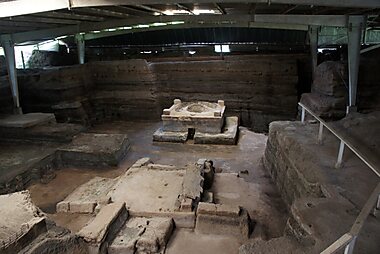
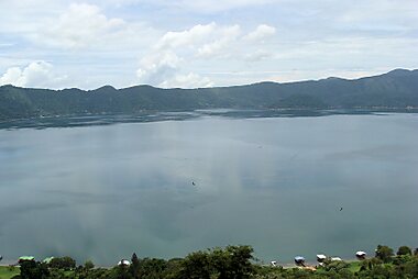
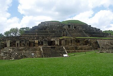
El Salvador’s landscape is defined by the dramatic peaks of the Santa Ana and Izalco volcanoes and the expansive Coatepeque crater lake. Historical sites range from the UNESCO-listed Joya de Cerén, a Maya farming village preserved by volcanic ash, to the pre-Columbian pyramids of Tazumal. Architectural highlights include the Neo-Gothic Santa Ana Cathedral, the neoclassical National Palace, and the unconventional El Rosario Church, known for its arched concrete roof and vibrant stained-glass windows.
11 мест


Экскурсии и активности
Сальвадор — Карта

 Открыть интерактивную карту
 Чаевые
10% (often added automatically)
round up
$1-2 for bellhop/housekeeping
10-15%
round up
Restaurants in cities often add a 10% service charge to the bill automatically — check before adding more. Where it is not included, 10% is the norm at sit-down restaurants; pupuserías and street stalls are not tipped. Taxi drivers are usually just rounded up to a convenient amount. A small tip for a hotel bellhop or a tour guide is appreciated but optional.
Электричество
El Salvador uses Type A/B plugs at 115 V and 60 Hz, the same as the United States. Travelers from Europe, the UK, and most of the rest of the world will need a plug adapter; check that dual-voltage devices are rated for 115 V before plugging in.
Язык
Spanish is the official language and the only one needed to get around. English is spoken at hotels, tour operators, and surf camps along the coast, but far less so in inland towns, markets, and on public transport — a few basic Spanish phrases go a long way outside tourist areas. A small number of people in western towns still speak Nahuat, an indigenous language, but it is not needed for travel.
Связь и интернет
Prepaid SIM cards from Claro, Tigo, or Digicel are sold at the airport and in shops in any town, with no ID registration required. Coverage is solid in cities and along the coast but can drop out in mountain areas like the Ruta de las Flores and the Morazán highlands.
Безопасность и экстренные службы
Police and ambulance share the number 911; the fire department uses a separate line, 913.
Security has improved dramatically since 2022, when the government began a large-scale crackdown on street gangs; homicide rates have fallen to among the lowest in the Americas, and the country is now rated on the same general safety tier as most of Western Europe. The main risks for visitors are practical rather than violent: avoid intercity travel after dark, since rural roads are unlit and poorly marked, and use a registered taxi or ride-hailing app rather than public buses at night. Strong currents at Pacific beaches cause more visitor injuries than crime does — check with lifeguards or locals before swimming.
Здоровье
Tap water is not reliably safe to drink outside upscale hotels; stick to bottled or filtered water, including for ice in smaller local restaurants. Mosquito-borne illnesses like dengue are present, especially in the rainy season from May to October — pack repellent and consider covering up in the evenings. Pharmacies ("farmacias") are easy to find in cities and stock most common medications without a prescription. No vaccinations are required for entry, but check with a travel clinic a few weeks before the trip, since recommendations depend on where in the country you plan to go.
Визы и въезд
Passport holders from the United States, Canada, the EU, the UK, Australia, and most Latin American countries can enter visa-free for tourism, typically for up to 90 days. El Salvador shares this allowance with Guatemala, Honduras, and Nicaragua under the CA-4 regional agreement — the 90 days is counted across all four countries combined and is not reset by crossing an internal land border. Citizens of some other countries need a visa arranged in advance.
Visa and entry requirements change frequently. Verify current requirements with the official immigration authority or your country's embassy before travel.
Правила этикета
Greetings matter: a handshake is standard on first meeting, and a light cheek kiss between women, or between a man and a woman, is common once you know someone. Address people formally ("usted") until invited to use the informal form. Modest dress — shoulders and knees covered — is expected inside churches and cathedrals. Bargaining is normal in craft markets like Nahuizalco's but not in shops with marked prices. Ask before photographing people, and never photograph police, military checkpoints, or government buildings.
Праздники и часы работы
Two periods affect travel more than any single public holiday: Holy Week (Semana Santa), when much of the country closes and beaches and the Ruta de las Flores fill with domestic tourists, and the early-August Fiestas Agostinas, San Salvador's patron saint festival, when the capital effectively shuts down for several days and the rest of the country slows too. Shops and pupuserías generally stay open on Sundays; government offices and banks close.
Транспорт
- By bus: A dense network of former US school buses ("chicken buses") links every town but is slow, and the safety advice above rules it out after dark. Faster direct "especial" buses run between San Salvador and the major cities.
- By shared van: Shared vans and microbuses cover routes buses don't, including much of the Ruta de las Flores, and are a common way to travel between smaller towns.
- By rental car: Renting a car is the practical way to string together volcanoes, the Ruta de las Flores, and the coast in one trip, since El Salvador is small enough to drive across in a day. Stick to daylight hours on rural roads.
- By ride-hailing: Uber and InDriver operate within the San Salvador metro area but do not reliably cover smaller towns or the coast — do not count on them once outside the capital.
Domestic flights are not needed; the country is small enough that road transport covers every destination.
Вождение автомобиля
- Speed limits: around 40 km/h in towns, 60–80 km/h on rural roads, and up to 90–100 km/h on the CA-1/CA-4 highways.
- Key rules: seatbelts and functioning headlights are checked at police checkpoints, which are common on highways; carry your passport and rental documents.
- Tolls: El Salvador's main highways are toll-free.
- Parking: paid lots ("parqueos") are standard in city centers; street parking is often watched by an informal attendant who expects a small tip.
- Fuel: stations are attended, not self-service — the attendant pumps for you. Petrol is sold as "gasolina especial" or "regular"; diesel is simply "diesel."
Еда и напитки
Food in El Salvador centers on corn. The national dish, the pupusa, is a thick corn or rice-flour flatbread stuffed with cheese, refried beans, or pork rind ("chicharrón") and cooked on a griddle. It is eaten at any meal, topped with a pickled cabbage slaw ("curtido") and a mild tomato salsa. Pupuserías range from roadside stalls to sit-down restaurants and are found everywhere, busiest in the evening.
Breakfast is often eggs, beans, fried plantain, and cream; lunch is usually the main meal of the day, eaten at a "comedor" or market stall. Beyond pupusas, look for tamales, fried yuca with pork ("yuca frita"), and "pan con pollo," a chicken sandwich served for special occasions. To drink, try horchata made from morro seeds (distinct from the rice-based Mexican version), fresh fruit juices ("frescos"), and coffee — El Salvador grows some of Central America's best. Local beers like Pilsener and Suprema are widely available.
Куда ещё съездить
El Salvador's main destinations for visitors cluster into a few regions, all within a couple of hours of the capital.
Around the capital
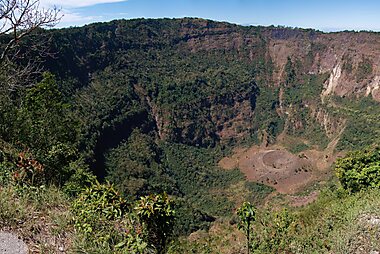
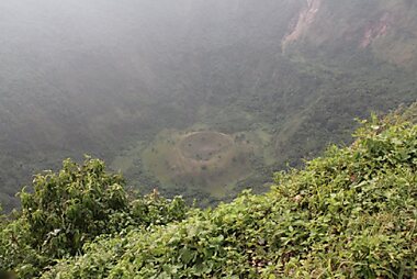
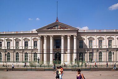
San Salvador holds the country's political and cultural landmarks, including the National Palace of El Salvador, the Catedral Metropolitana del Divino Salvador del Mundo, and the Monumento al Divino Salvador del Mundo. Just outside the city, hikers climb the crater at Parque El Boquerón on the San Salvador Volcano, and boaters head to Lago de Ilopango.
The Ruta de las Flores
A chain of hillside coffee towns west of the capital: Juayúa, known for its weekend food fair; Concepción de Ataco, painted with murals; and Nahuizalco, known for wicker crafts and a night market. The route is best done slowly, with a rental car or shared van.
West to the volcanoes and ruins
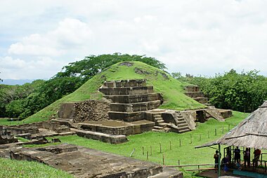
Santa Ana, the country's second city, is the base for climbing Volcán de Santa Ana and for visiting Lago de Coatepeque. Nearby, the pre-Columbian sites of Tazumal, Joya de Cerén Archaeological Site, and Parque Arqueológico San Andrés preserve Maya ruins on the way to Sonsonate and Ahuachapán.
The Pacific coast
La Libertad is the gateway to El Salvador's surf coast, including Playa El Tunco, one of Central America's best-known surf breaks.
Inland and east
The colonial town of Suchitoto, on the shore of Lake Suchitlán, is known for its arts scene and cobblestone streets. In the northern mountains, Northern Morazán was a guerrilla stronghold during the civil war; the Museo de la Revolución there tells that history through former combatants who lead tours.
Сальвадор — спланируй свою поездку
Выбери места, которые хочешь увидеть, а Tripomatic превратит их в маршрут по дням с удобной навигацией, оценкой времени и всем необходимым для отличной поездки.


Похожие направления


Data: © OpenStreetMap contributors, Wikidata, Wikipedia, Tripomatic, Official websites, geoBoundaries (CC BY 4.0). Tours by GetYourGuide. We earn commission from bookings. Travel guide generated with AI.