



Pollença
Pollença is a historic town in the north of Mallorca, in the Balearic Islands, at the foot of the Tramuntana mountains. It has a stone-built old town, a famous stairway of 365 steps up to a hilltop chapel, a Roman bridge and a lively Sunday market.
The municipality also includes the seaside Port de Pollença, with a sheltered bay, and the Formentor peninsula, with the island's most dramatic coastal road, a lighthouse and some of its best beaches. It is popular with walkers, cyclists and people who want a quieter side of Mallorca.

Pollença – Plánuješ výlet?
Zostav si itinerár deň po dni v aplikácii Tripomatic.


Kedy navštíviť
Spring and autumn are the best seasons for walking and cycling, and the sea is warm until October. July and August are hot and busy, with heavy traffic on the Formentor road. Winters are mild but can be wet, and some businesses at the port close.
The Pollença Music Festival (July and August) holds concerts in the cloister. The Moors and Christians festival (Moros i Cristians) on 2 August reenacts a battle in the streets.
Najlepší čas na návštevu: apríl, máj, jún, júl, august, september, október
Hlavné pamiatky

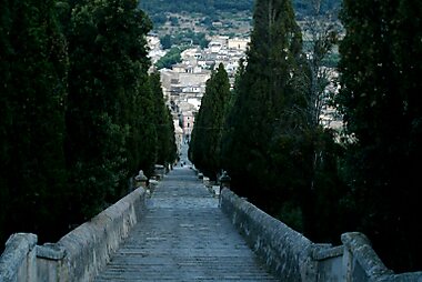
- Calvari Steps is the Calvari, a stairway of 365 steps between cypress trees, leading to a small chapel with views over the town.
- The Plaça Major is the main square, with cafés and the Sunday market.
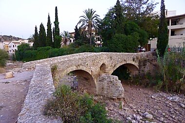
- Pont Romà is a Roman-style stone bridge over a dry riverbed on the edge of town.
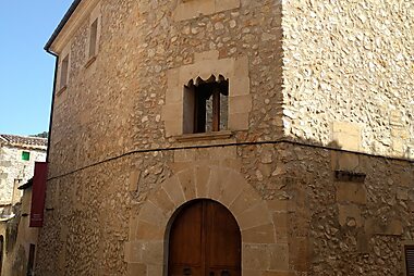
- Museu Dionís Bennàssar is a museum of local art, in a former convent.
- The church of Nostra Senyora dels Àngels is the main parish church, in the old town.
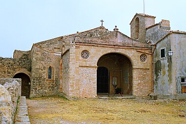
- puig de Maria is a hill with a 14th-century sanctuary and a view of the bay, reached by a path and a road.
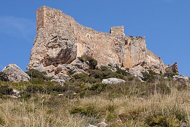
- Castell del Rei is a castle ruin on a hilltop over the north coast.
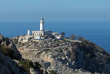
- Far de Formentor is a lighthouse at the end of the Formentor peninsula, on a cliff about 200 m above the sea.
- Es Colomer Viewpoint is a lookout tower with views of the coast and the cliffs, on the Formentor road.
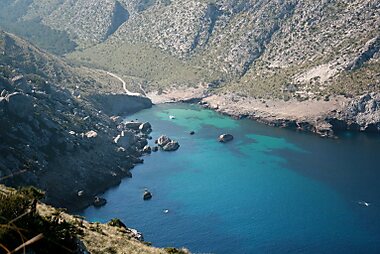
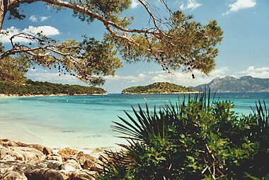
- Formentor Beach and Cala Figuera are beaches on the Formentor peninsula.
Odporúčané zoznamy


Natural Wonders
This collection highlights the diverse landscapes of northern Mallorca, centered around the Formentor peninsula and the Serra de Tramuntana. It includes the dramatic coastal cliffs of Cap de Formentor and Mirador des Colomer alongside the Bronze Age hypogeum of Coves de l'Alzinaret. Higher elevations like Puig de Maria and Puig Gros de Ternelles provide panoramic views of the bays of Pollença and Alcúdia, while the Talaia d'Albercutx stands as a historic watchtower overlooking the rugged coastline.
13 miest


Historic Sites of Pollença
Pollença’s history spans millennia, from the Bronze Age burial caves at Coves de l'Alzinaret to the Roman stone bridge of Pont Romà. The landscape is dotted with defensive architecture, including the 16th-century Talaia d'Albercutx watchtower and the medieval ruins of Castell del Rei. In the Tramuntana mountains, the "Cases de Neu" reflect traditional ice production, while the coastal La Fortalesa stands as a 17th-century military stronghold. These sites offer a comprehensive look at the architectural and strategic evolution of northern Mallorca.
7 miestČo zažiť
- Climb the 365 steps of the Calvari at sunset.
- Go to the Sunday market in the Plaça Major.
- Drive or cycle the Formentor road to the lighthouse, stopping at viewpoints.
- Swim at a beach on the Formentor peninsula.
- Walk up to the Puig de Maria sanctuary.
Prehliadky a aktivity
Pollença — Mapa

Jednodňové výlety
- l'Alcúdia (about 12 km): a walled town on a wide bay.
- Cap de Formentor (about 20 km): a winding road with viewpoints, to the lighthouse.
- Cala Sant Vicenç (about 6 km): a group of coves.
- Palma (about 55 km): the capital of Mallorca.
- Sa Calobra and Torrent de Pareis (about 40 km by road): a canyon and a pebble beach in the Tramuntana.
Kam sa vybrať
Ako sa tam dostať
- By air: Palma airport is about 55 km away, about an hour by car.
- By bus: Public buses run from Palma, Alcúdia and Port de Pollença to the town. A bus links the old town and the port.
- By car: The Ma-13 road from Palma and the Ma-2200 from Alcúdia lead to the town.
Doprava na mieste
- On foot: The old town is compact and walkable, with some steep streets. The port is about 6 km away.
- Bus: Local buses link the town, the port and the Formentor peninsula in summer.
- Cycling: The area is well known for road cycling, particularly the Formentor road.
Šoférovanie
- Is a car worth it?: Useful for Formentor and the coves. In summer, traffic and parking on the Formentor road are very busy, so go early.
- Parking: Paid parking is available near the old town. Check for current access rules for the Formentor road in summer.
- Roads: The Formentor road is narrow and winding, with tight bends and many cyclists.
Jedlo a pitie
Mallorcan cuisine is simple and island-based. Try pa amb oli (bread with oil and tomato), sobrassada (soft cured sausage), tumbet (a vegetable dish), frit (fried offal and vegetables) and fresh fish at the port. The ensaïmada, a spiral pastry, is the best-known sweet.
Local almonds and olives appear in many dishes.
Bezpečnosť a zdravie
Pollença is safe. In summer, use sun protection and drink water, particularly on the Calvari and at the beaches. Take care on the Formentor road, with sharp bends and cyclists. The cliffs at the lighthouse are high, so keep to the paths.
História
The area has been settled since the Bronze Age, and the Romans built a bridge and a nearby town, Pollentia, at Alcúdia. In 1550 pirates attacked Pollença, and the Moors and Christians festival commemorates the defence of the town against them.
In the 19th and 20th centuries artists and writers visited the area, and it became a retreat for painters and travellers. The Calvari steps were built in the 18th century.
Fakty o krajine
Quick practical facts for Spain at a glance:
- Mena
- euro EUR € · Platby kartou · Široko akceptované
- Tiesňové čísla
- 112
- Elektrina
- 230 V · 50 HzTyp C / Typ F
- Jazyky
- španielčina
- Voda z vodovodu
- Pitná
- Jazdná strana
- Vpravo
- Predvoľba
- +34


Pollença – Naplánuj si jednotlivé dni
Premeň miesta z tohto sprievodcu na skutočný itinerár s inteligentným plánovaním trás, časovými odhadmi a všetkým potrebným pre dokonalý výlet.


Súvisiace destinácie


Data: © OpenStreetMap contributors, Wikidata, Wikipedia, Tripomatic, Official websites, geoBoundaries (CC BY 4.0). Tours by GetYourGuide. We earn commission from bookings. Travel guide generated with AI.