


أنتقيرة
Antequera is a historic town in the north of the province of Málaga, in Andalusia, often called the "heart of Andalusia" for its central position. It is known for its prehistoric dolmens, which are a UNESCO World Heritage Site, and for its Renaissance and Baroque churches, a Moorish fortress and the limestone landscape of El Torcal.
It is a good base for the nearby Caminito del Rey walkway. It works as a one- or two-day stop between Málaga, Granada, Córdoba and Seville.

أنتقيرة – هل تخطط لرحلة؟
أنشئ خط سير رحلتك يوماً بيوم في تطبيق Tripomatic.


أفضل وقت للزيارة
Spring and autumn are the best seasons, with mild weather for the dolmens and for walking at El Torcal. Summer is hot and dry. Winters are cool, and fog can sit over El Torcal.
The Caminito del Rey is open most of the year, but tickets sell out in spring and autumn, so book ahead.
أفضل وقت للزيارة: أبريل, مايو, يونيو, سبتمبر, أكتوبر
أبرز المعالم




- Antequera Dolmens Site is the UNESCO-listed group of megalithic monuments, with the dolmens of Menga and Viera, and the Tholos of El Romeral.
- Dolmen de Menga is one of the largest megalithic burial chambers in Europe, built more than 5,000 years ago.
- Dolmen de Viera is a long corridor tomb aligned with the sunrise.
- Tholos de El Romeral is a Bronze Age tomb with a false dome, about 4 km from the center.
- The Alcazaba de Antequera is a Moorish fortress above the old town, with towers and views over the plain.
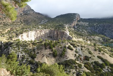
- Centro de Visitantes del Torcal de Antequera is the visitor center of El Torcal, a nature reserve of eroded limestone rock formations.
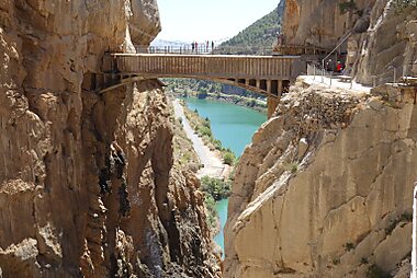
- Caminito del Rey is a walkway on the cliffs of a gorge, about 35 km west of town.
- El Chorro Gorge and Desfiladero de Los Gaitanes are the gorge and narrow canyon beside the walkway.
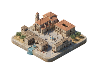
- The old town has many churches and Baroque houses, such as the Real Colegiata de Santa María la Mayor, next to the fortress.
قوائم مميزة


تجارب ننصح بها
- Enter the Menga dolmen and see the Viera chamber.
- Walk a trail in El Torcal among the rock formations.
- Spend half a day on the Caminito del Rey.
- Try the local dishes in a tavern in the old town.
جولات وأنشطة
أنتقيرة — خريطة

رحلات اليوم الواحد
- El Torcal de Antequera (about 15 km): a nature reserve with marked trails through limestone formations.
- Caminito del Rey (about 35 km, 40 minutes by car): a walkway above the Gaitanes gorge. Book tickets in advance.
- Fuente de Piedra lagoon (about 25 km): a lake with flamingos in winter and spring.
- Ronda (about 90 km): a town on a gorge.
- Carmona (about 130 km): a Roman and medieval hill town near Seville.
أماكن للاستكشاف
الوصول إلى الوجهة
- By train: Antequera-Santa Ana station has high-speed trains to Málaga, Córdoba and Seville, and trains to Granada. Book on Renfe.
- By bus: Buses link the town with Málaga, Granada and Seville.
- By air: Málaga airport is about 60 km away. A rental car or train connection is the easiest way.
التنقل والمواصلات
- On foot: The old town is on a hill, and the streets are steep. The dolmens are about 2 km from the center, and the train station is about 3 km out.
- Taxi and bus: Useful for the dolmens and the station.
- Car: The best way to reach El Torcal and the Caminito del Rey.
القيادة
- Is a car worth it?: Yes, for El Torcal, the Caminito del Rey and the lagoon. The town itself is small.
- Parking: Free and paid parking is available below the old town. The old town has narrow, steep streets.
- Roads: The A-92 and A-45 pass by. The road up to El Torcal is winding.
المأكولات والمشروبات
Antequera has its own dishes. Try porra antequerana, a thick cold tomato soup like salmorejo, served with ham and egg, and mollete, a soft bread, for breakfast. Bienmesabe is a fried marinated fish, and angelorum is a local sweet cake, based on the convent pastry tradition.
Local olive oil and cured meats are also well known.
السلامة والصحة
Antequera is a safe town. In summer the heat is strong, so bring water and sun protection to the dolmens and El Torcal. At El Torcal, the weather can change quickly, and fog and cold are possible in winter. On the Caminito del Rey, follow the rules and wear the helmet provided.
التاريخ
Antequera has been inhabited since prehistory. The dolmens of Menga and Viera date from the Neolithic period, about 5,000 years ago, and El Romeral from the Bronze Age. The Romans built a town here called Anticaria.
The Moors held the town until 1410, when it was taken by the Christian forces. The Renaissance and Baroque churches date from the later period of prosperity. The dolmens site, together with the Peña de los Enamorados and El Torcal, was listed by UNESCO in 2016.
حقائق عن البلد
Quick practical facts for Spain at a glance:
- العملة
- يورو EUR € · الدفع بالبطاقات · مقبولة على نطاق واسع
- أرقام الطوارئ
- 112
- الكهرباء
- 230 فولت · 50 هرتزالنوع C / النوع F
- اللغات
- الإسبانية
- مياه الصنبور
- صالحة للشرب
- جهة القيادة
- اليمين
- رمز الاتصال الدولي
- +34


أنتقيرة – خطط لأيامك
حوّل الأماكن المذكورة في هذا الدليل إلى خط سير حقيقي، مع ملاحة ذكية وتقديرات زمنية وكل ما تحتاجه لرحلة مثالية.


وجهات ذات صلة


Data: © OpenStreetMap contributors, Wikidata, Wikipedia, Tripomatic, Official websites, geoBoundaries (CC BY 4.0). Tours by GetYourGuide. We earn commission from bookings. Travel guide generated with AI.
خطط لرحلتك مع Tripomatic
- تخطيط مدعوم بالذكاء الاصطناعيدع الذكاء الاصطناعي يبني خط سير رحلتك، ويجيب عن أسئلة السفر، ويُدرج مستندات حجوزاتك داخل رحلتك.
- تنبيهات السفرإرشادات رسمية، وتحذيرات الطقس القاسي، والإضرابات، والمخاطر الطبيعية للأماكن المجدولة في كل يوم من رحلتك.
- العطلات الرسمية والفعالياتتعرف على العطلات والمهرجانات وأوقات الإغلاق خلال أيام رحلتك، وتأثيرها على خططك.
- تقدير التكاليفتفصيل تكاليف الرحلة مدعوم بالذكاء الاصطناعي لتعرف الميزانية المناسبة قبل انطلاقك.
- جولات وتذاكراحجز الجولات وتذاكر تجاوز طوابير الانتظار والأنشطة مباشرة من داخل خطتك.