


Oland
Öland is a long, flat limestone island in the Baltic Sea, joined to the mainland at Kalmar by a 6 km bridge. It is Sweden's second-largest island and a classic Swedish summer holiday spot. The land is open and windswept, with old wooden windmills, stone walls and wide skies.
The island suits a slow trip by car or bike. You can visit Iron Age forts, a royal summer palace, lighthouses at both tips and long sandy beaches in the north. The south is a UNESCO World Heritage landscape shaped by thousands of years of farming. Summer is busy and lively, while spring and autumn are quiet and good for birdwatching.

Oland – Plánuješ výlet?
Sestav si itinerář den po dni v aplikaci Tripomatic.


Kdy navštívit
Summer is the main season, with long, mild days and the warmest sea in July and August. Many sights, cafés and boat trips open only from late spring to early autumn. May, June and September are quieter, and spring and autumn bring huge numbers of migrating birds to the southern tip. Winter is grey, windy and very quiet.
The biggest event is the Öland Harvest Festival (Skördefest) on the last weekend of September. Farms, markets and artists open their doors across the whole island, and it draws thousands of visitors, so book accommodation early.
Nejlepší doba k návštěvě: červenec, srpen
Hlavní památky
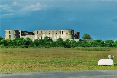



- Borgholm slott is the huge stone ruin above the island's only town. It burned in 1806 and now hosts a museum, concerts and summer events in its courtyard.
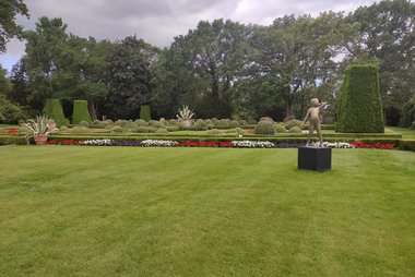
- Sollidens slott is the Italian-style summer home of the Swedish royal family, a short walk from the castle ruin. Its park is open to visitors from May to late September.
- Agricultural Landscape of Southern Öland is a UNESCO World Heritage Site. It includes Stora Alvaret, a vast open limestone plain with rare plants, plus old farming villages and stone walls.
- Eketorp Fortress is a rebuilt Iron Age ringfort in the south. In summer, staff in costume show crafts and daily life, and a small museum displays finds from the excavation.
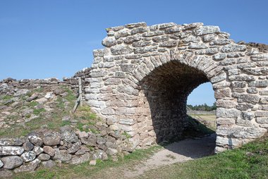
- Gråborg is the largest ancient ringfort on Öland. Its massive stone wall still stands, with the ruin of a medieval chapel close by.
- Sandby fornborg is a smaller ringfort where archaeologists found evidence of a massacre in the late 5th century. It gives a striking picture of violence in the Iron Age.
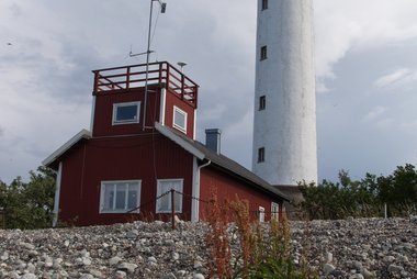
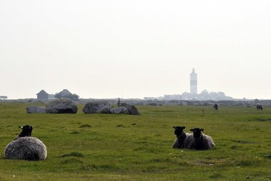
- Ölands Södra Udde is the southern tip, with the Långe Jan lighthouse from 1785, the tallest in Sweden. You can climb it in the warmer months, and Ottenby bird observatory is right beside it.
- Ölands Norra Udde is the northern tip, with the white Långe Erik lighthouse from 1845 on a small island linked by a bridge.
- Trollskogen, a nature reserve near the northern tip, has a short trail through wind-twisted pines and oaks.
Doporučené výběry


Co zažít
Some of the best moments on Öland are seasonal and outdoors:
- Join the Harvest Festival — on the last weekend of September, farms, artists and markets open across the island, with pumpkin displays and evening art walks by torchlight.
- Watch the bird migration — spring and autumn bring huge flocks past the southern tip. Ottenby bird observatory rings birds there, and the nature centre explains the migration.
- Walk on Stora Alvaret — the open limestone plain feels unlike anywhere else in Sweden. Go in late spring, when rare orchids and other wildflowers bloom.
- See the royal family on Victoria Day — each year on 14 July, the Crown Princess's birthday is celebrated at Solliden and in Borgholm, and the royal family greets the public.
Prohlídky a aktivity
Oland – Mapa

 Otevřít interaktivní mapu
Jednodenní výlety
Most visitors spend all their time on the island, but a few trips across the water are worth it:
- Kalmar Municipality — 15–30 minutes by car or bus over the bridge from the southern half of the island. See Kalmar Castle, the cathedral and the old town.
- Blå Jungfrun National Park — a granite island in Kalmar Sound, about 1.5 hours by tour boat from Byxelkrok in the north. Boats run daily from late June to mid-August.
- The Kingdom of Crystal (Glasriket) — glassworks in the forests of Province of Småland, about 40–70 minutes by car from Kalmar. Watch glassblowers at work and buy glass at the factory shops.
- Karlskrona — the UNESCO-listed naval port, about 1.5–2 hours by train or car from Kalmar.
Kam vyrazit na průzkum
Borgholms distrikt is the island's main town, with the castle ruin, the royal palace, shops and the busiest harbour.
Across the bridge, Kalmar Municipality is the gateway city and the place to catch trains and flights. The wider Province of Småland region offers forests, lakes and glassworks.
Further away, Stockholm is a good start or end point for a trip, and Gotland is Sweden's other big Baltic island.
Jak se tam dostat
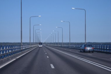
- By car: Drive over Öland Bridge from Kalmar Municipality. The bridge lands you at Färjestaden, about 30 minutes by car from Borgholm. Cycling and walking are not allowed on the bridge.
- By air: Öland has no airport. Kalmar Öland Airport is about 5 km from Kalmar, with several daily flights to Stockholm. Take a taxi or a local bus into Kalmar, then a bus to the island.
- By train: Trains run to Kalmar from Stockholm (about 5 hours with a change), Gothenburg and Malmö/Copenhagen. From Kalmar station, regional buses cross the bridge to the island.
- By bus: Long-distance coaches run from Stockholm to Kalmar, where you change to a regional bus to Öland.
Doprava na místě
- Car: The easiest way to explore. The island is about 137 km long, and many sights, beaches and nature reserves lie away from the bus routes.
- Bus: Kalmar Länstrafik runs regional buses along the island, including line 101 from Kalmar station to Borgholm. Pay by bank card on board or with a travel pass; cash is not accepted on board. Bikes can go on regional buses for an extra fee when there is space.
- Cycling: Öland is flat and good for cycling, with quiet back roads. Expect strong wind on open ground. Rent a bike on the island, since you cannot cycle over the bridge.
- On foot: Borgholm's centre is small and walkable, but the island as a whole is too spread out to explore on foot.
Řízení auta
- Is a car worth it?: Yes. A car is the most practical way to see the island, because buses are infrequent away from the main road and many sights are rural.
- Bridge: The Öland Bridge is the only road link to the island. Expect slow traffic on busy summer weekends.
- Parking: Most sights, beaches and nature reserves have free or low-cost car parks. In Borgholm's centre in summer, check the signs for time limits.
- On the road: Roads are narrow, and you share them with cyclists, tractors and grazing animals. Take care at dawn and dusk.
Jídlo a pití
Öland's signature dish is Ölands kroppkakor: large potato dumplings filled with pork, served with melted butter and lingonberries. The island is also known for its brown beans, which have EU protected status as "Bruna bönor från Öland". Look out for local lamb, smoked fish from small harbours, and fresh produce from farm shops in late summer and autumn.
The best eating clusters around Borgholm's harbour and centre, and in the small fishing harbours along the coast. Many cafés and restaurants open only in the summer season, so plan ahead outside June to August.
Bezpečnost a zdraví
Öland is very safe, and crime against visitors is rare. Use normal care with valuables in busy places such as Borgholm in high summer.
The main health risk is ticks in long grass and woods, so check yourself after walks. Bring sun protection, because the open landscape gives little shade, and windproof layers for the coast.
Historie
People have farmed Öland for thousands of years, and you can still read that history in the land. Prehistoric burial sites, stone walls and long rows of village farms survive across the south. This is why the Agricultural Landscape of Southern Öland is on the UNESCO World Heritage List.
In the Iron Age, islanders built more than a dozen stone ringforts as refuges. Gråborg is the largest, Eketorp Fortress has been rebuilt as it may have looked, and Sandby fornborg preserves the scene of a massacre in the late 5th century.
For centuries, the Swedish crown kept Öland as a royal hunting ground. A medieval fortress at Borgholm grew into a Baroque palace, Borgholm slott, until a fire left it a ruin in 1806. In the early 1900s, Crown Princess Victoria built Sollidens slott next to the ruin, and the royal family still spends its summers there.
For centuries Öland had no fixed link to the mainland. That changed in 1972, when the Öland Bridge opened and made the island an easy summer escape.
Fakta o zemi
Quick practical facts for Sweden at a glance:
- Měna
- švédská koruna SEK kr · Platby kartou · Široce přijímány
- Nouzová čísla
- 112
- Elektřina
- 230 V · 50 HzTyp C / Typ F
- Jazyky
- švédština
- Voda z kohoutku
- Pitná
- Strana jízdy
- Vpravo
- Předvolba
- +46


Oland – Naplánuj si jednotlivé dny
Proměň místa z tohoto průvodce ve skutečný itinerář s chytrým plánováním tras, časovými odhady a vším, co potřebuješ pro bezstarostný výlet.


Související destinace



Data: © OpenStreetMap contributors, Wikidata, Wikipedia, Tripomatic, Official websites. Tours by GetYourGuide. We earn commission from bookings. Travel guide generated with AI.