Tripomatic

Phang Nga Bucht

Bucht · Phangnga, 🇹🇭 Thailand

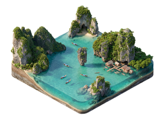
Phang Nga Bay is a wide bay on Thailand's Andaman coast between Phuket and Krabi. Tall limestone cliffs rise from green water, and hidden lagoons, caves and mangroves sit between the islands. Much of the bay is protected as a marine national park.

Most visitors explore it on a boat day trip from Phuket, Krabi or Khao Lak. Sea kayaks, longtail boats and speedboats are the usual ways to see the rocks up close.

Phang Nga Bucht

Phang Nga Bucht – Planst du eine Reise?

Erstelle deine Reiseroute Tag für Tag in der Tripomatic-App.

Beste Reisezeit

The best time is from November to April, when the sea is calm and skies are mostly dry. Boat tours run on a regular schedule and the water is easier to enjoy.

From May to October the rainy season brings rough seas and showers. Some tours are cancelled, and views can be hazy.

Monat auswählen

Typisches Wetter im Januar

Mäßig
  • 31° (gefühlt 34°) · Extreme 21°–34°
  • 23° nachts
  • 11 Regentage
  • 13 Sonnentage
  • 7 Sonnenstunden pro Tag
  • Drückende Schwüle
  • Windstill
  • 28 °C · angenehm warm zum Baden
  • UV-Index 9 · sehr hoch

Typisches Wetter im Februar

Mäßig
  • 33° (gefühlt 36°) · Extreme 21°–35°
  • 23° nachts
  • 8 Regentage
  • 17 Sonnentage
  • 8 Sonnenstunden pro Tag
  • Drückende Schwüle
  • Windstill
  • 29 °C · angenehm warm zum Baden
  • UV-Index 10 · sehr hoch

Typisches Wetter im März

Schlecht
  • 33° (gefühlt 37°) · Extreme 22°–36°
  • 24° nachts
  • 15 Regentage
  • 18 Sonnentage
  • 8 Sonnenstunden pro Tag
  • Drückende Schwüle
  • Windstill
  • 30 °C · angenehm warm zum Baden
  • UV-Index 11 · extrem
Bis zu 7 Tage über 35°

Typisches Wetter im April

Schlecht
  • 32° (gefühlt 37°) · Extreme 23°–36°
  • 25° nachts
  • 24 Regentage
  • 11 Sonnentage
  • 8 Sonnenstunden pro Tag
  • Drückende Schwüle
  • Windstill
  • 30 °C · angenehm warm zum Baden
  • UV-Index 11 · extrem

Typisches Wetter im Mai

Schlecht
  • 30° (gefühlt 36°) · Extreme 24°–33°
  • 25° nachts
  • 28 Regentage
  • 3 Sonnentage
  • 6 Sonnenstunden pro Tag
  • Drückende Schwüle
  • Windstill
  • 30 °C · angenehm warm zum Baden
  • UV-Index 9 · sehr hoch

Typisches Wetter im Juni

Schlecht
  • 30° (gefühlt 35°) · Extreme 23°–31°
  • 25° nachts
  • 26 Regentage
  • 4 Sonnentage
  • 6 Sonnenstunden pro Tag
  • Drückende Schwüle
  • Windstill
  • 30 °C · angenehm warm zum Baden
  • UV-Index 8 · sehr hoch

Typisches Wetter im Juli

Schlecht
  • 29° (gefühlt 34°) · Extreme 23°–31°
  • 24° nachts
  • 27 Regentage
  • 3 Sonnentage
  • 5 Sonnenstunden pro Tag
  • Drückende Schwüle
  • Windstill
  • 30 °C · angenehm warm zum Baden
  • UV-Index 8 · sehr hoch

Typisches Wetter im August

Schlecht
  • 29° (gefühlt 34°) · Extreme 23°–31°
  • 24° nachts
  • 27 Regentage
  • 4 Sonnentage
  • 5 Sonnenstunden pro Tag
  • Drückende Schwüle
  • Windstill
  • 29 °C · angenehm warm zum Baden
  • UV-Index 9 · sehr hoch

Typisches Wetter im September

Schlecht
  • 29° (gefühlt 34°) · Extreme 23°–31°
  • 24° nachts
  • 27 Regentage
  • 3 Sonnentage
  • 5 Sonnenstunden pro Tag
  • Drückende Schwüle
  • Windstill
  • 29 °C · angenehm warm zum Baden
  • UV-Index 9 · sehr hoch

Typisches Wetter im Oktober

Schlecht
  • 29° (gefühlt 34°) · Extreme 23°–31°
  • 24° nachts
  • 30 Regentage
  • 3 Sonnentage
  • 5 Sonnenstunden pro Tag
  • Drückende Schwüle
  • Windstill
  • 29 °C · angenehm warm zum Baden
  • UV-Index 9 · sehr hoch

Typisches Wetter im November

Schlecht
  • 29° (gefühlt 34°) · Extreme 22°–31°
  • 23° nachts
  • 25 Regentage
  • 4 Sonnentage
  • 6 Sonnenstunden pro Tag
  • Drückende Schwüle
  • Windstill
  • 29 °C · angenehm warm zum Baden
  • UV-Index 8 · sehr hoch

Typisches Wetter im Dezember

Mäßig
  • 29° (gefühlt 33°) · Extreme 21°–31°
  • 23° nachts
  • 16 Regentage
  • 8 Sonnentage
  • 6 Sonnenstunden pro Tag
  • Drückende Schwüle
  • Windstill
  • 29 °C · angenehm warm zum Baden
  • UV-Index 8 · sehr hoch

Klimadaten: NASA POWER + Copernicus ERA5-Land and ERA5 · 1996–2025

Top-Sehenswürdigkeiten

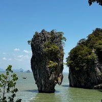
  • James Bond Island is a tall rock standing in the water, made famous by a 1970s James Bond film. Boats usually stop for a short visit and photos.
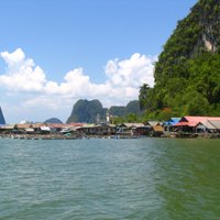
  • Koh Panyee is a village built on stilts over the water, where many tours stop for lunch.
  • Hong Island Kayaking is a popular kayaking stop among islands with lagoons and rock arches.

Empfohlene Listen

Erlebnisse & Aktivitäten

  • Sea kayaking: Paddle into lagoons and under limestone arches.
  • Longtail boat ride: See the cliffs and islands at your own pace.
  • Stilt village lunch: Eat seafood in the village built over the water.
  • Sunset cruise: Take an evening trip when the cliffs turn orange.

Touren & Aktivitäten

Phang Nga Bucht — Karte

Phang Nga Bucht — Karte

Tagesausflüge

These trips are listed from closest to farthest.

  • Hong Islands by kayak: a boat and kayak trip into hidden lagoons.
  • Longtail boat tour: a half-day trip around the main rocks and caves.
  • Full-day tour from Phuket or Krabi: a boat day trip that combines sea caves, Koh Panyee and island stops.

Orte zum Entdecken

  • Phang Nga is the province around the bay.
  • Khao Lak is a beach area north of the bay.
  • Phuket Town is a common starting point for tours.
  • Krabi is the province on the other side of the bay.

Anreise

  • From Phuket: Tours start from Phuket piers and often include hotel pick-up. The boat ride into the bay takes a while, depending on the pier.
  • From Krabi and Ao Nang: Tours leave from Krabi piers.
  • From Khao Lak: Day tours run to the northern part of the bay.
  • By private boat: Longtail boats can be hired from piers around the bay.

Unterwegs vor Ort

  • By boat: Boats are the main way to move around the bay. Most visitors join a tour.
  • By kayak: Guided kayak trips enter caves and lagoons that larger boats cannot reach.
  • On land: Roads run along the mainland coast, but most sights are on the water.

Autofahren

  • Is a car worth it?: A car helps for reaching piers on the mainland, but sights are on the water.
  • Driving side: Traffic drives on the left.
  • Roads: Main roads between Phuket and Krabi are paved.

Essen & Trinken

Seafood is the main food in the bay area, with prawns, fish and crab at village restaurants. Southern Thai dishes are spicy and rich with coconut milk.

The stilt village is a Muslim community, so alcohol may be limited.

Mittagessen
Pad ThaiGebratene Reisnudeln mit Ei, Tofu oder Garnelen, Sojasprossen und Tamarindensauce, garniert mit zerkleinerten Erdnüssen.
Som TamScharfer Salat aus geriebener grüner Papaya mit Limette, Chili, Fischsauce und Erdnüssen.
Boat Noodles  Kuay Teow ReuaKleine, intensiv gewürzte Schalen mit Nudelsuppe, die traditionell von Booten entlang der Kanäle Bangkoks serviert wurden.
Abendessen
Tom Yum Goong  Tom Yum KungScharf-saure Suppe mit Garnelen, Zitronengras, Galgant, Kaffir-Limettenblättern und Chili.
Grünes Curry  Gaeng Keow WanKokosmilch-Curry mit grünen Chilis, Thai-Basilikum und Fleisch oder Tofu, serviert mit Reis.
Massaman-Curry  Gaeng MassamanMildes, reichhaltiges Curry mit persischen und indischen Einflüssen, typischerweise zubereitet mit Rindfleisch oder Hähnchen, Kartoffeln und Erdnüssen.
Snacks & Streetfood
Satay  SateGegrillte marinierte Fleischspieße, serviert mit Erdnuss-Dipsauce.
Mango Sticky Rice Roti  RotiKnuspriges, in der Pfanne gebratenes Fladenbrot, oft süß mit Kondensmilch und Banane oder herzhaft serviert.
Süßspeisen & Desserts
Mango Sticky Rice  Khao Niao MamuangSüßer Klebreis, serviert mit frischen Mangoscheiben und Kokoscreme.
Getränke
Thailändischer Eistee  Cha YenKräftiger Schwarztee, gesüßt mit Kondensmilch und auf Eis serviert.
Singha / Chang Bier  Beer Chang / SinghaBeliebte thailändische Lagerbiere, die in Bars und Restaurants weit verbreitet sind.

Sicherheit & Gesundheit

  • Sea conditions: Check the weather and choose a tour with life jackets and a good safety record.
  • Kayaking: Follow your guide, as tides can change water levels inside caves.
  • Sun: Use sunscreen and wear a hat.
  • Crowds: Popular stops are busy in the morning. Visit early or late if you can.
  • Respect nature: Do not touch coral or feed wildlife.
  • Royal family: Do not speak or write badly about the monarchy. It is a serious crime in Thailand.

Geschichte

Phang Nga Bay has been home to coastal fishing communities for generations.

Tourism grew after a James Bond film brought attention to the bay in the 1970s, and much of the bay is now protected as a national park.

Länderfakten

Quick practical facts for Thailand at a glance:

Währung
Thailändischer Baht THB ฿ · Kartenzahlung · Häufig akzeptiert
Notrufnummern
191 Polizei
Stromnetz
Steckertyp A / Steckertyp B / Steckertyp C / Steckertyp O
220 V · 50 Hz
Sprachen
Thailändisch
Leitungswasser
Mit Vorsicht trinken
Fahrseite
Linksverkehr
Telefonvorwahl
+66
Mehr erfahren
James Bond Island
Auto
Koh Panyee
Auto
Ko Tapu

Phang Nga Bucht – Plane deine Tage

Verwandle die Orte aus diesem Reiseführer in eine echte Reiseroute mit intelligenter Routenführung, Zeitschätzungen und allem für eine perfekte Reise.


3 Mio.+ Downloads · 4,6 Sterne · 15 Jahre Reiseplanung
QR code
Scannen, um die App herunterzuladen

Ähnliche Reiseziele

Data: © OpenStreetMap contributors, Wikidata, Wikipedia, Tripomatic, Official websites. Travel guide generated with AI.