


Provinz Santiago
Santiago is Chile's capital and its largest city by far. It is home to more than a third of the country's population. The city sits in a wide valley between the Andes and the coastal range, and snow-capped peaks are visible from downtown streets on a clear day. Colonial-era churches stand close to a financial district of glass towers, mixing old and new.
Santiago works well as a destination on its own and as a base for exploring the rest of Chile. A few days here is enough to see the main sights and ride the fast, clean metro system. From the city, it is easy to reach the mountains, vineyards, and the Pacific coast nearby. The poet Pablo Neruda lived here for decades, and his hillside home is now one of the city's most visited museums.

Provinz Santiago – Planst du eine Reise?
Erstelle deine Reiseroute Tag für Tag in der Tripomatic-App.


Beste Reisezeit
Spring (September to November) and autumn (March to May) are mild, and are the best times to visit. Summer (December to February) is hot and dry. Winter (June to August) is cool, with occasional frost at night, and smog can settle over the valley for days at a time.
Plan around Fiestas Patrias, Chile's independence celebrations on September 18–19, when the city fills with fondas.
Beste Reisezeit: März, April, Mai, Juni, Juli, August, September, Oktober, November, Dezember
Top-Sehenswürdigkeiten
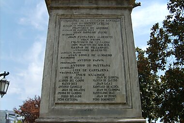


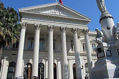

Plaza de Armas is the historic heart of Santiago. It is ringed by the cathedral, the old post office, and elegant 19th-century buildings.
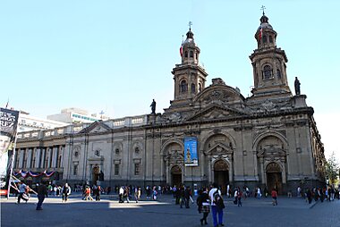
Metropolitan Cathedral of Santiago de Chile faces the square. It has been rebuilt several times after earthquakes, and its current facade dates mostly from the 18th and 19th centuries.
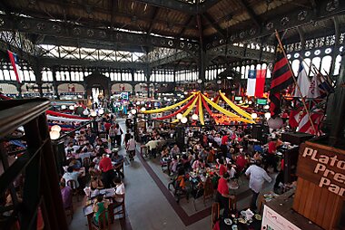
Mercado Central de Santiago is a cast-iron market hall from the 1870s, packed with seafood stalls and small restaurants serving the day's catch.
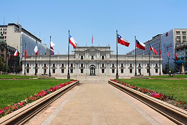
Presidential Palace of Chile is the seat of Chile's president and the site of the 1973 military coup. Free guided tours run on weekdays with advance online booking.
Cerro Santa Lucía is a small hill in the city center. Paths, fountains, and a viewpoint over the rooftops make it a short but rewarding climb.
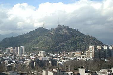
Cerro San Cristóbal is the largest hill in the city. A large statue of the Virgin Mary stands at the top, with open views toward the Andes.
Costanera Center holds the tallest building in South America. An observation deck near the top offers the widest views in the city.
Museum of Precolombian Art holds a large collection of pre-Columbian art, spanning thousands of years across the Americas.
Empfohlene Listen


Erlebnisse & Aktivitäten
A few Santiago rituals are worth building time for beyond the main sights.
- Swim at the public pools inside Cerro San Cristóbal park on a hot summer afternoon, a local tradition rather than just a viewpoint stop.
- Catch sunset from the Sky Costanera deck at Costanera Center, watching the Andes turn pink as the city lights come on below.
- During Fiestas Patrias in September, join a fonda — a temporary outdoor fair with live cueca dancing, rodeo shows, and grilled meat — held in parks across the city.
- Browse a neighborhood feria (street market) on a Saturday morning for fresh fruit, vegetables, and empanadas straight off the grill.
Touren & Aktivitäten
Provinz Santiago — Karte

Tagesausflüge
Mountains, vineyards, and the coast are all within a couple of hours of Santiago.
- Cajón del Maipo — about 1 hour by car or bus. A canyon in the Andes foothills with hot springs and hiking trails. The turquoise Embalse El Yeso reservoir is another hour or so further, along a partly unpaved road.
- Pomaire — about 1 hour by bus or car. A small village known for handmade clay pottery and large portions of traditional Chilean food.
- Maipo Valley — 45 minutes to 1 hour by car. Chile's oldest wine region, with wineries such as Concha y Toro open for tastings and tours.
- Valparaíso and Viña del Mar — about 1.5 hours by bus. A UNESCO-listed port city of steep hills and colorful houses, next to a popular beach resort town.
- Andes ski resorts — about 1.5 hours by car in winter. Valle Nevado, La Parva, and El Colorado are less than two hours from downtown, unusually close for a capital city.
Anreise
- By air: Arturo Merino Benítez International Airport (SCL) is Chile's main international gateway, about 20 km northwest of downtown. Airport buses run every 10–15 minutes to the city center and take 30–45 minutes depending on traffic. Taxis and ride-hailing apps are usually a bit faster in normal traffic, but cost more.
- By bus: Long-distance buses arrive at several terminals along Avenida Libertador Bernardo O'Higgins (the Alameda), with connections across Chile and to neighboring countries.
- By train: Santiago has no long-distance passenger rail to other major Chilean cities. Regional trains run south toward Rancagua and Chillán from Estación Central.
Unterwegs vor Ort
- Public transit: The Metro de Santiago covers most of the city and connects with the Red bus network under one fare system. Buy a reloadable bip! card at metro stations or kiosks, or tap a contactless bank card or phone directly at metro turnstiles. Red buses still require the bip! card or a QR code for now, and cash is not accepted on board. Check fares and routes at Metro de Santiago.
- Taxi / ride-hailing: Uber, Cabify, and DiDi all operate widely and are usually easier than hailing a street taxi.
- On foot / cycling: Central neighborhoods like Providencia, Las Condes, and the historic center are walkable on their own. The city overall is spread out, so combine walking with the metro between areas. Dedicated bike lanes run along the Mapocho river and through several neighborhoods, and bike-share stations are common in central areas.
Autofahren
- Is a car worth it?: Skip it within the city — traffic is heavy, parking is expensive, and the metro and ride-hailing apps cover the center well. A car makes more sense for day trips into the Andes or wine country.
- Parking: Use a paid parking lot ("estacionamiento") or metered street parking downtown and in Providencia; attendants in reflective vests collect street fees in Las Condes and Providencia.
- Restrictions: A rotating license-plate driving restriction ("restricción vehicular") applies to older, non-catalytic cars on high-pollution winter days. Rental cars are normally exempt, but confirm with the rental company for a long winter stay.
Essen & Trinken
Chilean food centers on seafood, beef, and hearty stews. Try empanadas de pino (baked pastries with minced beef, olives, and egg), a completo (a loaded hot dog), and pastel de choclo (a corn and beef casserole). Wash it down with a pisco sour or a glass of Chilean wine, both a source of national pride.
For a distinctive food experience, La Vega Central Market is where locals buy fresh produce and seafood early in the morning, with small stalls serving cheap, filling meals. For a wider choice of restaurants and bars, head to the streets around Patio Bellavista, or to Barrio Lastarria.
Sicherheit & Gesundheit
Santiago is generally safe for tourists, and violent crime against visitors is rare. The most common problems are petty theft: pickpocketing on crowded buses and the metro, and phone or bag snatching in tourist areas and outdoor markets. Keep valuables out of sight and stay alert around Plaza de Armas and on public transit at rush hour.
Political protests occasionally gather around Plaza Baquedano (Plaza Italia) and can turn disruptive, with tear gas and road closures. Check local news before visiting the area if a protest is planned.
Geschichte
Spanish conquistador Pedro de Valdivia founded Santiago in February 1541. He chose a site at the foot of Cerro Santa Lucía — a hill the local Picunche people called Huelén — because it was easy to defend and had water nearby. The city grew slowly for centuries, repeatedly damaged and rebuilt after earthquakes.
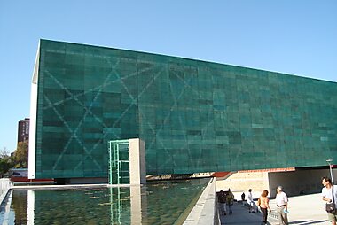
The 20th century brought faster change, as Santiago's population grew rapidly and the city became the center of major political upheaval. On September 11, 1973, the military bombed Presidential Palace of Chile during the coup that overthrew President Salvador Allende, beginning nearly two decades of dictatorship under Augusto Pinochet. Museum of Memory & Human Rights documents this period and its human cost in detail.
Länderfakten
Quick practical facts for Chile at a glance:
- Währung
- Chilenischer Peso CLP $ · Kartenzahlung · Weitgehend akzeptiert
- Notrufnummern
- 133
- Stromnetz
- 220 V · 50 HzSteckertyp C / Steckertyp L
- Sprachen
- Spanisch
- Leitungswasser
- Trinkbar
- Fahrseite
- Rechtsverkehr
- Telefonvorwahl
- +56


Provinz Santiago – Plane deine Tage
Verwandle die Orte aus diesem Reiseführer in eine echte Reiseroute mit intelligenter Routenführung, Zeitschätzungen und allem für eine perfekte Reise.


Ähnliche Reiseziele


Data: © OpenStreetMap contributors, Wikidata, Wikipedia, Tripomatic, Official websites, geoBoundaries (CC BY 4.0). Tours by GetYourGuide. We earn commission from bookings. Travel guide generated with AI.