


Printable Tourist Map of Krakow
Krakow: a free, high-resolution tourist map with the top sights numbered — print it, save it, or take it with you offline.
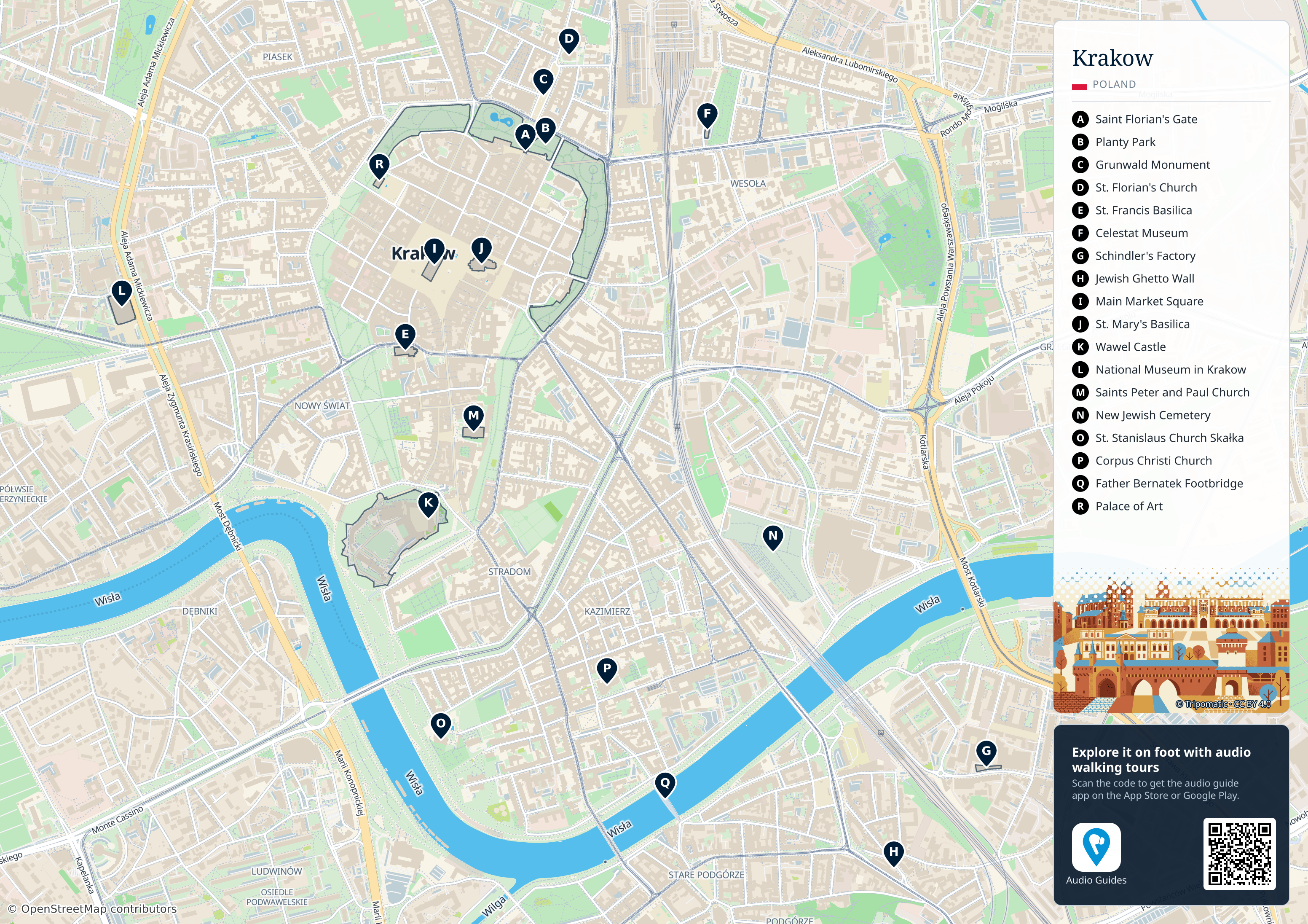
 Open the interactive map
 Top sights on this map
- Saint Florian's Gate
- Planty Park
- Grunwald Monument
- St. Florian's Church
- St. Francis Basilica
- Celestat Museum
- Schindler's Factory
- Jewish Ghetto Wall
- Main Market Square
- St. Mary's Basilica
- Wawel Castle
- National Museum in Krakow
- Saints Peter and Paul Church
- New Jewish Cemetery
- St. Stanislaus Church Skałka
- Corpus Christi Church
- Father Bernatek Footbridge
- Palace of Art
Audio Guides – Krakow
Explore on foot with a self-guided audio tour that narrates each stop as you reach it.

Best of Kraków
110 min2.8 km10 stops
Walk Kraków's Royal Route from its medieval city gate to the royal stronghold on Wawel Hill. This best-of tour crosses the vast Main Market Square, visits one of Poland's greatest art museums, ducks into the city's grandest Gothic and Baroque churches, and passes the country's oldest university before climbing to the castle and cathedral where Polish kings were crowned. Start at St. Florian's Gate, on the northern edge of the Old Town, an easy walk from the main train station.

Krakow with Kids: Dragon Legends of Wawel
110 min2.9 km9 stops
A treasure-hunt walk for families, from Krakow's medieval city gate down the old Royal Road to Wawel Hill. Follow the trail of the city's dragon and founding legends: a fortress gate built after a great invasion, a trumpeter's broken warning call, a saint's miracle, the king who built his castle on the hill, the giant bones that guard the cathedral door, and the clever trick that finally beat the terrible dragon. Every stop has a puzzle to solve on the spot. Starts at the Barbican and St. Florian's Gate.

Hear Krakow's audio tours
2 walks in Audio Guides by Tripomatic


Krakow – Add to Your Trip
Create a detailed travel itinerary with smart routing, time estimates, and everything you need for a perfect trip.


Use this map on your website
This map is free to share and adapt, even commercially, under the CC BY 4.0 license. Just credit Tripomatic and OpenStreetMap as shown below.
Credit line
Map by Tripomatic, CC BY 4.0 · Map data © OpenStreetMap contributors (ODbL)