



Zermatt
Zermatt sits at the foot of the Matterhorn, one of the most recognizable mountains in the world, in the canton of Valais. The village has no cars — visitors leave their vehicles at Täsch and arrive by train, so the streets stay quiet apart from electric taxis and, in winter, horse-drawn sleighs.
The resort works in both winter and summer. Skiers and snowboarders come for glacier skiing that runs almost year-round, while summer visitors come for high-alpine hiking, mountain railways, and close-up views of the Matterhorn. It suits travelers who want dramatic mountain scenery and outdoor activity more than city sightseeing, and who don't mind resort prices for it.

Zermatt – ¿Estás planeando un viaje?
Crea tu itinerario día a día en la app de Tripomatic.


Cuándo viajar
Zermatt is a year-round destination. Winter (December to April) is cold and snowy, with reliable skiing on the resort's high glacier slopes. Summer (June to September) is mild by day but still cool at night given the altitude, and it's the best season for hiking. Spring and late autumn are quieter, and some lifts close for maintenance during these shoulder seasons.
Plan around Zermatt Unplugged, an acoustic music festival held every April that brings well-known international artists to venues around the village — book accommodation early if you want to attend.
Even on a warm summer day in the village, temperatures drop fast above 3,000 meters, so bring warm layers for the mountain railways.
Lugares destacados
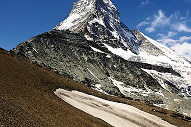


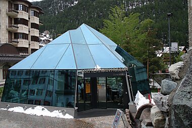
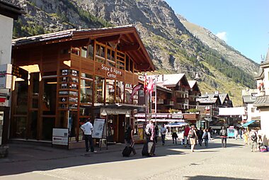

The Matterhorn is the reason most people come to Zermatt: a near-symmetrical pyramid of rock that towers over the village and appears in views from most points in town on a clear day.
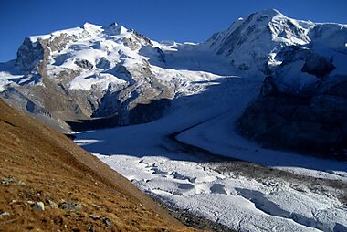
Gornergrat is reached by a cogwheel railway that climbs above the treeline to a panorama of dozens of 4,000-meter peaks, with a wide view of the Matterhorn from the east. The ride itself, on one of the highest open-air railways in Europe, is part of the experience.
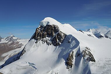
Klein Matterhorn, marketed as Matterhorn Glacier Paradise, is the highest point in Europe reachable by cable car. An ice tunnel near the top leads to an outdoor platform with glacier views reaching into Italy, and skiing continues here even in summer.
For a quieter panorama, ride the funicular up to Sunnegga and continue by cable car to Unterrothorn, a viewpoint that faces the Matterhorn directly across the valley, with fewer crowds than the higher stations.
Learn the mountain's human history at the Matterhorn Museum, built as a cluster of reconstructed mountain houses and centered on the first ascent of the Matterhorn in 1865.
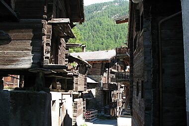
Walk through Hinterdorfstrasse, the oldest part of the village, where wooden chalets and grain stores raised on stone stilts date back centuries.
The Mountaineers' Cemetery, near the parish church, holds the graves of climbers who died on the surrounding peaks — a quiet counterpoint to the resort atmosphere elsewhere in the village.
Listas destacadas


Zermatt Peaks and Passes
Zermatt is surrounded by 38 peaks exceeding 4,000 meters, including the iconic Matterhorn and the Dufourspitze, the highest point in Switzerland. This list highlights significant summits within the Pennine Alps, such as the Breithorn and the Monte Rosa massif. It also features high-altitude mountain passes like Theodul Pass and Adlerpass, alongside viewpoints like Gornergrat, which offers expansive vistas of the Gorner Glacier and the surrounding glacier-covered ridges.
25 lugares
Qué experimentar
Zermatt's best experiences happen outdoors, at altitude.
- Photograph the Matterhorn's reflection in the Riffelsee, a small alpine lake near Gornergrat that mirrors the peak on a calm morning.
- Cross the swaying Furi-Hängebrücke, a 100-meter footbridge suspended 90 meters above a glacier gorge, on the signed trail out of Furi.
- In winter, ski across the border into Italy at Testa Grigia and stop for lunch in Cervinia before skiing back — a genuinely international day on the slopes.
- During the short summer climbing season, watch alpinists set off before dawn from the trailhead below the Matterhorn's Hörnli ridge.
Tours y actividades
Zermatt — Mapa

 Abrir el mapa interactivo
 Excursiones de un día
A few worthwhile excursions sit within reach of Zermatt by public transport.
- Randa — about 15 minutes north by train. A signed trail from the village leads to the Charles Kuonen bridge, the longest pedestrian suspension bridge in the world, a dramatic crossing high above the valley floor.
- Brig-Glis — around 1 hour 15 minutes by train. The historic gateway to the Simplon Pass, with the 17th-century Stockalper Palace and its onion-domed towers.
- Saas-Fee — roughly 1.5–2 hours by train and connecting bus via Visp. A car-free glacier village on the far side of the ridge from Zermatt, with its own cable cars and glacier viewpoints — worth comparing to Zermatt if you have an extra day.
- Sion — about 1 hour 45 minutes by train. Valais's historic capital, with two hilltop castles, a medieval old town, and vineyards on the surrounding slopes.
Cómo llegar
Zermatt has no through road — every visitor arrives by train.
- By car: drive to Täsch, the last village with road access, and park at the Matterhorn Terminal car park. A shuttle train to Zermatt runs every 20 minutes and takes about 12 minutes. Do not attempt to drive into Zermatt itself — private cars are banned year-round.
- By train: Zermatt is the terminus of a narrow-gauge line reached by changing trains at Visp, a stop on the Swiss mainline network; book connections via SBB. From Visp it's a little over an hour to Zermatt. The scenic Glacier Express also terminates here, arriving from St. Moritz or Andermatt.
- By air: the nearest airports with scheduled international flights are Geneva (GVA) and Zürich (ZRH), both around 3.5 hours away by train with a change at Visp.
Cómo desplazarse
- On foot: the whole village is pedestrian, and most hotels, shops, and restaurants are within a 15-minute walk of the station. Streets are narrow and can be steep in places.
- Electric taxis: small electric taxis and vans handle luggage transfers and trips between hotels and the lift stations, since regular cars aren't allowed; most hotels can arrange one.
- Mountain railways: the funicular to Sunnegga, the cable car to Klein Matterhorn, and the Gornergrat rack railway each need their own ticket — buy single rides at the station or a multi-day pass if you're spending several days in the mountains. See Zermatt Bergbahnen for routes and prices.
Conducción
- Is a car worth it? No — Zermatt itself is car-free, so a car only helps for reaching Täsch and exploring the wider Valais region before or after your stay.
- Parking: leave the car at the Matterhorn Terminal car park in Täsch (day and multi-day rates, payable by card) and take the connecting shuttle train the rest of the way.
- Restrictions: private cars are banned inside Zermatt year-round; even the local taxis and utility vehicles run electric.
Gastronomía
Zermatt's kitchens lean into Valais tradition: raclette, cheese melted tableside and scraped over potatoes, and air-dried Valais mountain meat served thinly sliced as a starter. Fondue and rösti show up on most menus too, often eaten on a sun terrace with the Matterhorn in view.
For a special meal, several mountain restaurants above the village — reached on foot or by cable car — serve full lunches partway up the slopes; check opening times, since most close once the lifts stop for the day. Otherwise, the streets around Hinterdorfstrasse and the village center hold Zermatt's widest everyday choice of restaurants and cafés.
Seguridad y salud
Zermatt is very safe, and petty crime is rare even around the busy station and main street. The real risks here are altitude and weather, not crime.
- The mountain stations sit at 3,000–3,900 meters; some visitors feel short of breath or lightheaded at that height, especially soon after arrival. Take it easy on your first day up top.
- Sun exposure is stronger at altitude and on snow — use high-factor sunscreen and sunglasses even on cool or cloudy days.
- Mountain weather changes fast, and cable cars occasionally stop running in high wind or poor visibility. Build a backup plan into any day trip to the summits.
- Only hike or ski off marked trails and pistes with a local mountain guide; the terrain around the Matterhorn and its glaciers is unforgiving.
Historia
Zermatt was a farming hamlet until the mid-19th century golden age of alpinism turned the Matterhorn into the last great unclimbed peak in the Alps. Edward Whymper's mixed British, Swiss, and Italian team finally reached the top of the Matterhorn in 1865 — but four of the seven climbers fell to their deaths on the descent, a disaster that made headlines across Europe and drew the first wave of mountaineering tourists to the valley.
That history is still visible today. The Mountaineers' Cemetery holds the graves of climbers who died on the surrounding peaks over the following century and a half, and Hinterdorfstrasse preserves the wooden chalets and grain stores of the farming village that stood here before tourism arrived. What began as a mountaineering outpost grew, with the railway's arrival at the end of the 19th century, into one of the best-known resorts in the Alps.
Datos del país
Quick practical facts for Switzerland at a glance:
- Moneda
- franco suizo CHF CHF · Pago con tarjeta · Ampliamente aceptado
- Teléfonos de emergencia
- 112
- Electricidad
- 230 V · 50 HzTipo C / Tipo J
- Idiomas
- alemán, francés, italiano, romanche
- Agua del grifo
- Potable
- Sentido de la circulación
- Derecha
- Prefijo telefónico
- +41


Zermatt – Planifica tus días
Convierte los lugares de esta guía en un itinerario real, con rutas inteligentes, estimaciones de tiempo y todo lo que necesitas para un viaje perfecto.




