



Ténérife
Tenerife is the largest of the Canary Islands and a year-round destination for sun, hiking, and volcanic landscape. The island is built around Pico del Teide, Spain's highest peak, whose cone dominates almost every view. The north is green and cloudy, shaped by trade winds and terraced farmland around La Orotava. The south is dry, sunny, and built for beach holidays, with the island's biggest resorts strung along the coast near Costa Adeje and Los Cristianos.
Tenerife suits very different trips at once: a family beach week in the south, a hiking base for the mountains and the Anaga and Teno ranges, or a short stopover built around the volcano and the old streets of Santa Cruz de Tenerife and La Laguna. The mix of subtropical coast and near-alpine summit in under an hour's drive is what sets it apart from mainland beach destinations.

Ténérife – Tu prépares un voyage ?
Crée ton itinéraire jour par jour dans l'application Tripomatic.


Quand partir
Tenerife has a mild, subtropical climate year-round, earning it the nickname "the island of eternal spring." There is no bad season for a beach trip, though the south coast around the resorts stays a little warmer, drier, and sunnier than the north.
Plan around Carnival of Santa Cruz de Tenerife in February if you can — it is one of the largest carnivals in the world after Rio de Janeiro, filling the capital with costumes, music, and an all-night street party for two weeks.
Meilleure période pour visiter: janvier, février, mars, avril, mai, juin, juillet, août, septembre, octobre, novembre, décembre
Sites incontournables
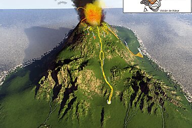
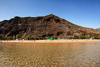
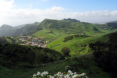

Pico del Teide is Spain's highest peak and the heart of Teide National Park. A cable car climbs to near the summit, and the surrounding lava fields and rock formations look almost lunar.
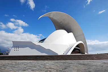
Auditorio de Tenerife Adán Martín is the striking wave-shaped concert hall on the Santa Cruz waterfront and the island's most photographed modern building.
Montañas de Anaga covers the island's northeastern tip with an ancient laurel forest and a network of ridge-top hiking trails through near-constant mist.
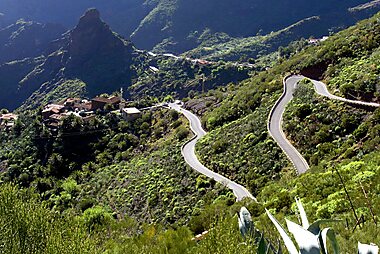
Valle de Masca is a dramatic gorge village reached by a winding mountain road, with one of the island's most popular hikes descending through the ravine to a small cove.
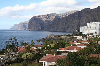
Acantilados de los Gigantes are sheer volcanic sea cliffs on the west coast, best seen from a boat trip out of nearby Los Gigantes.
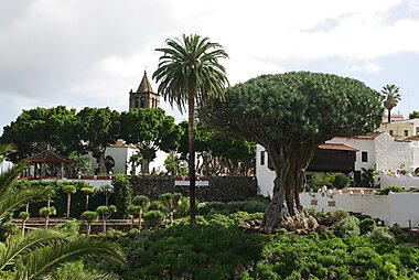
Drago Milenario in Icod de los Vinos is a dragon tree traditionally said to be close to a thousand years old, though scientists estimate it is several centuries younger; either way it is a long-standing symbol of the Canary Islands.
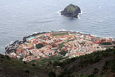
Garachico is a well-preserved historic town rebuilt after a 1706 volcanic eruption buried its original harbour; its natural lava-rock swimming pools are a popular stop.
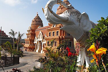
Siam Park is a large Thai-themed water park in the south, regularly rated among the best in the world and a good full-day option with kids.
Listes recommandées


Iconic Viewpoints of Tenerife
Tenerife’s diverse topography ranges from the 3,715-meter peak of Mount Teide to the vertical basalt walls of Los Gigantes. This collection highlights the island's geological contrasts, featuring the ancient laurel forests of Anaga Rural Park, the volcanic badlands of the Ucanca Plain, and northern coastal overlooks. These sites provide vantage points for observing the "sea of clouds" phenomenon and the unique rock formations of the UNESCO-listed Teide National Park.
15 lieux


Expériences à vivre
- Stargaze at altitude on Teide. A working astronomical observatory sits high on the volcano, and a guided night tour above the cloud line gives some of the clearest, darkest skies in Europe.
- Watch for pilot whales and dolphins: a resident pod of pilot whales lives year-round in the deep water off the southwest coast, making a boat trip one of the most reliable wildlife outings in Europe.
- Join a wine harvest: the volcanic slopes around La Orotava and the north coast grow wine on ungrafted vines, and autumn harvest visits and tastings are a genuine local tradition, not a tourist add-on.
- Paraglide over the coast, where thermals off the southern cliffs and the Teno mountains draw schools offering tandem flights with views over the Atlantic.
Visites et activités
Ténérife — Carte

 Ouvrir la carte interactive
 Excursions à la journée
Tenerife sits at the centre of the Canary archipelago, so island-hopping is an easy way to fill a spare day.
- La Gomera — ≈50 min by fast ferry from Los Cristianos. The closest island, mostly covered by the UNESCO-listed Garajonay laurel forest and laced with steep hiking trails.
- Gran Canaria — ≈1.5–2 h by ferry from Santa Cruz, or a ≈40 min flight. A miniature continent with the old town of Las Palmas and the dunes of Maspalomas.
- La Palma — ≈35 min flight or a longer ferry. "La Isla Bonita" is quieter and greener, known for volcanic landscapes and some of the world's clearest night skies.
Où s'aventurer
Towns and areas on Tenerife
- Santa Cruz de Tenerife — the island's capital and main port, with a lively old town and the Auditorio waterfront.
- Puerto de la Cruz — the north coast's long-standing resort town, built around volcanic-sand lidos.
- La Orotava — a historic hillside town known for its balconied mansions and banana terraces.
- El Rosario — a quieter district on the slopes above Santa Cruz.
- Teide National Park — the protected volcanic heart of the island, home to Mount Teide itself.
Other Canary Islands
- Gran Canaria, La Gomera, and La Palma — covered above as easy day trips or short stays.
- Lanzarote — volcanic, sculpted by architect César Manrique, further out toward the African coast.
- El Hierro — the smallest and least-visited of the main islands, a quiet base for diving and hiking.
S'y rendre
- By air: Tenerife South Airport (Reina Sofía) is the main international gateway, close to the southern resorts, with frequent budget and charter flights from across Europe. Tenerife North Airport (Los Rodeos), near La Laguna, mainly handles domestic and inter-island flights. Both airports connect to the main towns by public bus.
- By sea: Overnight ferries link the island to mainland Spain (from Cádiz, roughly 2 days) and to the other Canary Islands, docking mainly in Santa Cruz de Tenerife and Los Cristianos.
Se déplacer
- Public transit: An island-wide bus network (locally called guaguas) connects almost every town, and a modern tram links Santa Cruz de Tenerife with La Laguna. Buy single tickets on board or load a rechargeable card at a kiosk for lower fares on longer trips.
- Taxis are widely available in the resorts and towns; ride-hailing apps have limited coverage outside the capital area.
- The southern resort towns are flat and walkable along the coast, but elsewhere the terrain is steep and volcanic, so cycling is for the fit and well-prepared rather than casual sightseeing.
Conduite
- Is a car worth it? Not for a resort-only stay in the south, where buses and taxis cover everything. A car is worth renting if you want to reach Anaga, Masca, or the Teide interior at your own pace, since buses to these areas run infrequently.
- Parking is paid blue-zone in town centres; car parks near beaches and trailheads are usually free but fill early in high season.
- The mountain routes into Masca and across the Anaga ridge are narrow, winding, and cliff-edge in places — drive slowly and expect to meet oncoming traffic on blind bends.
Gastronomie
Canarian food is simpler and less spice-driven than mainland Spanish cuisine, built around what the volcanic soil and the Atlantic provide. Order papas arrugadas — small wrinkled potatoes boiled in salted water — served with mojo sauces, a red version made with paprika and a green one with coriander. Fresh fish and gofio, a toasted grain flour used in everything from soups to desserts, are island staples worth seeking out over anything imported.
For places to eat, the old-town streets around Plaza Weyler and Calle del Castillo in Santa Cruz de Tenerife cluster with tapas bars and small Canarian restaurants, and La Laguna's historic centre has a similar concentration aimed more at locals than tourists.
Sécurité et santé
Tenerife is a very safe destination for tourists; violent crime against visitors is rare. The main risk is petty theft — bag-snatching and pickpocketing around crowded beach promenades, markets, and Carnival crowds — so keep valuables out of sight rather than avoiding these places.
The Atlantic coast has genuine rip currents on some beaches. Follow the flag system: swim only where a green or yellow flag is flying, and never enter the water under a red flag, even if the sea looks calm.
Hiking at altitude on Teide brings strong sun, thin air, and rapid temperature swings even in summer. Carry water, sun protection, and a layer for the summit regardless of the weather at sea level.
Histoire
Before the Spanish arrived, Tenerife was home to the Guanches, an indigenous Berber-descended people who lived across the island in independent territories. Their resistance was fierce, and Tenerife was the last of the Canary Islands to fall to Castilian conquest, in 1496.
That same year, the Spanish founded Santa Cruz de Tenerife's inland neighbour as the island's first capital, San Cristóbal de La Laguna. Its grid of streets, unusually planned rather than fortified, became the model for many Spanish colonial towns in the Americas and earned it UNESCO World Heritage status; Catedral de Nuestra Señora de los Remedios still anchors its historic centre today.
Local legend holds that a statue of the Virgin appeared on the shore near Candelaria before the conquest, and was already venerated by the Guanches themselves. Basilica Nuestra Señora de Candelaria now stands on the spot and remains the island's most important pilgrimage site, drawing crowds each August for her feast day.
In 1706, a volcanic eruption buried the harbour of Garachico, then Tenerife's busiest port, forcing trade to shift north to Puerto de la Cruz. The town never fully recovered its old status, which is part of why its historic core survives so intact today.
Infos pays
Quick practical facts for Spain at a glance:
- Devise
- euro EUR € · Paiements par carte · Largement acceptées
- Numéros d'urgence
- 112
- Électricité
- 230 V · 50 HzType C / Type F
- Langues
- espagnol
- Eau du robinet
- Potable
- Sens de conduite
- À droite
- Indicatif téléphonique
- +34


Ténérife – Planifie tes journées
Transforme les lieux de ce guide en un véritable itinéraire, avec des itinéraires intelligents, des estimations de temps et tout ce dont tu as besoin pour un voyage parfait.




