Tripomatic

Provinz Thanh Hoa

Region · 🇻🇳 Vietnam

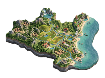
Thanh Hóa is a large province in north-central Vietnam, about 150 km south of Hanoi. It has one of the country's oldest histories. Its main sights are the Citadel of the Hồ Dynasty, a UNESCO World Heritage Site, the beach resort of Sầm Sơn, and the forests of Pù Luông in the west.

Most visitors stop for a day from Hanoi or Ninh Bình, or spend a weekend on the beach.

Provinz Thanh Hoa

Provinz Thanh Hoa – Planst du eine Reise?

Erstelle deine Reiseroute Tag für Tag in der Tripomatic-App.

Beste Reisezeit

May to September is the beach season at Sầm Sơn, with warm water but also hot and crowded weekends. October to November is mild and drier. Winter from December to February is cold and grey, and the sea is rough. Typhoons can hit between July and October.

Beste Reisezeit: Januar, Februar, November, Dezember

Monat auswählen

Typisches Wetter im Januar

Sehr gut
  • 21° (gefühlt 20°) · Extreme 7°–27°
  • 13° nachts
  • 5 Regentage
  • 3 Sonnentage
  • 2 Sonnenstunden pro Tag
  • Angenehme Luftfeuchtigkeit
  • Windstill
  • 20 °C · erfrischend zum Abkühlen
  • UV-Index 4 · mäßig

Typisches Wetter im Februar

Sehr gut
  • 23° · Extreme 9°–31°
  • 15° nachts
  • 6 Regentage
  • 2 Sonnentage
  • 2 Sonnenstunden pro Tag
  • Angenehme Luftfeuchtigkeit
  • Windstill
  • 20 °C · erfrischend zum Abkühlen
  • UV-Index 5 · mäßig

Typisches Wetter im März

Gut
  • 27° (gefühlt 28°) · Extreme 13°–33°
  • 18° nachts
  • 9 Regentage
  • 1 Sonnentag
  • 2 Sonnenstunden pro Tag
  • Schwülwarme Luft
  • Windstill
  • 21 °C · erfrischend zum Abkühlen
  • UV-Index 5 · mäßig

Typisches Wetter im April

Mäßig
  • 30° (gefühlt 33°) · Extreme 16°–37°
  • 21° nachts
  • 10 Regentage
  • 2 Sonnentage
  • 4 Sonnenstunden pro Tag
  • Drückende Schwüle
  • Windstill
  • 24 °C · angenehm warm zum Baden
  • UV-Index 6 · hoch

Typisches Wetter im Mai

Schlecht
  • 32° (gefühlt 36°) · Extreme 20°–37°
  • 24° nachts
  • 18 Regentage
  • 5 Sonnentage
  • 6 Sonnenstunden pro Tag
  • Drückende Schwüle
  • Windstill
  • 28 °C · angenehm warm zum Baden
  • UV-Index 8 · sehr hoch
Bis zu 5 Tage über 35°

Typisches Wetter im Juni

Schlecht
  • 32° (gefühlt 37°) · Extreme 24°–36°
  • 26° nachts
  • 18 Regentage
  • 5 Sonnentage
  • 6 Sonnenstunden pro Tag
  • Drückende Schwüle
  • Windstill
  • 30 °C · angenehm warm zum Baden
  • UV-Index 9 · sehr hoch

Typisches Wetter im Juli

Schlecht
  • 32° (gefühlt 37°) · Extreme 25°–35°
  • 26° nachts
  • 21 Regentage
  • 5 Sonnentage
  • 6 Sonnenstunden pro Tag
  • Drückende Schwüle
  • Windstill
  • 30 °C · angenehm warm zum Baden
  • UV-Index 9 · sehr hoch

Typisches Wetter im August

Schlecht
  • 31° (gefühlt 36°) · Extreme 24°–34°
  • 26° nachts
  • 23 Regentage
  • 4 Sonnentage
  • 5 Sonnenstunden pro Tag
  • Drückende Schwüle
  • Windstill
  • 30 °C · angenehm warm zum Baden
  • UV-Index 8 · sehr hoch

Typisches Wetter im September

Schlecht
  • 30° (gefühlt 34°) · Extreme 21°–33°
  • 24° nachts
  • 20 Regentage
  • 4 Sonnentage
  • 5 Sonnenstunden pro Tag
  • Drückende Schwüle
  • Windstill
  • 30 °C · angenehm warm zum Baden
  • UV-Index 7 · hoch

Typisches Wetter im Oktober

Mäßig
  • 28° (gefühlt 30°) · Extreme 17°–31°
  • 21° nachts
  • 16 Regentage
  • 4 Sonnentage
  • 4 Sonnenstunden pro Tag
  • Drückende Schwüle
  • Leichte Brise
  • 28 °C · angenehm warm zum Baden
  • UV-Index 6 · hoch

Typisches Wetter im November

Sehr gut
  • 25° (gefühlt 26°) · Extreme 12°–30°
  • 18° nachts
  • 9 Regentage
  • 6 Sonnentage
  • 4 Sonnenstunden pro Tag
  • Schwülwarme Luft
  • Leichte Brise
  • 26 °C · angenehm warm zum Baden
  • UV-Index 5 · mäßig

Typisches Wetter im Dezember

Sehr gut
  • 21° (gefühlt 20°) · Extreme 8°–27°
  • 14° nachts
  • 5 Regentage
  • 4 Sonnentage
  • 3 Sonnenstunden pro Tag
  • Angenehme Luftfeuchtigkeit
  • Leichte Brise
  • 22 °C · erfrischend zum Abkühlen
  • UV-Index 4 · mäßig

Klimadaten: NASA POWER (MERRA-2); NASA POWER + Copernicus ERA5-Land and ERA5 · 1996–2025

Top-Sehenswürdigkeiten

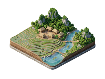
Pù Luông Nature Reserve, in the west of the province, has rice terraces and homestays. See Pu Luong.

Erlebnisse & Aktivitäten

  • Walk the Citadel walls: The south gate is the best preserved.
  • Swim at Sầm Sơn: The beach is busy in summer, with lifeguards in marked zones.
  • Eat seafood on the promenade: Fresh squid, crab and fish.
  • Visit a bronze village: See traditional casting.
  • Take a trip to Pù Luông: Terraces and homestays in the hills.

Touren & Aktivitäten

Provinz Thanh Hoa — Karte

Provinz Thanh Hoa — Karte

Tagesausflüge

  • Pu Luong: Pù Luông is about 3 hours west of the city by road.
  • Ninh Binh: Ninh Bình is the next province north, about 1 hour away.
  • Hanoi: Hanoi is about 3 hours north.
  • Nghe An: Nghệ An lies to the south.

Orte zum Entdecken

Anreise

  • By train: Thanh Hóa station is on the north–south line. Vietnam Railways
  • By road: Buses and cars run along Highway 1 and the expressway from Hanoi.
  • By air: Thọ Xuân Airport has a few domestic flights.
  • To Sầm Sơn: Buses and taxis take about 30 minutes from Thanh Hóa city.

Unterwegs vor Ort

  • Taxi and ride-hailing: Available in Thanh Hóa city and Sầm Sơn.
  • Motorbike hire: Good for the Citadel and the coast.
  • Bicycle: Flat roads suit cycling around Sầm Sơn.

Autofahren

  • Is a car worth it? For the Citadel, Sầm Sơn and Pù Luông, a car or motorbike is the easiest.
  • Roads: Highway 1 is busy. The expressway from Hanoi is faster.
  • Summer weekends: Traffic to Sầm Sơn is heavy.

Essen & Trinken

Thanh Hóa food is hearty. Try nem chua, fermented pork rolls, chả tôm, fried shrimp rolls, and fresh seafood at Sầm Sơn. Local rice cakes and sweet snacks are common gifts.

Frühstück
Pho  PhởBeef or chicken noodle soup with a fragrant broth, fresh herbs, and rice noodles; commonly eaten for breakfast.
Mittagessen
Bun Cha  Bún chảGrilled pork patties and slices served with rice vermicelli, herbs, and a sweet-sour dipping sauce; a Hanoi specialty.
Bun Bo Hue  Bún bò HuếA spicy, lemongrass-scented beef noodle soup from the city of Hue.
Cao Lau  Cao lầuA noodle dish unique to Hoi An, with thick chewy noodles, pork, and greens, traditionally made with local well water.
Snacks & Streetfood
Banh Mi  Bánh mìA French-influenced baguette sandwich filled with pork, pate, pickled vegetables, and herbs.
Banh Xeo  Bánh xèoA crispy turmeric rice-flour crepe filled with pork, shrimp, and bean sprouts, wrapped in lettuce and herbs.
Goi Cuon  Gỏi cuốnFresh (uncooked) spring rolls filled with shrimp, pork, herbs, and vermicelli, wrapped in rice paper.
Süßspeisen & Desserts
Che  ChèA category of sweet dessert soups or puddings made with beans, fruit, jelly, and coconut milk, served hot or over ice.
Getränke
Ca Phe Sua Da  Cà phê sữa đáStrong drip coffee served over ice with sweetened condensed milk; Vietnam's signature drink.
Bia Hoi  Bia hơiCheap, light draft beer brewed fresh daily and sold at street-side stalls, especially in Hanoi.

Sicherheit & Gesundheit

Thanh Hóa is safe for visitors.

  • Swim only in marked zones at Sầm Sơn. Currents can be strong.
  • Typhoon season runs from July to October.
  • The beach is crowded in summer. Keep valuables close.
  • Agree prices for seafood before ordering.
  • Use sun protection.

Geschichte

Thanh Hóa has been inhabited since prehistoric times and is the home of the Đông Sơn bronze culture. Several dynasties, including the Later Lê and the Nguyễn lords, came from the province.

In 1397 Hồ Quý Ly built the stone citadel of the Hồ Dynasty as a new capital. The dynasty lasted only seven years, but the citadel survives. UNESCO listed it as a World Heritage Site in 2011.

Länderfakten

Quick practical facts for Vietnam at a glance:

Währung
Vietnamesischer Dong VND ₫ · Kartenzahlung · Häufig akzeptiert
Stromnetz
Steckertyp A / Steckertyp C / Steckertyp F
220 V · 50 Hz
Sprachen
Vietnamesisch
Leitungswasser
Nicht trinkbar
Fahrseite
Rechtsverkehr
Telefonvorwahl
+84
Mehr erfahren
Pu Luong Nature Reserve
Auto
Ninh Binh Provinz
Auto
Hanoi

Provinz Thanh Hoa – Plane deine Reise

Wähle die Orte aus, die du sehen möchtest, und Tripomatic erstellt daraus eine Route Tag für Tag – mit intelligenter Wegführung, Zeitschätzungen und allem für die perfekte Reise.


3 Mio.+ Downloads · 4,6 Sterne · 15 Jahre Reiseplanung
QR code
Scannen, um die App herunterzuladen

Ähnliche Reiseziele

Data: © OpenStreetMap contributors, Wikidata, Wikipedia, Tripomatic, Official websites, geoBoundaries (CC BY 4.0). Travel guide generated with AI.