


Printable Tourist Map of Bonaire, Sint Eustatius, and Saba
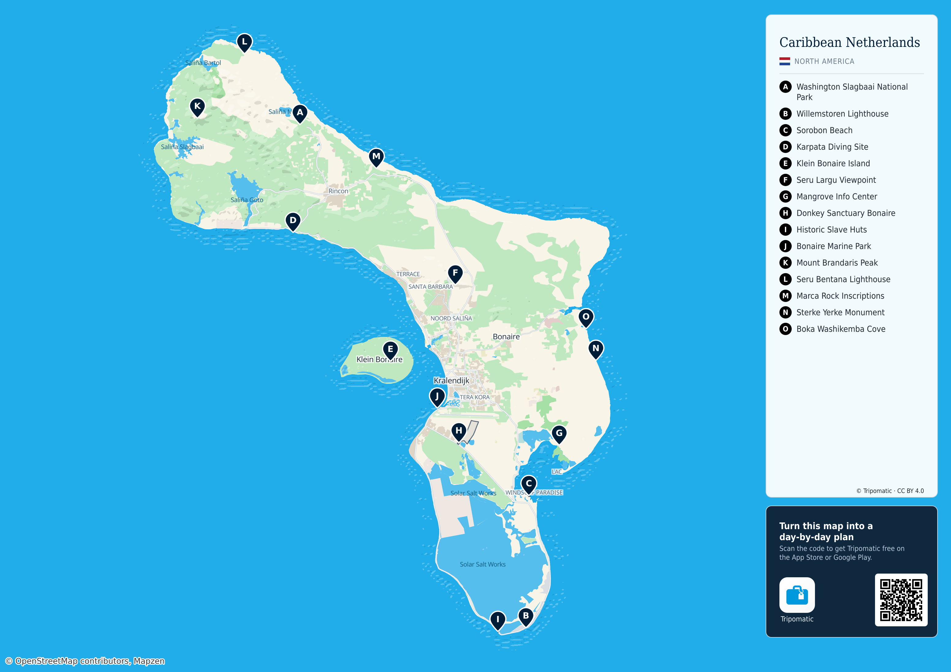
Bonaire, Sint Eustatius, and Saba: a free, high-resolution tourist map with the top sights numbered — print it, save it, or take it with you offline.
 Open the interactive map
Top sights on this map
- Washington Slagbaai National Park
- Willemstoren Lighthouse
- Sorobon Beach
- Karpata Diving Site
- Klein Bonaire Island
- Seru Largu Viewpoint
- Mangrove Info Center
- Donkey Sanctuary Bonaire
- Historic Slave Huts
- Bonaire Marine Park
- Mount Brandaris Peak
- Seru Bentana Lighthouse
- Marca Rock Inscriptions
- Sterke Yerke Monument
- Boka Washikemba Cove

Washington Slagbaai National Park

Wilemstoren Lighthouse

Sorobon Beach
Bonaire, Sint Eustatius, and Saba – Add to Your Trip
Create a detailed travel itinerary with smart routing, time estimates, and everything you need for a perfect trip.


3M+ downloads · 4.6 stars · 15 years of trip planning


Use this map on your website
This map is free to share and adapt, even commercially, under the CC BY 4.0 license. Just credit Tripomatic and OpenStreetMap as shown below.
Credit line
Map by Tripomatic, CC BY 4.0 · Map data © OpenStreetMap contributors (ODbL)