


Dolomites
The Dolomites are a range of pale limestone peaks in north-eastern Italy. Sheer rock towers rise straight out of green alpine meadows, and in the evening the walls often glow pink and orange. The range is a UNESCO World Heritage Site and spreads across South Tyrol, Trentino and the Veneto, with a small part in Friuli-Venezia Giulia.
This is not one destination but a group of valleys, each with its own base towns. Val Gardena, Alta Badia and Val di Fassa sit around the Sella massif and share one ski circuit. Cortina d'Ampezzo is the best-known resort in the east, close to the Tre Cime. Quieter bases include Val di Funes, the Alta Pusteria valley and the Alpe di Siusi plateau. In the northern valleys, German and Ladin are spoken as widely as Italian, and many places have two or three names.
The Dolomites suit two very different trips. In summer, people come for hiking, via ferrata routes, cable cars and huts with a view. In winter, it is one of Europe's largest ski regions. Plan to base yourself in one or two valleys rather than trying to see everything.

Dolomites – planujesz wycieczkę?
Stwórz swój plan podróży dzień po dniu w aplikacji Tripomatic.


Kiedy jechać
Summer, from late June to mid-September, is the hiking season, and early September is often the calmest time. The ski season runs from about early December to early April. Late spring and November are quiet, with many lifts and hotels closed. The climate data below is for Cortina d'Ampezzo on the valley floor; the passes and summits are much colder, with snow possible even in summer. The main event is the Maratona dles Dolomites cycling race in Alta Badia in early July, when the passes around the Sella massif close to traffic.
Główne zabytki





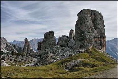
Alta Pusteria and Cortina
- Tre Cime di Lavaredo - Drei Zinnen are the most famous peaks in the Dolomites. An easy loop of about 10 km circles the three walls from Rifugio Auronzo, passing Dreizinnenhütte - Rifugio Antonio Locatelli/Sepp Innerkofler, which has the classic view of the north faces.
- Pragser Wildsee - Lago di Braies is a green-blue lake under steep cliffs, with wooden rowing boats in summer. A flat path goes around it in about an hour. Come early or late in the day.
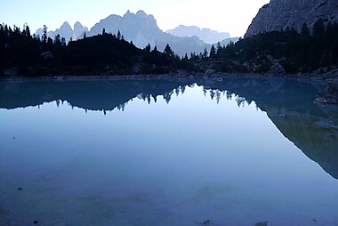
- Sorapiss Lake is a milky turquoise lake below the Sorapiss massif, reached on foot from Passo Tre Croci near Cortina. The path has exposed ledges with cables, so it needs a steady head.
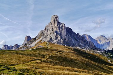
- Lagazuoi has a cable car from Falzarego Pass to a hut terrace with one of the widest views in the range. First World War tunnels run through the mountain.
Val Gardena, Alpe di Siusi and Val di Funes
- Seceda is reached by lifts from Ortisei. From the top, the sharp Odle ridge rises above a long, tilted wall of grass. In summer, book the lift online in advance; most rides are sold with time slots. Landowners may charge a small fee on the path to the classic photo spot, so carry some cash.
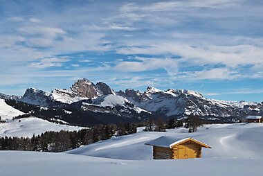
- Seiser Alm is a huge high plateau of meadows below the Sciliar and Langkofel. It has easy walks in summer and gentle ski slopes in winter.
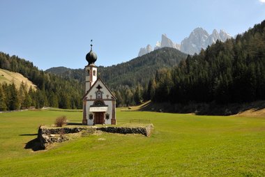
- Villnößtal - Val di Funes is a quiet farming valley under the Odle peaks. The small chapel of St. Johann in Ranui - S. Giovanni in Ranui is one of the most photographed views in the Dolomites.
Marmolada
- Marmolada is the highest mountain in the Dolomites, at 3,343 m, with the range's largest glacier. A cable car climbs close to the top.
Polecane zestawienia

Editor's Choice — Must‑See Views
A curated selection of the region's top must‑see spots: an iconic high mountain pass and peaks, a UNESCO villa, a dramatic waterfall, historic mountain crosses and a noted regional heritage farm — perfect for panoramic views, culture and photo-worthy detours.
7 miejsc


Cable Cars & Gondolas
Scenic cable cars, gondolas and chair lifts that link valley towns with high Dolomite plateaus, ski areas and hiking trails. Many stations provide quick vertical access to rifugi (mountain huts), marked alpine routes and ski lifts; several operate on seasonal timetables with separate winter and summer schedules.
8 miejsc


Czego warto doświadczyć
Most of the best moments in the Dolomites happen outdoors, and many depend on the season.
- Ski the Sella Ronda: a one-day ski circuit of more than 40 km around the Sella massif. It crosses four passes and links Val Gardena, Alta Badia, Arabba and Val di Fassa. It suits average skiers; start by 10 a.m.
- Climb a via ferrata: these protected climbing routes use fixed steel cables and ladders. Rent a harness, helmet and lanyard set, and hire a mountain guide if you are new to it.
- Walk down the war tunnels on Lagazuoi: take the cable car up, then descend through First World War tunnels with a headlamp.
- Sleep in a mountain hut: a night in a rifugio means dinner with a view, sunrise on the peaks and an early start. Book ahead in July and August. The long-distance Alta Via 1 links huts from Braies south to Belluno.
- Watch the alpenglow: at sunset the pale rock turns pink and red. The Ladin call it enrosadira. Legend says the dwarf king Laurin cursed his rose garden on the Catinaccio so it could be seen only at dusk.
- Ride the passes on a bike: on some summer days, the roads around the Sella massif close to cars for cyclists only.
Wycieczki i aktywności
Dolomites — Mapa

Wycieczki jednodniowe
The Dolomite valleys sit close to old towns and wide valleys that make easy days out, especially on a rainy day.
- Chiusa: about 30 minutes from Val Gardena by car. A small medieval town below the hilltop Sabiona Monastery, on the way to Val di Funes.
- Brixen: about 45 minutes from Val Gardena or Val di Funes by car or bus. An old bishops' town with a cathedral, arcaded streets and good shops.
- Bolzano: about 1 hour from Val Gardena or Val di Fassa by car or bus. The main city of South Tyrol, with a market square and the museum of Ötzi, the ice man who lived more than 5,000 years ago.
- Toblacher See - Lago di Dobbiaco: about 40 minutes from Cortina by car or bus. A calm lake with an easy shore path, just south of Dobbiaco.
- Merano: about 1.5 hours from Val Gardena by car. A spa town with riverside promenades and large botanical gardens.
- Venice: about 2.5 hours from Cortina by car or bus. A long day, but possible.
Gdzie warto się udać
The Dolomites are spread across many valleys, and each town makes a different base.
- Around the Sella massif: Val Gardena with its villages Ortisei, Santa Cristina Valgardena and Selva di Val Gardena; Corvara in Alta Badia; and Canazei in Val di Fassa. The Sella Group rises in the middle, with the Marmolada just to the south.
- East: Cortina d'Ampezzo is the largest resort. San Vito di Cadore, Auronzo di Cadore and Calalzo di Cadore are quieter towns in the Veneto.
- North-east: Dobbiaco and Braies are the bases for the Pusteria valley and the Tre Cime.
- Gateway cities: Bolzano, Brixen and Chiusa sit on the main railway in the valley below. Trento is the gateway to the Trentino side.
Most of the range lies in Trentino-South Tyrol and the Veneto, with the smaller Friulian Dolomites in Friuli Venezia Giulia.
Jak dotrzeć
- By air: Bolzano has a small airport with scheduled SkyAlps flights to a few European cities. The main gateways are Venice Marco Polo (about 2.5 hours by road to Cortina), Treviso, Verona and Innsbruck (about 2–2.5 hours to Val Gardena). Munich is about 4 hours away by road. Daily coaches link Venice airport with Cortina d'Ampezzo, and seasonal transfer buses serve the South Tyrol valleys.
- By train: the Brenner railway between Verona and Innsbruck stops in Trento, Bolzano, Chiusa and Brixen. Buses continue from there into Val Gardena, Val di Funes and Alta Badia. The Pusteria line runs east to Dobbiaco. On the Veneto side, trains from Venice run to Calalzo di Cadore, with buses on to Cortina. Trenitalia
- By bus: coaches run every day from Venice airport and Venice-Mestre station to Cortina. Regional buses link Dobbiaco with Cortina, and connect Bolzano, Chiusa and Brixen with the South Tyrol valleys.
Poruszanie się na miejscu
- Car: the most flexible option, since many sights are at passes or valley heads. See the driving section for access rules.
- Buses in South Tyrol: regional buses of the südtirolmobil network serve Val Gardena, Alta Badia, the Pusteria valley and Braies. Buy tickets at machines or in the südtirolmobil app. In many South Tyrol towns, hotels give guests a free guest pass for regional buses and trains. südtirolmobil
- Buses in the Veneto: Dolomiti Bus serves Cortina and the Belluno valleys. You can tap a contactless bank card or phone on the validator, and you are charged one day ticket for each day of travel. Dolomiti Bus
- Lifts: cable cars and chairlifts are part of the transport network, especially in summer. Most summer lifts run from late May or June to October or early November. Dates change each year, so check locally.
- Restricted spots: in summer, Lago di Braies and the Alpe di Siusi limit cars during the day. The Tre Cime toll road must be booked online in advance. The Seceda lift is also best booked online in advance, with a time slot. The bus is often the easier way in, but some lines need advance booking.
- On foot and by bike: the villages are compact and walkable. Road cycling over the passes and e-bike touring are very popular.
Prowadzenie samochodu
- Is a car worth it?: yes, for most visitors. Buses link the main towns, but a car is the easiest way to reach several valleys and passes in a day. Without a car, choose one well-connected base, such as Ortisei or Cortina.
- Pass roads: expect hairpin bends, steep climbs, many cyclists and motorbikes, and summer traffic jams at the most famous passes. Allow extra time.
- Restricted roads: in summer, the road to Lago di Braies is closed to cars during the day unless you book parking online. The Alpe di Siusi road is closed to private cars while the Siusi cable car runs, apart from early morning and evening. The road up to the Tre Cime is a toll road, booked online in advance.
- Parking: car parks at the passes and lift stations are usually paid. Arrive before 9 a.m. at popular spots.
- Winter: carry winter tyres or snow chains from mid-November to mid-April. Passes can close after heavy snow.
- Arriving from Austria: Austrian motorways need a vignette, and the Brenner motorway has its own toll.
Jedzenie i napoje
Food here mixes Tyrolean and Italian cooking. Look for canederli (bread dumplings with speck or cheese), schlutzkrapfen (spinach and cheese ravioli), polenta with game or mushrooms, apple strudel and kaiserschmarrn (torn pancake with jam). Around Cortina, try casunziei, ravioli filled with beetroot and topped with poppy seeds. Ladin valleys have their own dishes, such as turtres, fried pastries filled with spinach or sauerkraut.
The most memorable meals are often at mountain huts, which serve hearty food on terraces with big views. Many huts close in the late afternoon, so plan lunch, not dinner, unless you sleep there. For high-end dining, Alta Badia has two Michelin-starred restaurants. Some huts still take cash only, so carry some.
Bezpieczeństwo i zdrowie
The Dolomites are very safe for crime; the real risks are in the mountains.
- Weather: afternoon thunderstorms are common in summer. Start hikes early and be off ridges and via ferratas by early afternoon.
- Terrain: many popular paths have steep, exposed or rocky sections. Wear proper hiking shoes, and do not go off marked trails.
- Altitude and cold: high passes and summits can be near freezing even in July. Carry a warm layer and rain jacket.
- Glaciers: on 3 July 2022, part of the Marmolada glacier collapsed and killed 11 people. Never cross a glacier without a guide.
- Rescue: call 112 in an emergency. Mountain rescue can be expensive, so consider insurance that covers it.
- Water: tap water is safe. Do not drink from streams below grazing pastures.
Historia
The Dolomites take their name from Déodat de Dolomieu, an 18th-century French scientist who studied the rock they are made of. The pale peaks began as coral reefs in a tropical sea more than 200 million years ago.
For centuries, most of the northern valleys belonged to Tyrol, part of the Austrian Habsburg lands. During the First World War, the front line between Italy and Austria-Hungary ran across the peaks. Soldiers dug tunnels into the rock and fought through the winters at high altitude. You can still walk through these tunnels on Lagazuoi, and see restored trenches at Cinque Torri. A war museum stands high on the Marmolada, at a cable car station. After the war, South Tyrol and Cortina became part of Italy, which is why German is still spoken in many villages.
The Ladin language, related to Latin, survives in Val Gardena, Alta Badia, Val di Fassa and a few other valleys. Cortina d'Ampezzo hosted the Winter Olympics in 1956 and was co-host of the 2026 Winter Olympics with Milan. In 2009, UNESCO listed nine separate mountain groups of the Dolomites as one World Heritage Site.
Informacje o kraju
Quick practical facts for Italy at a glance:
- Waluta
- euro EUR € · Płatności kartą · Powszechnie akceptowane
- Numery alarmowe
- 112
- Elektryczność
- 230 V · 50 HzTyp C / Typ F / Typ L
- Języki
- włoski
- Woda z kranu
- Zdatna do picia
- Ruch drogowy
- Prawostronny
- Numer kierunkowy
- +39
Dolomites – zaplanuj wycieczkę
Wybierz miejsca, które chcesz zobaczyć, a Tripomatic przekształci je w trasę dzień po dniu – z inteligentnym wyznaczaniem tras, szacowanym czasem i wszystkim, czego potrzebujesz na udaną wycieczkę.


Powiązane cele podróży







Data: © OpenStreetMap contributors, Wikidata, Wikipedia, Tripomatic, Official websites. Tours by GetYourGuide. We earn commission from bookings. Travel guide generated with AI.