



Faroe Islands
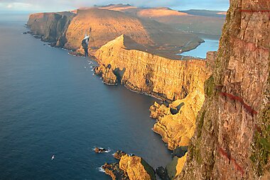
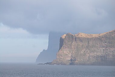
The Faroe Islands are eighteen volcanic islands in the North Atlantic, roughly halfway between Norway and Iceland. Grass-topped cliffs drop straight into the sea, sheep outnumber the 54,000 residents, and the weather can shift from sun to fog within an hour. The islands are a self-governing nation within the Kingdom of Denmark, with their own language, flag and parliament, though defense and foreign affairs stay with Copenhagen.
This is a destination for travelers who want dramatic nature over city life: hiking to cliffside villages, watching Múlafossur spill into the ocean, or standing on the ridge at Trælanípa, where a lake seems to float above the water below. Most visitors base themselves in Tórshavn, one of the smallest capitals in the world, and make day trips to the seabird cliffs of Mykines, the sea stacks known as Risin og Kellingin, and the turf-roofed church at Saksunar Kirkja. Distances are short, but narrow roads, single-lane tunnels and sudden weather mean journeys take longer than the map suggests.






Faroe Islands – Planning a Trip?
Build your day-by-day itinerary in the Tripomatic app.
Money & payments
The Faroe Islands use the Danish krone. The islands also issue their own Faroese króna banknotes, worth exactly the same as the Danish krone but usable only on the islands — spend or exchange them before you leave; coins are the standard Danish ones.
ATMs are common in Streymoy and the other larger towns but scarce on the smaller islands, so withdraw cash before a day out to Kalsoy, Mykines or Suðuroy.


Featured Lists


Natural Wonders
The Faroe Islands feature a dramatic geological intersection of freshwater and the Atlantic Ocean. This collection highlights Vágar's vertical coastal drops, including the 60-meter Múlafossur and Bøsdalafossur, which drains the archipelago's largest lake. The list also covers the tidal lagoon of Saksunarvatn and the high-altitude mountain lakes of Suðuroy and Sandoy, representing the islands' diverse glacial topography and basaltic landscapes.
11 places Tours & Activities
Faroe Islands — Map

Tipping
Tipping is not part of Faroese culture. Service is included in restaurant and bar prices, and taxi drivers do not expect a tip. Rounding up the bill for good service is fine but never required.
service is included; round up if you liked it
a small tip for a hiking or boat guide is appreciated, not expected
Hiking and boat guides are the one exception: a small tip after a good trip, such as a guided boat trip to Drangarnir, is appreciated but still optional.
Electricity
The Faroe Islands use 230 V at 50 Hz, the same as the rest of Europe. Sockets are the round two-pin Danish/European type, so travelers from the UK, US or Australia need an adapter.
Language
Faroese, a West Nordic language closely related to Icelandic, is the national language, and Danish is taught in every school and used alongside it. Almost everyone working in tourism, shops and restaurants speaks fluent English, including in villages far from the capital. Road signs and place names are written in Faroese, with a few letters unfamiliar to English speakers, such as ð, ø and á — maps and navigation apps use the same spelling, so this rarely causes confusion.
Staying connected
The Faroe Islands sit outside the European Union, so EU/EEA roaming plans do not automatically cover calls and data here the way they do inside the EU — check with your provider before arrival, or buy a local SIM. Prepaid SIM cards from the two local operators are sold at the airport and in Tórshavn, with no registration beyond photo ID. Mobile coverage reaches almost every populated area, including inside the road tunnels, though it can drop out on remote hiking trails and boat crossings.
Safety & emergencies
The Faroe Islands are very safe: violent crime and theft are rare, and most visitors never think about personal safety. The real hazards are natural — cliffs with no barriers, and weather that can close in with fog or strong wind within minutes. Stay back from cliff edges, check the forecast before a hike, and let someone know your planned route on remoter islands such as Kalsoy or Mykines.
Health
Tap water is safe to drink everywhere and tastes good — it comes from natural springs and reservoirs, not treatment plants. Pharmacies are concentrated in Streymoy and the other larger towns; the smaller islands have none, so bring any regular medication with you. No special vaccinations are required to visit.
Visas & entry
The Faroe Islands belong to the Kingdom of Denmark but sit outside both the European Union and the Schengen Area, so entry rules differ from mainland Denmark. Citizens of EU, Schengen and Nordic countries can enter with a passport or national ID card and no visa. Travelers from many other countries, including the United States, Canada, Australia and the United Kingdom, can also enter visa-free for short stays, but a standard Schengen visa is not automatically valid here — anyone who needs a visa should confirm it is issued or endorsed specifically for the Faroe Islands.
Visa and entry requirements change frequently. Verify current requirements with the official immigration authority or your country's embassy before travel.
Etiquette
Much of the Faroese countryside, including some of the best-known hikes, crosses privately owned land. Several trails — among them the walk to Trælanípa above Lake Sørvágsvatn, the lighthouse hike on Kalsoy, and the boat trip to Drangarnir — charge a landowner's access fee or require a guide, usually booked online in advance. Pay the fee, stay on the marked route, and treat it as normal practice rather than a tourist tax.
Sheep have the right of way on roads and in the hills; slow down and give them room. Photography is welcome almost everywhere, but ask before photographing people or entering gardens in small villages. Traditional pilot whale hunting still takes place in the islands and remains a genuinely divisive subject even among Faroese people; visitors are very unlikely to encounter it during an ordinary trip.
Holidays & opening hours
Ólavsøka, the national holiday on 28–29 July, is the biggest event of the year: rowing races, a parliamentary procession and street parties fill Tórshavn, on the island of Streymoy, and many businesses close or run reduced hours. Christmas, New Year and the movable religious holidays also close most shops and offices.
Shops generally close on Sundays outside the capital, and small-town shops often keep short afternoon hours — check ahead if you are relying on a village shop for supplies.
Getting around
- By car: the practical way to see the islands. A single connected road network links most islands by tunnel and bridge, and a rental car or organized tour covers the main sights in a few days.
- By tunnel and bridge: Eysturoy and Borðoy connect to Streymoy by bridge and tunnel with no ferry needed; the tolled Eysturoy and Sandoy subsea tunnels (see Driving) cut journeys that once took over an hour to a few minutes.
- By ferry: Strandfaraskip Landsins runs the inter-island ferries, including the routes to Suðuroy, Mykines and Kalsoy; book vehicle space ahead in summer.
- By helicopter: a small, heavily subsidized helicopter service links the more remote islands, including Mykines, at low fares; seats are limited and bookable about a week ahead through Atlantic Airways.
- By bus: Strandfaraskip Landsins runs scheduled bus routes (Bygdaleiðir) connecting towns across the main islands, and Tórshavn has its own local Bussleiðin city buses — useful for travelers without a car, though inter-town services are infrequent outside the capital area.
Driving
- Speed limits: 50 km/h in towns, 80 km/h on the open road; there are no motorways.
- Tunnels: several older tunnels are single-lane with marked passing bays — pull into one to let oncoming traffic through rather than forcing the right of way.
- Sheep: expect sheep on and near the road everywhere outside town; slow down on blind bends.
- Fuel: most stations are self-service and card-only, including outside staffed hours.
- Winter driving: snow and ice are common from November to April; main routes are salted and plowed, but check conditions before crossing a high pass.
Food & drink
Faroese food grew out of sheep farming and fishing, with almost nothing grown locally beyond potatoes, rhubarb and a few hardy vegetables. Preservation by wind-drying and fermenting in an open shed, a hjallur, is still common: skerpikjøt is mutton cured this way for months, and ræst fiskur is fish prepared the same way. Boiled lamb, dried fish and potatoes remain the base of a traditional meal.
Fresh seafood is excellent: langoustine, cod, halibut and farmed salmon, a major Faroese export, appear on most menus. Tórshavn has an outsized fine-dining scene for its size, built around foraged and fermented local ingredients — Koks, the islands' two-Michelin-star restaurant, is the best-known example, though tables book out months ahead. Rhubarb turns up in cakes and desserts, and coffee and cake is a common way to be welcomed into a Faroese home.
Two local breweries, Föroya Bjór and Okkara, supply most bars and restaurants, with pilsners and seasonal beers worth trying alongside the food.
Where to explore
The eighteen islands split into a few natural travel bases.
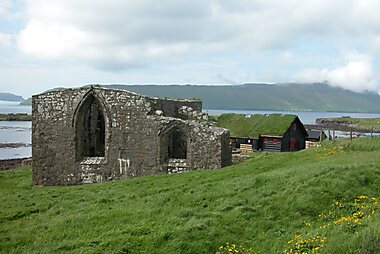
Streymoy, the largest island, holds the capital Tórshavn along with the medieval ruins at Magnus Cathedral and the working church Ólavskirkjan in the village of Kirkjubøur. The fort Skansin and the cathedral Tórshavn Cathedral sit in Tórshavn's old town, and the Nordic House in the Faroe Islands hosts concerts and exhibitions. The turf-roofed church at Saksunar Kirkja, in the village of Saksun, is one of the most photographed spots on the island.
Vágar, home to the international airport, has some of the country's best-known views: Trælanípa looks out over a lake that appears to float above the ocean, and Bøsdalafossur drains that same lake straight into the sea. Boats from Sørvágur run to the twin sea stacks at Drangarnir, and the waterfall Múlafossur, spilling off a cliff above the village of Gásadalur, is one of the most photographed places in the country.
Mykines, reached by ferry or helicopter, is the place to see puffins between May and August, with trails leading out to the Mykinesholmur Lighthouse.
Eysturoy connects to Streymoy by bridge and has its own highlights: the twin sea stacks Risin og Kellingin, the waterfall Fossá, and Slættaratindur, the islands' highest peak.
Borðoy, reached from Eysturoy through a subsea tunnel, is home to Klaksvík, the country's second-largest town and a good base for the northern islands. Kalsoy, a short car-ferry ride from Klaksvík, has a narrow spine famous for the hike out to the lighthouse at its northern tip.
Suðuroy, the southernmost island, is quieter and less visited: Beinisvørð is its highest sea cliff, and Akraberg Lighthouse marks the country's southern tip.

Faroe Islands – Plan Your Days
Turn the places from this guide into a real itinerary, with smart routing, time estimates, and everything you need for a perfect trip.




