


Printable Tourist Map of North Dakota
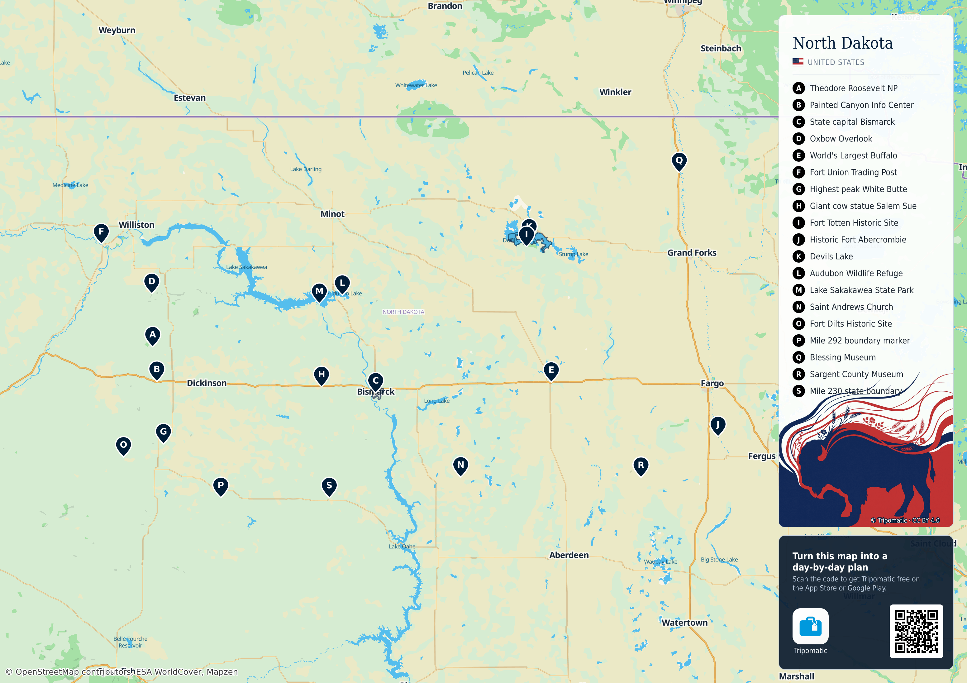
North Dakota: a free, high-resolution tourist map with the top sights numbered — print it, save it, or take it with you offline.
 Open the interactive map
Top sights on this map
- Theodore Roosevelt NP
- Painted Canyon Info Center
- State capital Bismarck
- Oxbow Overlook
- World's Largest Buffalo
- Fort Union Trading Post
- Highest peak White Butte
- Giant cow statue Salem Sue
- Fort Totten Historic Site
- Historic Fort Abercrombie
- Devils Lake
- Audubon Wildlife Refuge
- Lake Sakakawea State Park
- Saint Andrews Church
- Fort Dilts Historic Site
- Mile 292 boundary marker
- Blessing Museum
- Sargent County Museum
- Mile 230 state boundary

Theodore Roosevelt National Park

Theodore Roosevelt Painted Canyon Visitor Center
Oxbow Overlook
North Dakota – Add to Your Trip
Create a detailed travel itinerary with smart routing, time estimates, and everything you need for a perfect trip.


3M+ downloads · 4.6 stars · 15 years of trip planning


Use this map on your website
This map is free to share and adapt, even commercially, under the CC BY 4.0 license. Just credit Tripomatic and OpenStreetMap as shown below.
Credit line
Map by Tripomatic, CC BY 4.0 · Map data © OpenStreetMap contributors (ODbL)