



Sillian
Sillian is a village in the Hochpustertal, the upper Puster valley, in East Tyrol. It lies a few kilometres from the Italian border and the Dolomites, with the Carnic Alps to the south and the Villgraten mountains to the north.
The village is small and calm. It suits hikers, cyclists and skiers who want Alpine scenery and quick access to South Tyrol.

Sillian – Planning a Trip?
Build your day-by-day itinerary in the Tripomatic app.


When to visit
June to October is best for hiking and cycling. The Helm mountain is a popular summer and winter peak. Winter has skiing at the Sillian ski area and cross-country trails in the valley.
Top sights
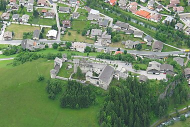
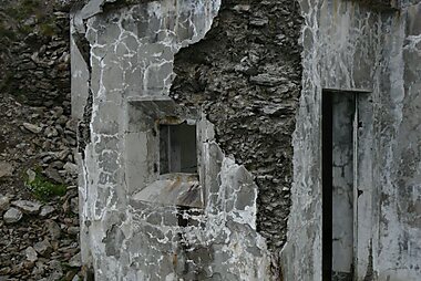
- Museum Burg Heinfels is a medieval castle ruin above the village, now a museum.
- Helm - Monte Elmo is the mountain above Sillian, with a cable car and views of the Dolomites.
- Helmhaus is a mountain hut near the summit.
- Heimkehrerkreuz is a memorial cross on the Helm.
- Thurntaler is a peak for a long hike.
- Sillianer Hütte is a hut on the Carnic Alps high-level route.
- Loacker Museum is a small museum in the village.
Featured Lists


What to experience
- Ride the cable car up the Helm.
- Hike on the Carnic main ridge.
- Cycle the Drau path.
- Visit the castle museum.
- Cross the border to the Dolomites.
Tours & Activities
Sillian — Map

Day trips
- Lienz is about 35 minutes away by car or by train.
- Kals am Großglockner is about 50 minutes away by car.
- Innichen and Sexten in the South Tyrol Dolomites are about 10 to 20 minutes away by car.
- Lake Braies is about 40 minutes away by car.
- Cortina d'Ampezzo is about 1 hour away by car.
Where to explore
- Kals am Großglockner is the nearest preferred destination.
- Lienz is the nearest town.
Getting there
- By air: Innsbruck Airport is about 2 hours away by car. Salzburg is about 2 hours 30 minutes.
- By train: Regional trains run along the Drau valley from Lienz to Sillian and on to Innichen. Check times on ÖBB.
- By car: Take the road along the Drau valley from Lienz, or from South Tyrol over the border at Arnbach.
Getting around
The village is walkable. A cable car leads up the Helm, and regional buses and trains serve the valley. A car helps for the wider area.
Driving
A car helps for the Dolomites. Roads are quiet in the valley. Winter tyres or chains are required in snow. Motorways in Austria need a vignette, and Italy has its own road rules.
Food & drink
East Tyrolean food shows South Tyrolean and Italian influence. Look for Schlutzkrapfen, filled pasta, Kaspressknödel, cheese dumplings in broth, and Strauben, fried batter. Huts serve simple, hearty meals.
Safety & health
Sillian is very safe. Watch the weather on high routes. Tap water is clean and safe to drink. The emergency number is 112. The mountain rescue number is 140.
History
Sillian sits on an old route along the Drau valley, between the Alps and the Dolomites. The castle above the village guarded this crossing. Border changes in the 20th century set the line to South Tyrol, and the village remains a quiet gateway to both regions.
Country facts
Quick practical facts for Austria at a glance:
- Currency
- Euro EUR € · Card payments · Commonly accepted
- Emergency numbers
- 112
- Electricity
- 230 V · 50 HzType C / Type F
- Languages
- German
- Tap water
- Safe to drink
- Driving side
- Right
- Calling code
- +43


Sillian – Plan Your Days
Turn the places from this guide into a real itinerary, with smart routing, time estimates, and everything you need for a perfect trip.


Related destinations
Other Destinations
Data: © OpenStreetMap contributors, Wikidata, Wikipedia, Tripomatic, Official websites, geoBoundaries (CC BY 4.0). Tours by GetYourGuide. We earn commission from bookings. Travel guide generated with AI.