Tripomatic

Saint Thomas

Island · 🇺🇸 United States
Population 42,261
Area 145 km²
Time zone America/St_Thomas

Printable tourist map

Saint Thomas – Planning a Trip?

Build your day-by-day itinerary in the Tripomatic app.

Featured Lists
Saint Thomas — Map

Saint Thomas — Map

Climate & when to visit

Best time to visit: January, February, March

Select a month

Typical weather in January

Great
  • 26° · extremes 24°–27°
  • 25° at night
  • 12 rainy days
  • 21 sunny days
  • 8 hours of sunshine per day
  • Oppressive humidity
  • Light breeze
  • 27°C · warm for swimming
  • UV index 7 · high

Typical weather in February

Great
  • 26° (feels like 25°) · extremes 24°–27°
  • 25° at night
  • 10 rainy days
  • 22 sunny days
  • 9 hours of sunshine per day
  • Muggy, humid air
  • Light breeze
  • 26°C · warm for swimming
  • UV index 9 · very high

Typical weather in March

Great
  • 26° · extremes 24°–27°
  • 25° at night
  • 11 rainy days
  • 25 sunny days
  • 9 hours of sunshine per day
  • Muggy, humid air
  • Light breeze
  • 26°C · warm for swimming
  • UV index 10 · very high

Typical weather in April

Good
  • 27° · extremes 25°–28°
  • 26° at night
  • 13 rainy days
  • 22 sunny days
  • 9 hours of sunshine per day
  • Oppressive humidity
  • Light breeze
  • 27°C · warm for swimming
  • UV index 11 · extreme

Typical weather in May

Fair
  • 28° (feels like 29°) · extremes 25°–29°
  • 27° at night
  • 19 rainy days
  • 19 sunny days
  • 9 hours of sunshine per day
  • Oppressive humidity
  • Light breeze
  • 28°C · warm for swimming
  • UV index 11 · extreme

Typical weather in June

Fair
  • 28° (feels like 29°) · extremes 27°–30°
  • 27° at night
  • 19 rainy days
  • 17 sunny days
  • 9 hours of sunshine per day
  • Oppressive humidity
  • Light breeze
  • 28°C · warm for swimming
  • UV index 10 · very high

Typical weather in July

Fair
  • 29° · extremes 27°–30°
  • 28° at night
  • 21 rainy days
  • 19 sunny days
  • 9 hours of sunshine per day
  • Oppressive humidity
  • Light breeze
  • 28°C · warm for swimming
  • UV index 10 · very high

Typical weather in August

Poor
  • 29° (feels like 30°) · extremes 27°–30°
  • 28° at night
  • 24 rainy days
  • 22 sunny days
  • 9 hours of sunshine per day
  • Oppressive humidity
  • Light breeze
  • 29°C · warm for swimming
  • UV index 11 · extreme

Typical weather in September

Poor
  • 29° (feels like 31°) · extremes 27°–30°
  • 28° at night
  • 24 rainy days
  • 20 sunny days
  • 9 hours of sunshine per day
  • Oppressive humidity
  • Light breeze
  • 29°C · warm for swimming
  • UV index 10 · very high

Typical weather in October

Poor
  • 29° (feels like 31°) · extremes 27°–30°
  • 28° at night
  • 23 rainy days
  • 19 sunny days
  • 8 hours of sunshine per day
  • Oppressive humidity
  • Light breeze
  • 29°C · warm for swimming
  • UV index 9 · very high

Typical weather in November

Fair
  • 28° (feels like 29°) · extremes 26°–29°
  • 27° at night
  • 20 rainy days
  • 18 sunny days
  • 7 hours of sunshine per day
  • Oppressive humidity
  • Light breeze
  • 28°C · warm for swimming
  • UV index 7 · high

Typical weather in December

Good
  • 27° · extremes 25°–28°
  • 26° at night
  • 16 rainy days
  • 20 sunny days
  • 8 hours of sunshine per day
  • Oppressive humidity
  • Light breeze
  • 28°C · warm for swimming
  • UV index 7 · high

Climate data: NASA POWER + Copernicus ERA5 · 1996–2025

Practical information

Currency
US Dollar USD $ · Card payments · Widely accepted
Emergency numbers
911 Police · Ambulance · Fire brigade
Electricity
Type A / Type B
120 V · 60 Hz
Languages
English
Tap water
Safe to drink
Driving side
Right
Calling code
+1
Learn more

Tours & Activities

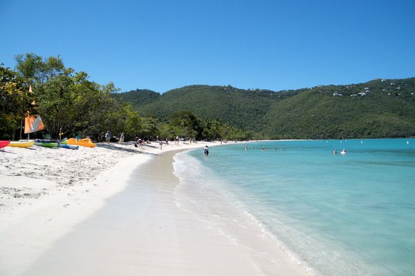
Magens Bay
Drive
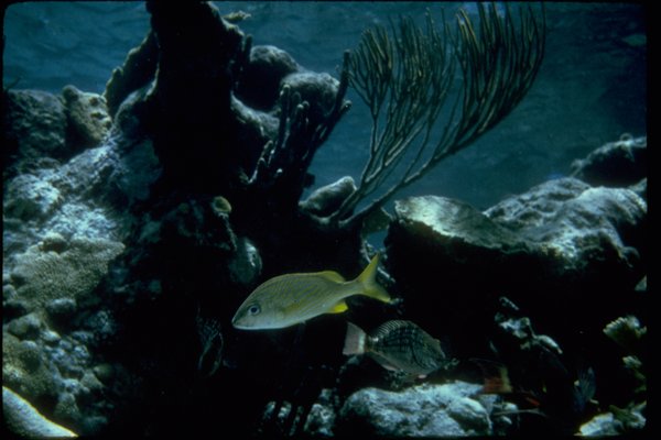
Coral World Ocean Park
Drive
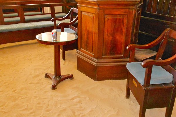
Saint Thomas Synagogue

Saint Thomas – Plan Your Days

Turn the places from this guide into a real itinerary, with smart routing, time estimates, and everything you need for a perfect trip.


3M+ downloads · 4.6 stars · 15 years of trip planning
QR code
Scan to download the app

Related destinations

Data: © OpenStreetMap contributors, Wikidata, Wikipedia, Tripomatic, Official websites, geoBoundaries (CC BY 4.0).